
by The American Geosciences Institute Friday, December 29, 2017
Click to enlarge photo.
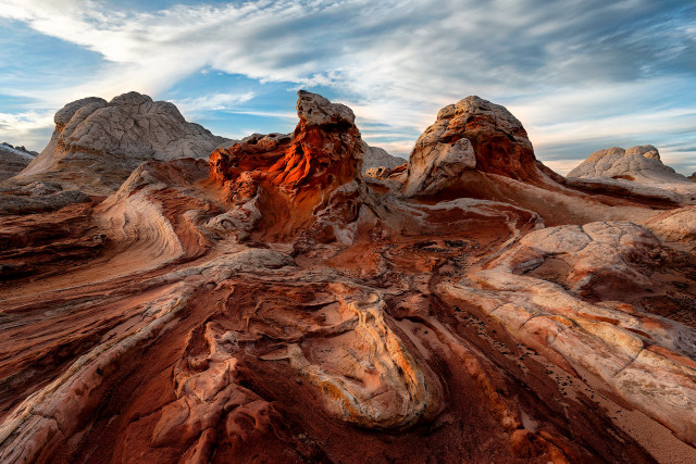
This locality in the Jurassic Navajo Sandstone exhibits soft-sediment deformation that occurred after deposition, possibly by a submarine landslide. Groundwater bleaching here has leached color from the sandstone and weathering has broken the surface into polygons.
It lies east of a more famous undulating outcrop of the Navajo Sandstone, and both fall within the bounds of the same colorfully named national monument near the border of Utah and Arizona.
Getting to this remote spot is not easy: You must drive for an hour and a half through deep sand, turning at corrals and farmhouses, watching for washouts and crossing cattle gates (close them behind you!). The national monument has no services, so visitors must be prepared.
Scroll down for the answer
Answer: White Pocket, a formation in the Jurassic Navajo Sandstone in Vermilion Cliffs National Monument near the border of Utah and Arizona, exhibits soft-sediment deformation that occurred after deposition, possibly by a submarine landslide. Photo by Gregg Beukelman.
January 2018 Winners: Diane Ahrens (Bunker Hill, Ill.) Robert W. Eschrich (Oro Valley, Ariz.) Julia Jackson (Cumberland, Md.) Shelley Judge (Wooster, Ohio) George Robitaille (Dumfries, Va.)
Visit the ‘Where on Earth?’ archive.
EARTH also welcomes your photos to consider for the contest. Learn more about submitting photos.
© 2008-2021. All rights reserved. Any copying, redistribution or retransmission of any of the contents of this service without the expressed written permission of the American Geosciences Institute is expressly prohibited. Click here for all copyright requests.