
by John Stenmark Wednesday, April 23, 2014
Credit: Kathleen Cantner, AGI
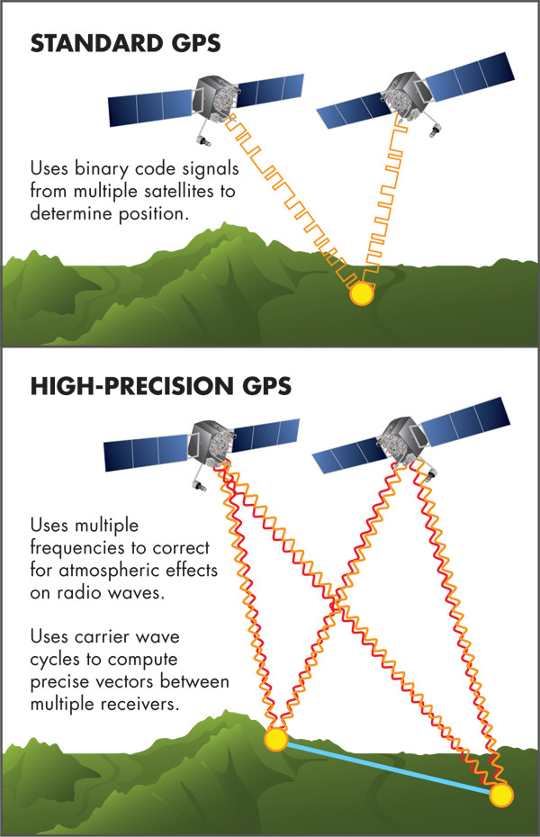
Like the GPS navigation system in your car or smartphone, a high-precision GPS receiver uses signals from satellites to determine the distance from the receiver to the satellite. But that’s where the similarities end. Today’s scientific and commercial-grade GPS receivers use two frequencies and carrier phase measurements (distance expressed in units of cycles of the carrier frequency) to produce precise results. In addition to the U.S. GPS satellites, many receivers use data from Russia’s GLONASS navigation satellites and are capable of using signals from the planned European (Galileo) and Chinese (BeiDou) systems. New U.S. satellites will provide an additional third frequency. The combination of the new and existing satellites is collectively known as the Global Navigation Satellite System, or GNSS. GNSS will provide significant benefits to commercial applications such as surveying, agriculture and construction, as well as earth science research.
© 2008-2021. All rights reserved. Any copying, redistribution or retransmission of any of the contents of this service without the expressed written permission of the American Geosciences Institute is expressly prohibited. Click here for all copyright requests.