
by Jesse Davenport Friday, April 3, 2015
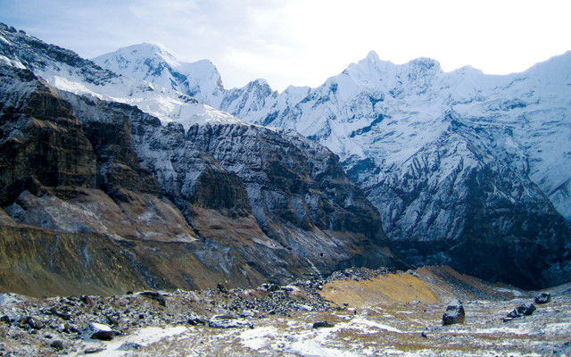
Near the Annapurna Base Camp in Nepal. Credit: Julia Rosen.
[Editor’s Note: On April 25, 2015, a magnitude-7.8 earthquake struck 80 kilometers northwest of Kathmandu, Nepal, killing and injuring thousands and devastating many of the areas written about earlier in this Travels in Geology feature. The disaster prompted the U.S. State Department to issue a Nepal Travel Alert that will remain in effect until Aug. 1, 2015.]
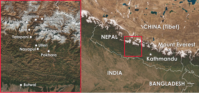
In October 2014, I had the opportunity to travel to Nepal with a group of about 30 international doctoral students, postdoctoral researchers and professors representing a wide range of earth science disciplines. The newly launched group, called iTECC (Investigating Tectonism Erosion Climate Couplings in the Himalaya), brings together researchers studying various aspects of the link between tectonics and climate that results mainly from the uplift and exposure of rock and its subsequent erosion.
The Himalaya-Tibet Orogeny — the result of the ongoing collision of the Indian Plate with the Eurasian Plate that started about 50 million years ago, and which has produced the highest topography on the planet — is the perfect natural laboratory in which to study how active mountain belts influence global climate. Each student in the iTECC group is researching an aspect of Himalayan geology — for example, constraining the timing of a certain thrust belt, or refining the precision and accuracy of techniques such as noble gas mass spectrometry for use on sediment samples.
The trip, led by Arnaud Pecher, a preeminent researcher of Himalayan structural geology and now an emeritus faculty member at the University of Joseph Fourier in Grenoble, France, was intended to introduce the students to the geology and culture of the Himalaya. For many of us, including those who mostly work in the lab, it was our first opportunity to get into the field and experience the geology we had been studying.
If you are an avid geologist or even just an avid outdoors person, Nepal is the ultimate trekking destination. Boasting eight of the 14 peaks in the world taller than 8,000 meters, Nepal may seem like a rugged, remote destination, but its friendly people and the availability of many different types of adventures — from bird watching to extreme mountaineering — make it accessible to a wide variety of tourists.
Credit: both: K. Cantner, AGI.
A view of the magnificent Annapurna Massif on the way from Kathmandu to Butwal. Credit: Jesse Davenport.
Our trip began in Kathmandu, a city dating back to A.D. 185 with a rich history that includes many myths and legends, one of which holds that the city was once the site of a large lake called Nagdaha. Indeed, the next day, as we drove out of town toward our first stop in Butwal, we saw miles of lacustrine deposits — the remnants of an ancient lake that, at its largest extent about 30,000 years ago, was roughly 1,400 meters deep and covered almost the entire Kathmandu Basin.
As we descended toward the town of Butwal, which lies at 365 meters, almost 1,000 meters below the elevation of Kathmandu, we saw long exposures of gneiss. This rock resulted from an episode of metamorphism 20 million years ago, and now poses a famous Himalayan geological conundrum. The metamorphism redistributed radiogenic strontium from older silicate terranes to younger carbonate rocks throughout the Himalaya. Normally, marine carbonates have a strontium isotopic signature that is indistinguishable from seawater due to their depositional environment. However, in the Himalaya, many of the carbonate rocks became enriched with radiogenic strontium during metamorphism. When analyzing sediment deposits, this isotopic similarity makes it difficult to distinguish how much material has weathered from igneous and metamorphic rocks and how much from carbonate rocks. Determining how much each rock type is weathering is important because, on geologic timescales, silicate weathering consumes carbon dioxide. Therefore, knowing how much silicate material is in the rivers can tell us how much carbon dioxide the Himalayas are consuming as they erode. The 20-million-year-old metamorphic event has thus complicated attempts to understand the role of Himalayan weathering on climate.
We soon arrived in Butwal, located on the northern edge of the Terai Plains below the Siwalik Hills. Butwal’s close proximity to India has long made it a major cultural and trade center between India and Nepal and, in the early 19th century, it was a center of pro-British sentiment. Also of note, in 1932, ancient hominoid fossils, including a 10.1-million-year-old tooth, were discovered here.
In Butwal, we spent two days studying the Siwalik Group, a 15.8-million- to 1-million-year-old river-sediment sequence containing sandstones, oxidized paleosols, histosols and gravelly, braided stream deposits. These sediments were eroded from the Higher Himalaya over the past 20 million years and gradually deposited throughout the Himalayas, but mainly in the Siwaliks. On our walking tour of the Siwaliks, we also documented other interesting features, including mudstones and coarsely bedded conglomerates, as well as telltale metamorphic minerals such as garnet, kyanite and staurolite.
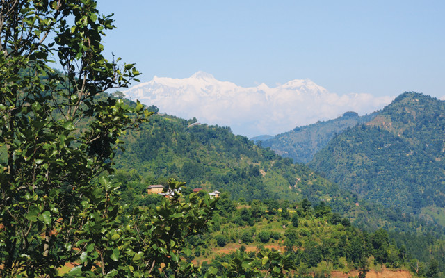
The Annapurna range seen from Pokhara. Credit: Julia Rosen.
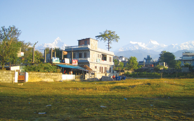
After our brief time in Butwal, we headed for Pokhara, the tourist center of Nepal. Along the way, we entered the Pokhara Basin and saw some impressive successions of lake and fluvial terraces, along with our first views of the famous Annapurna Massif, which towers over 8,000 meters tall.
Pokhara is located beside a deep green lake, nestled among forested hills with a postcard backdrop of gleaming Himalayan peaks. But it is also a bustling commercial center that was founded as a waypoint along the trade route between India and China, and it has a long history of annexation, rebellions and refugees. Once accessible only on foot, the city — and its tourism trade — grew rapidly after the Siddhartha Highway connecting Kathmandu and Pokhara was constructed in the late 1960s.
As we traveled on the highway, we passed through the Lesser Himalayan Group, made up of two major rock groups: a lower unit composed mostly of sandstones and volcanic sediments and a higher unit composed of schists, limestones and dolomites. The Lesser Himalaya zone is bounded to the north by the Main Central Thrust and to the south by another major fault zone, the Main Boundary Thrust. Unlike the Higher Himalaya, the Lesser Himalaya experienced much less severe metamorphism. The rocks here originated primarily from the main body of the Indian continent, and now display a series of dramatic, sheared anticlines and synclines.
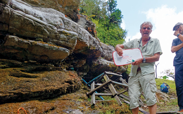
The field trip leader, Arnaud Pecher, a French structural geologist, teaches the group about the stratigraphy of the Lesser Himalaya at an outcrop of phyllites and schist. Credit: Jesse Davenport.
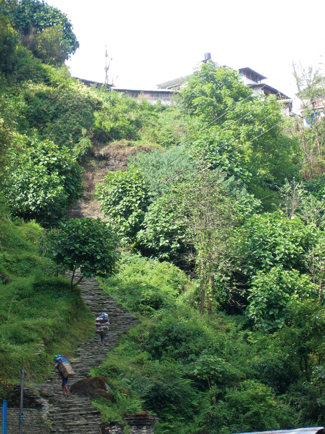
Nepali porters ascend the steps above Nayapul. Credit: Julia Rosen.
Heading out of Pokhara the next day, we stopped at a small trail village called Nayapul, which sits at an elevation of 2,070 meters. It’s a one-road town lined with shops catering to trekkers. This is the start of the popular and difficult Annapurna Base Camp Trek — a roughly 10-day trek up to the 4,130-meter-high base camp set amid the mighty peaks of Annapurna I (8,091 meters), Annapurna South (7,219 meters), Machhapuchchhre (6,993 meters) and Hiunchuli (6,441 meters) — and the easier Poon Hill Trek, a four-day trek with a maximum elevation of 3,210 meters.
From here, we would proceed on foot. Our guides strapped our luggage to trail horses and we strapped on our backpacks for the 1,030-meter climb up to the hill town of Ulleri, an ancient village of stone houses sitting high above terraced farmland and sheer cliffs.
As we ascended the steps, we noticed stone memorials dotting the path that mark places where villagers have been killed by monsoon-triggered landslides. This was also the first time we saw the famous Nepali porters. The loads they heft — perhaps 45 kilograms or more in baskets toted by a band around the porter’s forehead — seem much too large for anyone to carry up such steep paths. Despite the exceptionally difficult working conditions, the men are probably happy to have the work, which garners them about $8 per day for their Herculean efforts, our guide told us.
At lunchtime, we stopped at a village and our guide pointed out a distant ridge on the next mountain. “That’s where we stay tonight,” he told us. Two hours after lunch, and 3,200 grueling stone steps later, we arrived in the village of Ulleri, with the 7,219-meter snow-capped peak of Annapurna South in the distance. Along with the stunning views, the geology that day had been quite impressive, offering views of phyllites, many different schists and some augen gneiss, all part of the Lesser Himalaya.
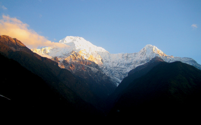
The sun rises over Annapurna Massif. Credit: Julia Rosen.
From Ulleri, we still had another 800 meters of steps to go to get to the village of Ghorepani, a popular tourist destination and jumping-off point for some of the easier treks in the Himalaya.
Along the way, we saw a number of metamorphosed sedimentary rocks like phyllites, schists and quartzites. The high-grade metamorphism exhibited in these rocks results from their proximity to the Main Central Thrust, a major geological fault associated with the collision of the northward-moving Indian Plate and the Eurasian Plate. The Main Central Thrust is a ductile shear zone along which the high-grade metamorphic rocks of the High Himalayan Sequence were thrust above the low-grade rocks of the Lesser Himalaya.
The Main Central Thrust has been the subject of considerable debate. The metamorphic grade changes continuously across the fault, and some evidence suggests that different parts may have been active at different times, leading to a complicated story to piece together. Although numerous studies have been carried out, the Main Central Thrust has not yet been exhaustively explored and further work will be needed to solve its puzzle.
A particularly popular spot near Ghorepani is Poon Hill. Many trekkers spend the night in Ghorepani and get up very early the next morning to take a 30-minute walk (a 200-meter ascent) to the top of Poon Hill, renowned for its amazing sunrise views, which include the Annapurna and Dhaulagiri high ranges. Unfortunately, when we hoofed it up Poon Hill early the next morning, we found clouds — and crowds — blocking some of the view, but it was nevertheless a breathtaking vista, at least for a geologist.
From here, one can see an almost complete sequence of the High Himalayan Crystalline Series — high-grade metamorphic rocks of Late Proterozoic to Early Cambrian age consisting of mica schist, quartzite, paragneiss, migmatite and leucogranites. Most geologists agree that these rocks are the metamorphic relatives of the Tethyan sediments that cap them. As India moved forward on its collision course with Eurasia, the Indian Plate scoured and accreted rocks from the floor of the Tethys Sea, the ocean between Asia and India at the time. Locating and studying these formerly marine rocks, some of which are now contained in the High Himalayan Crystalline Series, has been a focus of research for many years.
Searching for the South Tibetan Detachment System along the Kali Gandaki River. Credit: Jesse Davenport.
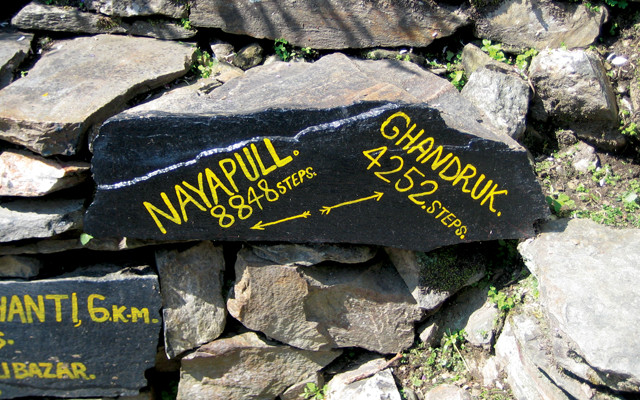
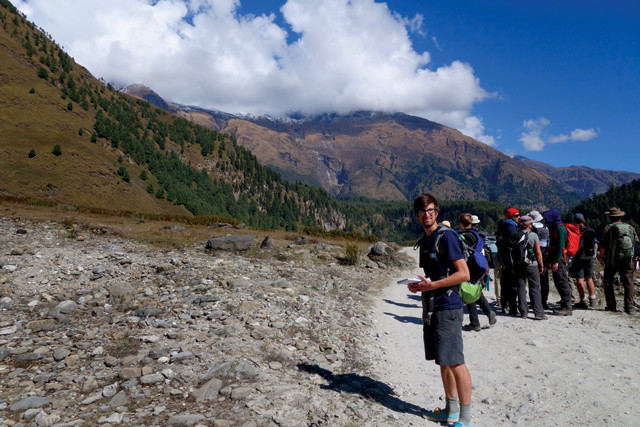
The popular and difficult Annapurna Base Camp Trek begins in Nayapul. Credit: Julia Rosen.
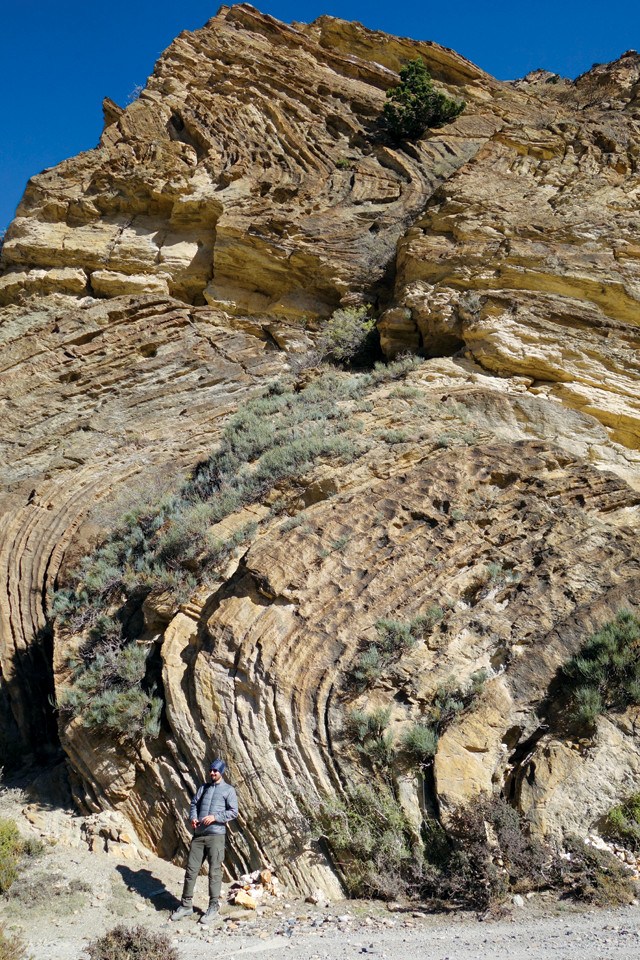
Folding in the Tethyan Sedimentary Series, seen along the road to Jomsom. Credit: Jesse Davenport.
The next leg of our journey was a 2,000-meter descent from Ghorepani to Tatopani. Along the way, we saw more of the Lesser Himalayan amphibolites, quartzites, phyllites and some more beautiful examples of folding. Tatopani is another popular tourist destination along the raging Kali Gandaki River. The name literally translates as “hot water,” and there are two popular hot springs near the river, which are very relaxing after a long day’s hike.
In Tatopani, we got back on the bus for the 1,290-meter climb, along a route bordered by sheer drops of 1,000 meters or more, to our next destination, Lete. Nerve-wracking as the trip was, it offered us the chance to see two large rockslides and debris flows: the prehistoric Dhampu-Chhoya rockslide, which blocked the Kali Gandaki River and subsequently formed a large lake, and a catastrophic debris flow coming off the northern slopes of the Nilgiri and Tilicho peaks. Rare, large events like these play a key role in shaping the Himalaya, but the more frequent, medium-sized events are much more of a concern to Nepali villagers. As we continued on, we got a close-up view of the High Himalayan Crystalline Series above the Main Central Thrust that we had seen from Poon Hill. At stops along the way, we also began observing crystals of garnet, staurolite and kyanite: evidence of increasing metamorphic grade in these crystalline rocks.
From Lete, the next leg was a long, but thankfully flat, 14-kilometer hike along the Kali Gandaki River. Our goal that day was to spot the South Tibetan Detachment System, the elusive boundary fault between the metamorphic rocks of the High Himalayan Crystalline Series and the Tethyan Sedimentary Series. The boundary is difficult to discern in most places, although it is more easily visible on some of the higher peaks in the region. In the 1980s, geologists suggested the boundary was discernible near the Chhaktan Khola, a small river near Jomsom. In Lete, however, the metamorphic rocks of the High Himalayan Crystalline Series intrude into the Tethyan Sedimentary Series sedimentary rocks, obscuring any clear boundary.
Back on the road to our next destination of Tukche, we passed a Tibetan monastery. Behind it, and along the road for many kilometers, were clusters of Tibetan refugee camps — a startling and tangible reminder of the political unrest that has plagued that neighboring country for so long.
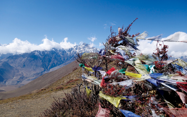
Tibetan prayer flags near Muktinath. Credit: Jesse Davenport.
After a night in the village of Tukche, we packed up our gear and headed to our final destination, Jomsom, some 13 kilometers away. Now amid the Tethyan Sedimentary Series proper, we were again seeing sedimentary rocks, such as limestones, shales and some lower grade meta-sedimentary rocks formed from the sediments scraped from the floor of the closing Tethys Sea. Although they can be seen at relatively low elevations near Tukche, these are the same sediments that compose the high peaks of the Himalaya, including Mount Everest.
As we walked from Tukche to Jomsom, we transitioned from an area of relatively high year-round precipitation into the rain shadow of the Himalaya where very little annual precipitation falls. The landscape changed completely, from lush forests and meadows to wind-swept barren landscapes, reminding me of Southern California’s mountains and desert.
Appropriately, our last day on the trail was to be our highest in elevation. Rising early, we took an 18-kilometer jeep ride, gaining 1,020 meters in elevation, to the village of Muktinath at 3,700 meters. The village is named after the holy temple of Muktinath, where methane gas seeping from the moraine sediments below the temple feeds three continuously burning holy flames, which Hindus believe were lit by Brahma himself as an offering to the creator.
We left Muktinath and, with high winds at our backs pushing us along, made the hike back across the Kali Gandaki River floodplain to Jomsom. As we hiked, we tried to spot the South Tibetan Detachment System, which we finally caught a glimpse of on the higher peaks. The next morning, we were again up early for the flight from Jomsom to Pokhara and back to Kathmandu to begin our journeys home.
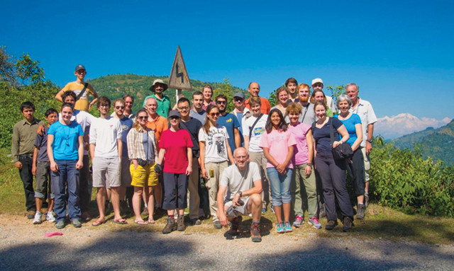
The iTECC group in Nepal. Credit: Jesse Davenport.
The Himalaya is an awe-inspiring place filled with too many breathtaking sites to count, a warm and welcoming people, and opportunities galore for adventure, exploration and reflection. At home, it is often easy to forget the ferocity of our natural world and the forces at play that shape the landscapes on which we live. In Nepal, these forces are clearly evident — from the vast mountains that are still rising to the devastating landslides and earthquakes that can sweep over the region in the snap of a finger. On the flight back to France, I began planning when I will next return to Nepal.
© 2008-2021. All rights reserved. Any copying, redistribution or retransmission of any of the contents of this service without the expressed written permission of the American Geosciences Institute is expressly prohibited. Click here for all copyright requests.