
by R. Forrest Hopson Wednesday, June 6, 2018
Lake Tahoe's famed water clarity has been clouded in recent years by increased algal growth due to nutrient runoff. Credit: ©Mary Caperton Morton
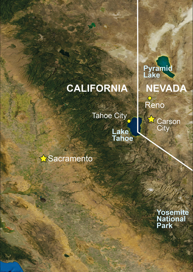
With a rich geological and cultural history, and ample hiking, camping and sightseeing opportunities, Lake Tahoe is one of most popular vacation destinations in the United States. The lake straddles the California-Nevada border at an elevation of 1,900 meters, occupying an intermontane basin rimmed by the towering peaks of the Sierra Nevada, including the two highest peaks in the basin, Freel Peak and Jobs Sister, each with an elevation of approximately 3,300 meters.
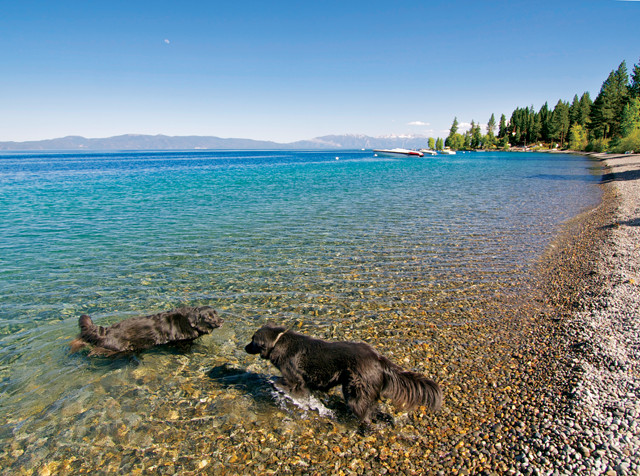
Lake Tahoe's western shoreline. Credit: ©Mary Caperton Morton
The first reported sighting of Lake Tahoe was in 1844 by John Frémont, who observed it while crossing the Sierra Nevada at Carson Pass. However, the lake was rarely visited until 1852 when J.C. Johnson established a route between Carson City, Nev., and Placerville, Calif., that crossed the Sierra Nevada at Echo Summit. Lake Tahoe was originally named Lake Bigler for California businessman John Bigler. However, when Bigler was elected governor of California, he infuriated his constituents who then began a campaign to rename the lake. The lake most likely owes its name to the Washoe Indian tribe word Tah-hoe, meaning “big water.” However, Mark Twain wrote in his book “Innocents Abroad” that Tahoe really means “grasshopper soup,” a favorite dish of the Paiute and Digger Indians.
Well known for its 500-meter-deep azure waters, Lake Tahoe is appropriately nicknamed the Jewel of the Sierra.
Geology of Lake Tahoe
Credit: AGI/NASA
Lake Tahoe and the surrounding mountains are underlain by Jurassic and Cretaceous granitic rocks (predominately granodiorite) that locally enclose small pendants of Triassic and Jurassic metamorphic rocks. In the Carson Range on the east side of Lake Tahoe, plugs of Miocene latite and trachyte, very fine-grained extrusive igneous rocks containing alkali feldspar, intrude the granodiorite bedrock. Capping the granitic and metamorphic basement rocks are Early Miocene rhyolite ashflow tuffs and Pliocene to Pleistocene basalt and local latite and associated lahar deposits. Capping the Carson Range is a pre-Miocene, possibly Eocene, stream gravel deposit that was laid down by an ancient river that flowed from Nevada into California before the Sierra Nevada was uplifted.
Modern Lake Tahoe began to form about 2 million years ago following the eruption of volcanic basalt and latite lava flows that dammed the outlet several times at the head of the Truckee River, at present-day Tahoe City. During periods of Pleistocene and Early Holocene glaciation (118,000 to 9,990 years ago), ice caps covered the Sierra Nevada with large valley glaciers that scoured out the granitic bedrock. Temporary damming of the lake’s outlet by the glaciers caused water levels to rise, occasionally leading to catastrophic flooding as far downstream as present-day Reno when the dams were eventually breached. When the last of the glaciers melted, they left behind jagged peaks, lake-filled basins, and U-shaped valleys.
The lake lies in an active fault-bounded basin, a half graben that formed about 3.7 million years ago. Although Lake Tahoe Basin is geographically within the Sierra Nevada, it is technically a Basin and Range structure because it was created by extensional forces that continue to act on the Basin and Range Province to the east. Five east-dipping normal faults cut the basin, and at least three of them are active and capable of producing magnitude-7.0 earthquakes. If such a quake occurred on either of two of the faults, it could produce a 10-meter-high tsunami in certain parts of the lake. In addition, a recent study showed that several faults in the western half of the Lake Tahoe Basin are capable of producing earthquakes between magnitude 6.3 and 6.9 that could trigger more landslides.
Such an event is not unprecedented in the lake’s geologic past. On the California shore of Lake Tahoe lies McKinney Bay, which was created by a massive submarine landslide that generated an immense tsunami in the lake. The landslide left behind a 168-meter-high underwater headwall with a slope of more than 20 degrees and a debris apron on the lake bottom that extends outward for about 10 kilometers. Beyond the toe of the debris apron, scattered about on the flat lake bottom, are isolated blocks of lakebed sediments carried from the west side of the lake by the landslide. They measure up to 914 meters long, 366 meters wide and 73 meters high. The exact age of the landslide is unknown but is thought to have occurred about 9,000 years ago — after the Tioga stage of the Wisconsinan glaciation — because deposits laid down by the landslide-generated tsunami overlie till of known Tioga age.
Lake Tahoe is famous for its clear water. However, water clarity has been declining recently, causing concern among scientists and public officials. As of 2010, the lake is clear to about 19 meters below the surface, compared to 31 meters in 1968. Clarity loss is the result of increased fine sediment particles, organic matter, and nutrients being washed into the lake by erosion, stream runoff and atmospheric deposition. Algae, which feeds on nitrogen and phosphorus from urban runoff, is chiefly to blame. In addition, car exhaust, sewage and hydrocarbon spills also threaten water quality.
Navigating Around the Lake
The best and easiest way to see Lake Tahoe’s geology is to drive the highways that encircle the lake, a distance of 116 kilometers. The highways provide excellent views of the lake and mountains, and for the tourist’s convenience, there are numerous roadside turnouts with interpretive displays. The turnout on Highway 431, known to locals as the Mount Rose Highway, provides the best roadside panoramic view of Lake Tahoe and the Sierra Nevada. Note that the roads are often narrow and high and they wind around steep mountainsides; a drive around the lake will take awhile.
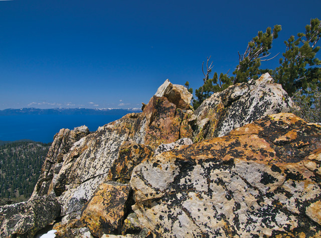
Rocky summit along the Tahoe Rim Trail, which stretches 241 kilometers around the lake. Credit: ©Mary Caperton Morton
There are two must-see stops for visitors interested in Lake Tahoe geology: Cave Rock and Emerald Bay. Cave Rock is an 8.7-million-year-old trachyte intrusion that owes its name to an overhang above the tunnels on the south wall. Sometime between 118,000 and 56,000 years ago, the level of Lake Tahoe was about 27 meters higher than it is today. Crashing waves hollowed out the caves and created a wave-cut bench.
One of the most scenic places in the Lake Tahoe Basin is Emerald Bay, which occupies a drowned glacial valley that was filled during a previous high stand of Lake Tahoe. The glacier that created Emerald Bay advanced from an ice cap about 6.5 kilometers to the southwest, and proceeded down Eagle Creek where it emptied into Lake Tahoe. This glacier left behind two lateral moraines that form the bay and a terminal moraine at its mouth. Also at Emerald Bay is a rockslide scar that crosses California Route 89 along the southeastern wall. The large rockslide occurred in the winter of 1953 when granodiorite failed along joint surfaces that parallel the highway and dip into the bay. The probable cause was undercutting during construction of the highway. Rain and snowmelt runoff lubricated the joint surfaces, which caused the slope to fail. The slide caused considerable damage to the highway.
Another good place to stop is Sand Harbor State Park where visitors can get a good look at the granodiorite. Estimated to be 90 million to 80 million years old, this is a typical Sierran granodiorite with inclusions and aplite dikes.
Many trails allow hikers to explore Lake Tahoe Basin. The more adventurous traveler can hike the Tahoe Rim Trail, a 241-kilometer-long trail that follows the ridge crests that bound the basin. Two favorite trails are to the summits of Mount Tallac and Mount Rose, both of which offer panoramic views of the basin. Two trails lead to the summit of Mount Tallac; on both, hikers encounter Cretaceous granodiorite and Jurassic metavolcanic rocks of the Mount Tallac Pendant while crossing over glacial landforms on a 975-meter climb. The trail to Mount Rose gains about 579 meters in elevation and crosses Cretaceous granodiorite and Miocene laharic deposits on its way to the Miocene andesite that caps the summit. The summit of Mount Rose offers great views not only of Lake Tahoe, but also of Reno and the mountain ranges to the east.
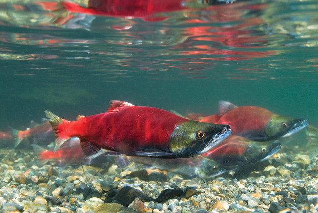
Each year in early October, as the land-locked Kokanee salmon migrate back to Taylor Creek to spawn and die, the U.S. Forest Service sponsors the Kokanee Salmon Festival at the Lake Tahoe Visitor Center. Credit: ©iStockphoto.com/David Safanda
Visitors to Lake Tahoe during the autumn months will want to visit Taylor Creek to watch the annual Kokanee salmon run. Each year the Kokanee salmon, introduced to Lake Tahoe by biologists in 1944, make their annual migration up Taylor Creek from the lake to spawn. The U.S. Forest Service has established a paved footpath along Taylor Creek in the salmon viewing area. This includes several interpretive displays that describe the salmon’s life cycle and migration. If you are lucky, you might even spy a bear feasting on the hapless salmon. Also, don’t miss the viewing tank along the footpath a few hundred meters west of the visitors’ center, which allows visitors close-up views of the salmon and rainbow trout that live in Taylor Creek.
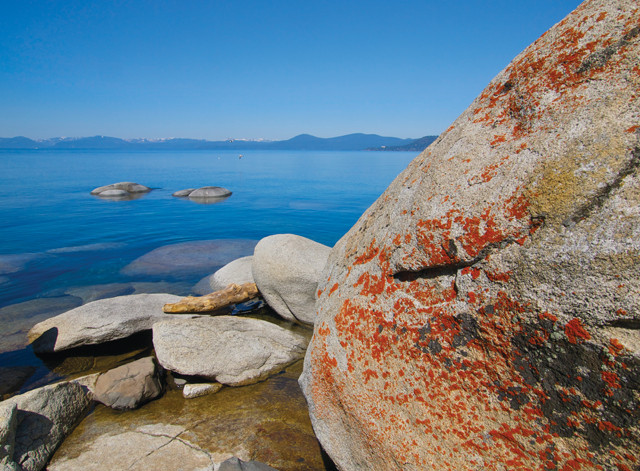
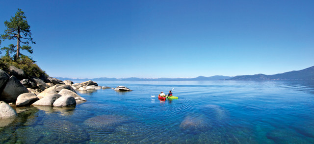
Beautiful granitic boulders line the lake. Credit: ©Mary Caperton Morton
The Lake Tahoe Basin is easy to appreciate. With the lake’s deep blue water, towering peaks, forested mountainsides, luscious green meadows, and a wide variety of recreational opportunities ranging from gambling to hiking to skiing, it is easy to understand why Lake Tahoe attracts visitors from all over the world. Furthermore, the interesting geology that includes granitic, metamorphic and volcanic rocks, as well as glacial landforms will appeal to geologists and anyone interested in geology. Lake Tahoe is truly the jewel of the Sierra Nevada.
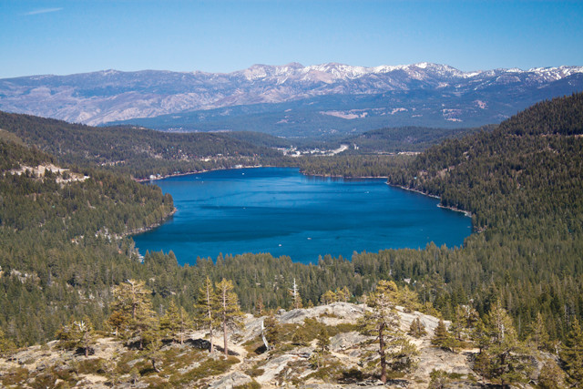
Donner Lake — named for the famed Donner Party, the emigrants who were stuck in the Sierras during the winter of 1846-1847 — is a nice stop along Interstate 80 on the drive from Sacramento to Lake Tahoe. Credit: R.F. Hopson
© 2008-2021. All rights reserved. Any copying, redistribution or retransmission of any of the contents of this service without the expressed written permission of the American Geosciences Institute is expressly prohibited. Click here for all copyright requests.