
by Terri Cook and Lon Abbott Wednesday, May 30, 2018
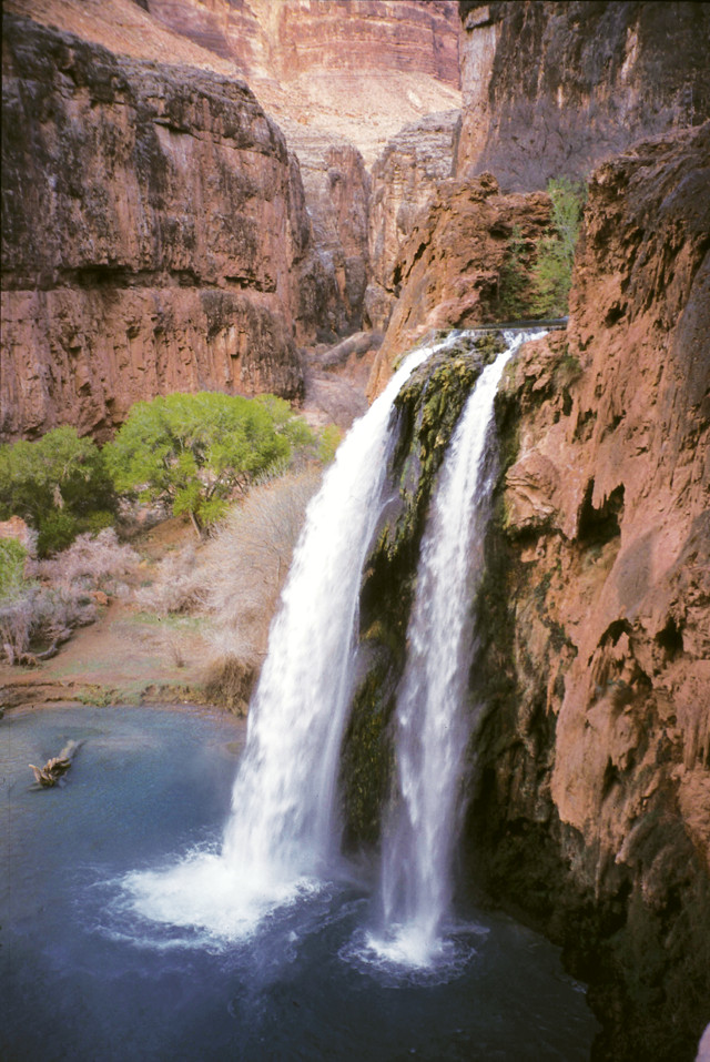
The most famous of Havasu Canyon's waterfalls, Havasu Falls, is shown prior to the 2008 flash flood that eradicated its famous twin jets. Credit: Lon Abbott and Terri Cook
For Northern Arizona’s Havasupai tribe, whose name means “People of the Blue-Green Water,” a deep connection with the land has been the culture’s cornerstone for hundreds of years. It is easy to see why when you journey to their magnificent homeland below the Grand Canyon’s rim. There you are treated to all the majestic grandeur you expect in the Grand Canyon, plus a robust stream with the most vibrantly turquoise water this side of the tropics. The stream — Havasu Creek — rushes from one deep emerald pool to the next over a series of small travertine dams and plunges over five spectacular waterfalls as it tumbles pell-mell toward the Colorado River. The shape of each waterfall is slowly modified by the addition of new travertine rock that precipitates out of the very water that tumbles over its lip. More dramatic resculpting is done by the frequent flash floods that roar down Havasu Creek, most recently in 2008.
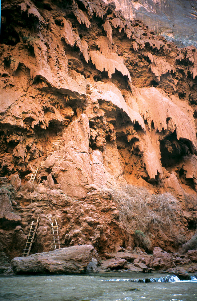
The hike to Mooney Falls involves clambering down ladders, ducking through tunnels, and traversing steep sections while grasping chain handrails. Credit: Lon Abbott and Terri Cook
Havasu is truly a place to witness geology in action.
Credit: Kathleen Cantner, AGI
A Plethora of Falls
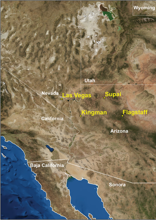
The village of Supai, the Havasupai capital, is the only full-fledged town within the confines of the Grand Canyon. Just getting to this isolated community is an adventure. From the end of the road at the Grand Canyon’s southern rim, you have three options. You can shoulder a pack and tackle the scenic 13-kilometer hike into the canyon along the Hualapai Trail. You can follow the same route on horseback. Or, you can hop aboard the helicopter that occasionally ferries supplies to Supai.
After arriving in Supai, you’ll likely want to hit the trail to the world-famous Havasu Falls, two kilometers downstream. Here, Havasu Creek’s turquoise waters leap over a 30-meter-tall cliff of travertine rock. The deep emerald pool beneath the falls forms an idyllic swimming hole. Havasu Creek then drops through a tranquil section of travertine pools as it crosses through the campground, whose water is supplied by natural springs, until it reaches Mooney Falls, 1.2 kilometers downstream.
At 60 meters tall, Mooney is the largest of the five Havasu waterfalls. Most visitors favor the scenery of Havasu, but that is probably because they’ve only viewed Mooney from its rim, where the easy trail ends. Experienced hikers who are comfortable with heights can pick their way to the base of Mooney Falls — an exhilarating adventure involving clambering down ladders, ducking through tunnels, and traversing steep sections while grasping chain handrails, all with the roar of the nearby falls filling your ears. During the descent, the view of Mooney Falls as you emerge from the first tunnel is simply breathtaking.
The Story of Havasu Travertine
Havasu Canyon’s beautiful blue-green water, its spectacular waterfalls, and its popular swimming holes are all the products of the abundant travertine rock that has been, and still is, forming in this part of the Grand Canyon over the last few million years. The story of Havasu travertine formation is an enjoyable one for any geology enthusiast to contemplate while lazing under the warm sun between periodic swims in the emerald pools. The story begins with the specific location of the Grand Canyon, which the Colorado River has carved through the southern tip of the Kaibab Plateau. The plateau is actually a broad dome that formed about 70 million years ago during the same episode of regional compression that created the Rocky Mountains. Because of the canyon’s location on the dome’s southern end, its rocks tilt gently south — toward the river on the north rim and away from the river on the south rim.
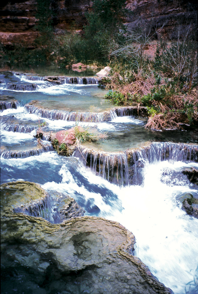
When calcite-laden water emerges at a spring, or where it is agitated at a rapid or a waterfall, it loses dissolved carbon dioxide, causing calcite to precipitate out of the water as travertine. Credit: Lon Abbott and Terri Cook
The porous nature of the Kaibab Limestone — the rock comprising the canyon rim throughout Grand Canyon National Park — means that most of the rain and snow that falls on the plateau percolates into the subsurface, becoming groundwater. Because of the rocks’ gentle southward tilt, most of the south rim’s groundwater flows to the south-southwest, eventually re-emerging as a spring where the ground surface intersects the water table. In Arizona’s “canyon country,” such springs typically form at the base of cliffs lining the deepest canyons. As the largest tributary on the Grand Canyon’s southwest rim, Havasu Creek has carved the deepest and longest canyon, and thus captures the lion’s share of the south rim’s groundwater. That water emerges at Havasu Springs, the biggest spring south of the Colorado River, a short distance upstream of the point where the Hualapai Trail reaches Havasu Creek. Above the spring, Havasu Canyon is a typical ephemeral wash with only occasional water and little vegetation; below the spring is a riparian paradise that has sustained the Havasupai people for hundreds of years and attracts thousands of visitors to its beautiful waterfalls.
The interaction between limestone and water is the next important step in the travertine formation process. The Grand Canyon’s walls are festooned with bold limestone cliffs, the most famous of which are the Kaibab and the Redwall limestones. The Redwall forms the canyon walls adjacent to both Havasu and Mooney falls. Limestone is composed of the mineral calcite, which is made of ions of calcium and carbonate that easily dissolve in even mildly acidic water such as rainwater or groundwater.
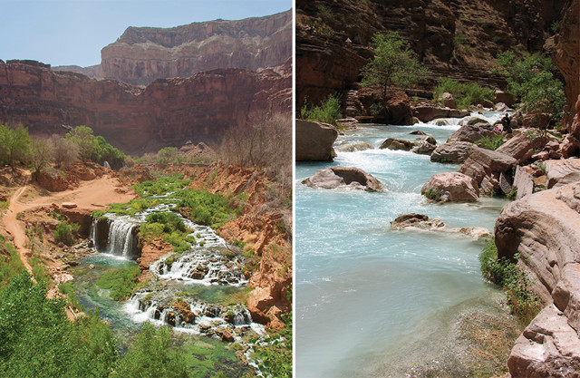
Havasu's blue-green waters nourish oases of vegetation that have sustained the Havasupai people for centuries. Credit: Left: ©iStockphoto.com/seb fremont; right: Lon Abbott and Terri Cook
As groundwater percolates through the Grand Canyon’s numerous limestone layers, it dissolves abundant calcite. When the water emerges at a spring, or where it is agitated at a rapid or a waterfall, it loses dissolved carbon dioxide. This reverses the chemical reaction that dissolved the limestone in the first place, causing calcite to precipitate out of the water as travertine. Travertine formation is further aided by chemical reactions mediated by bacteria, made evident by the thin veneer of travertine found encrusting twigs and leaves along Havasu Creek. Because Havasu Creek transports the majority of the south rim’s emergent groundwater, it contains the most travertine, but travertine mounds are also present at springs along the Little Colorado River, at Elves Chasm and numerous other locations throughout the canyon.
Based on an analysis of helium isotopes in travertines from around the Southwest, University of New Mexico geochemist Laura Crossey recently determined that travertine formation is strongly favored when groundwater originally sourced from rain or snowmelt (known as meteoric groundwater) mixes with much deeper groundwater that has risen up from the mantle. The isotopic signature of Havasu travertine fits that interpretation: water from the mantle rises here beneath your feet and mixes with water from above to form the Havasu travertine.
Natural Springs, Fertile Soil and Flash Floods
The Havasu waterfalls all stand where thick plugs of travertine have formed. The portion of Havasu Canyon surrounding Supai is flat and boasts fertile soil that the Havasupai people have tilled for centuries. The reason for both the topography and the rich soil is that a travertine plug downstream once dammed the creek, backing up a lake behind it. Silt eventually filled the lake, smoothing the canyon floor and enriching its soils with nutrients.
The travertine dam that formed the lake was eventually breached, likely during a flash flood, and the lake drained away. (Flash floods are commonplace on Havasu Creek and have claimed the lives of several hikers.) Travertine dams are malleable and ephemeral features; flash floods routinely modify them and, consequently, the shape of the waterfalls they host. The biggest flood known on Havasu Creek, which wiped out the village of Supai, occurred on New Year’s Day 1910. Fortunately, almost all of the residents were away on a pilgrimage and no one died. Although a few similar winter floods are also known, most Havasu floods occur during torrential summer thunderstorms, most commonly during El Niño years. The most recent flash flood to alter the waterfalls occurred on the night of Aug. 16-17, 2008. Helicopters evacuated Supai residents and campers as the water level rose 2.5 meters overnight. Fortunately, no one was killed, but the area was closed to tourists until June 2009 while stream banks were fortified, trails were rerouted and an early warning system was installed for the village.
About 1.5 kilometers below Supai, the 2008 flood changed the course of Havasu Creek, diverting it around the old Navajo Falls. In the process, the flood created two new falls: Upper (or New) Navajo and, about 200 meters downstream, Lower Navajo (or Rock) Falls. Havasu Falls was slightly lowered and lost its once-signature twin water jets. Frequent Havasu visitors attest that, despite these dramatic changes, the canyon is as beautiful as ever.
The opportunity to witness geologic change on a human timescale only serves to enhance Havasu’s allure for the geotourist, who can observe Mother Nature’s latest masterpiece — wrought in travertine and blue-green water — before she unleashes another flash flood to rework her geologic vision of this idyllic place.
© 2008-2021. All rights reserved. Any copying, redistribution or retransmission of any of the contents of this service without the expressed written permission of the American Geosciences Institute is expressly prohibited. Click here for all copyright requests.