
by Terri Cook and Lon Abbott Thursday, June 7, 2018
Most people go to the Caribbean to escape — to relax on pristine beaches, enjoy fruity island drinks or perhaps swim with the dolphins. In Barbados, you can certainly do that. But in between your beach days, you may want to spend some time exploring the island’s unique geological features. The island provides the rare opportunities to stand on an active accretionary wedge and to visit uplifted coral reefs that have played a pivotal role in reconstructing climate and sea-level records of the recent geological past.
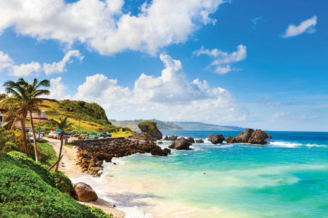
The lush paradise of Barbados stands in curious isolation far to the east of the other Lesser Antilles islands. Except Barbados, all the isles — which collectively form the sweeping island arc associated with the Lesser Antilles Subduction Zone — are composed of volcanic rock. Barbados consists of sedimentary rock, a great wedge of layers scraped off the top of the downgoing tectonic plate below like a mound of snow piling up on a shovel. Although such accretionary wedges exist at subduction zones around the world, they are usually submerged. Barbados is one of a few places on the planet where enough material has piled up to push the accreted sediments above sea level. These unusual circumstances make Barbados one of the best places in the world to determine the history of sea-level rise and fall during the last 700,000 years.
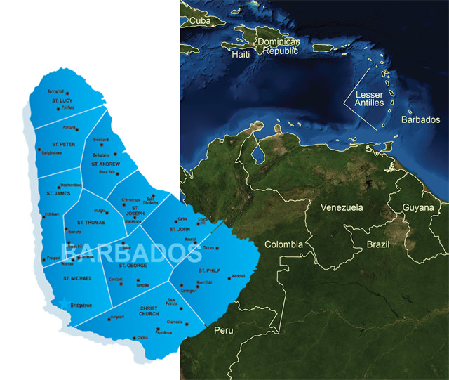
Barbados stands in curious isolation far to the east of the other Lesser Antilles islands. Credit: left: ©iStockphoto.com/woewchikyury; right: AGI/NASA
The island of Barbados is the only exposed portion of a broader uplift called the Barbados Ridge. The ridge sits above the subduction zone between the descending South American Plate to the east and the overriding Caribbean Plate to the west. Barbados’ basement rocks consist of Eocene-aged marine mudstones and sandstones scraped off the downgoing plate early in the wedge’s development. That sediment supply has been delivered from the north coast of South America via submarine canyons, the most important of which is the underwater extension of the mighty Orinoco River. The basement rocks are overlain by a slice of sedimentary rock initially deposited in the Tobago Trough, the basin sandwiched between Barbados and the other Lesser Antilles islands. The slice was pushed eastward, over the older accretionary wedge rocks by continued subduction.
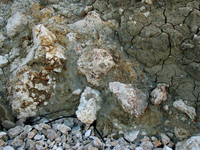
This messy mixture of mud and rocks is part of the diapir that continues to push Barbados above sea level. Credit: ©Terri Cook and Lon Abbott
Under Barbados, the accretionary wedge’s waterlogged mud forms a diapir, a blob of sediment that is less dense than the surrounding rock and thus rises toward the surface like a bubble in a lava lamp. The island emerged from the waves about 700,000 years ago when this diapir began to force up the great sediment pile, which it continues to push ever higher. Although the uplift rate varies from place to place, on average the island is rising about 30 centimeters every thousand years.
As it ascends, it lifts up the island’s encircling coral reefs. After one reef is elevated, exposed and dies, a new one develops and the cycle repeats. The result is a giant’s staircase of ancient reefs. Each step consists of a former fringing reef whose coral grew to sea level but no higher, thus recording the height of sea level at the time the reef formed. Pairing past global temperature fluctuations (determined from analysis of oxygen isotopes in both ice and deep-sea sediment cores) with past sea-level changes is of crucial importance for predicting future sea-level rise, making the Barbados terraces indispensable in climate change research.
Climbing the Giant’s Staircase
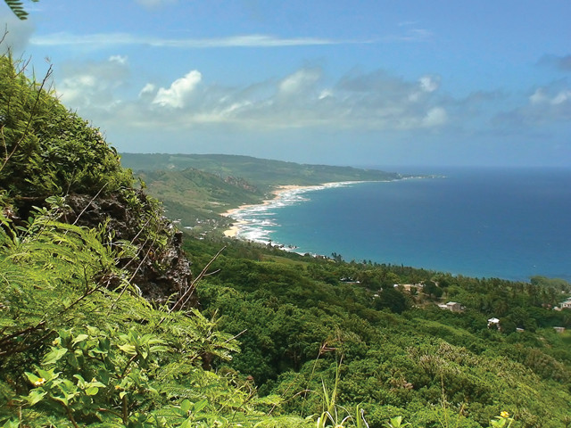
View looking northward from Hackleton's Cliff. Credit: Siegfried Weisner
A delightful geo-excursion is to climb the giant’s staircase of reefs from Barbados’ east coast up to Mount Hillaby, the island’s highest point at 340 meters. From Bathsheba, ascend either the H2 or the H3 highway, aiming first for Hackleton’s Cliff. During the ascent, look for the flat treads of the staircase, each of which marks a separate terrace. Each tread formed during a sea-level highstand that marked a fluctuation in the Pleistocene climate. Sea-level highstands occurred during both interglacial and interstadial (unusually warm glacial time) periods.
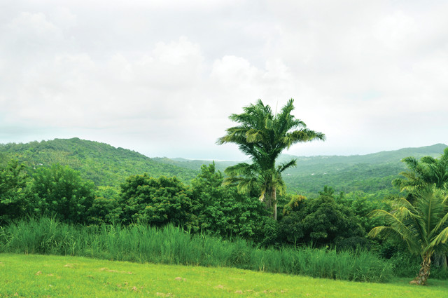
The lush highlands of Barbados. Credit: ©iStockphoto.com/blendshapes
You cross six separate terraces on the drive up to Hackleton’s Cliff. Although some are obscured by rainforest, most are easily visible because they were cleared to plant sugarcane, which was the island’s economic mainstay until tourism took over. The lowest terrace stands just a few meters above current sea level. It formed 82,000 years ago, during an interstadial period within the most recent glacial episode. The next higher terrace, known locally as First High Cliff, stands 30 to 60 meters above sea level and is especially prominent. It formed 125,000 years ago during the peak of the last interglacial episode, when sea level stood six meters higher than it does today. Research on this cliff was instrumental in convincing climate scientists that Milankovitch cycles (cyclic changes in Earth’s orbit) drove the Pleistocene climatic oscillations.
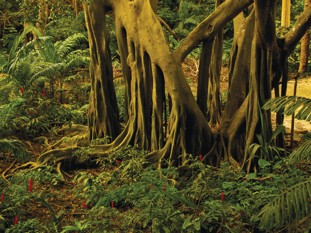
A hike through the botanical gardens of Welchman Hall Gully reveals a completely different landscape than most of the rest of the island. Credit: Nicole Gerace
Hackleton’s Cliff is an especially tall limestone escarpment that is a composite feature formed by the erosion of several different terraces, which amalgamated them into a single cliff. From here, you will be treated to one of Barbados’ best views of the wild, and nearly empty, east coast. Several more terraces produce the staircase-like topography above Hackleton’s Cliff, culminating in the coral cap on Mount Hillaby, which records sea levels back to 640,000 years ago. The ages of these terraces match the times of interglacial and interstadial episodes recorded in the deep-sea climate record, and they match the periodicity of the Milankovitch cycles.
The bottom step of the staircase is composed of actively growing reefs. These are found largely on the west (leeward) coast, where a gently sloping shelf extends about 300 meters from shore. You can experience the modern reefs by diving, snorkeling or descending by submarine.
A Mélange of Geologic Sites
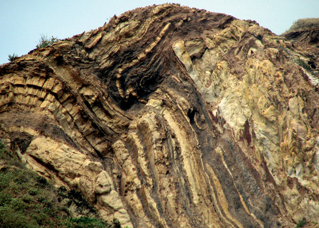
Dramatically folded basement rocks along the east coast were deposited in submarine canyons before being uplifted. Credit: ©Terri Cook and Lon Abbott
On a one-day excursion, you can examine the diapir that birthed the island, view the wedge of rocks it elevated, and ascend the giant’s staircase of reefs, the Rosetta Stone for deciphering Quaternary fluctuations in sea level. Other geo-adventures include diving or snorkeling along the modern coral reef, exploring a botanical garden sheltered in a limestone sinkhole, and strolling along a pristine beach studded with wildly sculpted rocks.
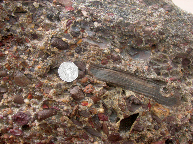
Barbados' basement rocks, like these along the beach north of Cattlewash, consist of turbidites scraped off the downgoing South American Plate to form the Barbados Ridge accretionary wedge. ©Terri Cook and Lon Abbott
The beach at Bathsheba is known for its mushroom-shaped boulders. Credit: ©iStockphoto.com/TommL
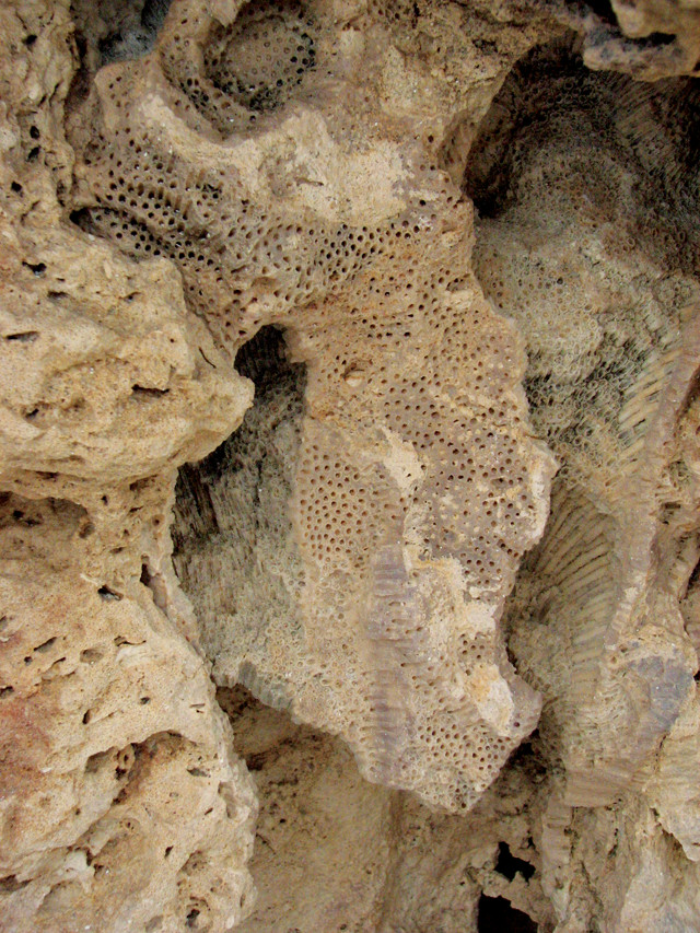
Barbados' uplifted reef terraces contain individual coral specimens from which scientists analyze isotopic composition to derive the terrace age. Credit: ©Terri Cook and Lon Abbott
As the terraces are slowly uplifted, erosion works to reshape them. Near Mount Hillaby, explore the beautiful stalactites of Harrison’s Cave, carved out of Pleistocene limestone, and the botanical garden in cool, moist Welchman Hall Gully, which oddly hosts limestone stalactites and stalagmites — features not normally seen aboveground.
In the island’s Scotland District along the beautiful, wind-swept central east coast, you can see both the basement rocks and the remnants of the mud diapir. Outcrops of mélange — the messy diapiric mixture containing blocks of all sizes embedded in a sheared, muddy matrix — are visible along the coast near Bathsheba. The mélange is also prominent at Coconut Grove, just south of Chalky Mount, where fossils indicative of an ancient cold seep ecosystem have been found. The dramatically folded basement rocks are visible along the beach north of Cattlewash, as well as at Chalky Mount. These folded rocks are mainly turbidites, sediment that was swept from northern South America onto the deep ocean floor by strong underwater currents about 44 million years ago.
At Bathsheba, a long swath of beach famous for its surfing hosts odd-looking, mushroom-shaped limestone boulders. After tumbling down to the shore, each boulder developed an intertidal notch around its base, sculpting the distinctive mushroom shape. The notch is not formed by the battering of waves, but rather by the feeding action of invertebrates scraping algae from the rock, a reminder that geological processes both large and small are constantly at work.
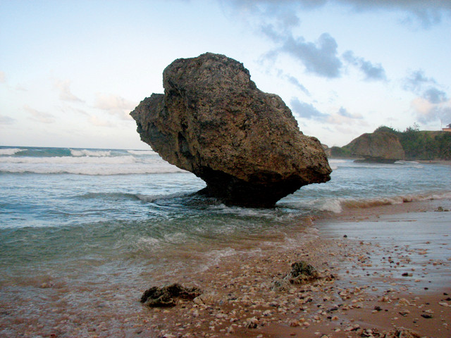
The mushroom-shaped rocks near Bathsheba were formed by invertebrates lunching on algae from the rocks. Credit: ©Terri Cook and Lon Abbott
Along the central east coast near Bath, a petroleum seep is visible near the beach, and it is common to spot patches of oil coating rocks. Just north of the island’s international airport, a small oilfield produces 1,000 barrels per day, fulfilling about 11 percent of the country’s needs. The oilfield’s lifetime production totals more than 9 million barrels. The oil is sent to Trinidad for refining. The hydrocarbons’ source is organic-rich mudstones within the basement rocks, which were subducted down into the “oil window.” Here, elevated heat and pressure converted the solid organics into liquid oil, which gradually rose toward the surface due to its relatively lower density.
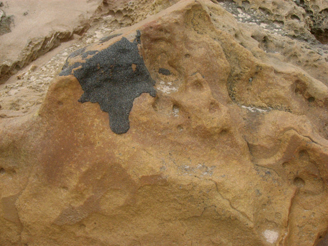
Natural oil seeps stain rocks along the island's east coast. Credit: ©Terri Cook and Lon Abbott
Barbados is an idyllic tropical destination, and for geology buffs, a visit to this island offers not only the chance to relax but also the chance to see geologic processes in action.
© 2008-2021. All rights reserved. Any copying, redistribution or retransmission of any of the contents of this service without the expressed written permission of the American Geosciences Institute is expressly prohibited. Click here for all copyright requests.