
by Mary Caperton Morton Friday, January 13, 2017
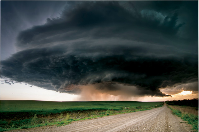
Updraft patterns in the lower reaches of supercell storms may help scientists better predict which storms will spawn tornadoes. Credit: Lane Pearman, CC BY 2.0.
Sometimes, large thunderstorms called supercells spawn tornadoes; sometimes they don’t. Predicting whether supercell drafts will spiral into a tornado is tricky, with false-alarm rates running as high as 75 percent. In a new study using helium balloons to study tornadogenesis in supercells, researchers have shown that wind patterns in the lowest 1 kilometer of a storm may play a major role in forming twisters.
Traditional weather monitoring systems, including radar and long-range weather balloons, are usually unable to distinguish between tornadic and nontornadic supercells, says Brice Coffer, a graduate student studying meteorology at North Carolina State University (NC State) and lead author of the new study, published in Monthly Weather Review. This leads to a high rate of false alarms, he says.
To get a clearer picture of what goes on inside a developing supercell, Coffer and co-author Matthew Parker, also at NC State, launched dozens of helium-filled balloons equipped with instruments to measure wind speed, humidity, pressure and temperature directly into seven tornadic and five nontornadic storms in a project called Verification of the Origins of Rotation in Tornadoes Experiment, or VORTEX2. They then used data collected by the balloons to create computer simulations of tornadic and nontornadic storms.
“Normally, you don’t have this many observations of a storm, and it’s even less common to get a clear picture of what’s happening in the lower levels, which radar can’t see,” Coffer says. Comparing the tornadic and nontornadic models, he and Parker found significant differences in the way that upward-sweeping feeder winds — called updrafts — were drawn into the storm. “In nontornadic storms, the updrafts were disorganized, like a football being thrown end over end.” In tornadic storms, however, the updraft patterns resembled footballs thrown with perfect spirals. “This spiraling updraft created a more organized spin [in the supercell] and allowed for greater stretching and convergence of wind patterns into a tornado,” he says.
Supercells can extend up to 14 kilometers into the atmosphere, but the new study shows that tornadogenesis predictions may be improved by focusing monitoring efforts more on the lowest reaches of storms, below 1 kilometer. “It seems that’s where all the important action is that determines whether the storm is going to produce a tornado or not,” Coffer says.
© 2008-2021. All rights reserved. Any copying, redistribution or retransmission of any of the contents of this service without the expressed written permission of the American Geosciences Institute is expressly prohibited. Click here for all copyright requests.