
by Julie Brigham-Grette, Martin Melles, Pavel Minyuk and Christian Koeberl Thursday, January 5, 2012
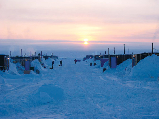
Sunrise at the scientists' field camp on the western shore of Lake El'gygytgyn. El'gygytgyn International Science Crew
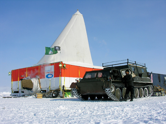
One of the tents at the drilling platform. El'gygytgyn International Science Crew
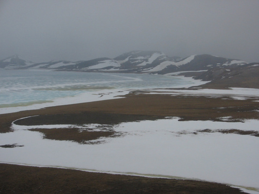
Lake El'gygytgyn as it might have looked during the last peak glaciation 21,000 years ago. El'gygytgyn International Science Crew
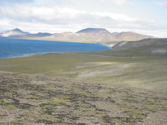
Lake El'gygytgyn as it looks today in summer, during the present interglacial. El'gygytgyn International Science Crew
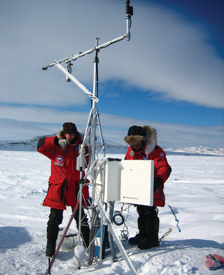
This meteorological station in Chukotka records temperature and precipitation data. El'gygytgyn International Science Crew
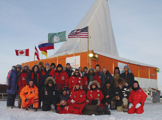
The drilling team. El'gygytgyn International Science Crew
Nearly 3.6 million years ago, a large asteroid slammed into Earth in what is today northeastern Russia. Within minutes, the impact formed an 18-kilometer-wide hole in the ground that then filled with water. The sediments that collected in the bottom of that lake since the impact may provide one of the best stratigraphic records of high-latitude climate change over the last 3.6 million years. Last year, we traveled to this remote region to drill into these sediments to see what we could learn about Arctic change.
The impact occurred in a region of rolling, low mountains; it left behind one of the best-preserved large impact structures on the planet. But the crater has hardly been studied because of its remote location: At 100 kilometers north of the Arctic Circle in central Chukotka, on the continental divide between the Arctic Ocean and the Bering Sea, El’gygytgyn (pronounced el ghee-git-gin) Crater — now Lake El’gygytgyn — is inaccessible by road.
But because it is so remote and well-preserved, Lake El’gygytgyn offers a unique opportunity to learn more about impact processes and past climate change. Large, deep lake systems are not uncommon throughout the world, but Lake El’gygytgyn holds untapped scientific potential principally because of the crater’s age and strategic geographic location.
The structure is a classic “complex” impact crater with a raised portion in the center, which is currently still buried underneath lake sediments. It is also the only impact crater known on Earth that has formed in siliceous volcanic rocks. Its study thus not only allows us to gain unique information about shocked volcanic rocks (which is useful for comparison with other planets), but also about the effects of a large impact event in a delicate environment.
The formation of an impact crater is a surprisingly rapid geological process — the main sequence of events is over in just a few minutes. In the case of El’gygytgyn, an asteroid about 1 kilometer in diameter traveling at about 15 to 30 kilometers per second hit the surface of the Cretaceous-aged volcanic rocks, almost instantaneously melting and vaporizing the top layers of rock. The energy released during this impact was orders of magnitude larger than the combined nuclear arsenal of the whole world. The melted material splashed mostly outside the crater rim. A shock wave spread out radially through the ground, compressing the volcanic rocks and causing irreversible changes in the structure of the minerals in those rocks. Shocked minerals, high-pressure minerals and melted rocks from this shock wave are still preserved at the impact site today.
As a result of the shock wave, the layers of rocks in the main crater were broken, melted and thrown many tens of kilometers in the air. Some of the material fell back into the crater — even as the bottom of the crater rebounded from the impact to form what’s known as a central uplift. Within tens of seconds, a mountain of rock about 1.5 kilometers in height and several kilometers in diameter was uplifted.
As the rocks that were thrown into the sky rained back down, they buried the central uplift and formed a layer of different types of rocks (called suevites), including some impact melt or glass inclusions, that is hundreds of meters thick, maybe even a kilometer or two.
For a few thousand years after the violent impact, heat from the event fueled hot springs and hydrothermal waters that circulated in the fractured rocks. Only after the fractured rocks from the impact, called breccia, cooled was the impact phase over, giving way to a calmer post-impact history, when a lake formed on the crater floor and sediments were deposited over the next few million years, perfectly preserving the Arctic’s climatic history.
Lake El’gygytgyn is located nearly in the center of Beringia — the largest contiguous landscape in the Arctic to have escaped widespread, continental-scale glaciation throughout time. As a consequence, sediments accumulated since the time of impact should chronicle a long, unbroken terrestrial record of past climate change.
When the impact occurred in the warm middle Pliocene 3.6 million years ago, northeastern Russia was not the snow-covered wasteland it resembles today. It was free of permafrost; instead, the Arctic borderlands were forested all the way to the northernmost coasts, blanketed largely by coniferous forests, complete with alder, birch, hemlock, fir, several types of pines and larch.
Mean annual temperatures were probably 10 to 14 degrees Celsius warmer than today. Meanwhile, the Arctic Ocean was many degrees warmer, lacking summer sea ice (though the surface may have frozen over briefly in the winter), and the Greenland Ice Sheet did not exist in its present form. In fact, nearly a million years passed between the asteroid’s impact and the onset of the first major glaciation of the Northern Hemisphere.
It has seen a lot of changes since then, which is precisely why we wanted to study it.
The fact that this sediment record is so continuous provided major impetus for our project. After years of challenging logistical planning and the development of international partnerships, an international team of scientists from the United States, Germany, Russia and Austria, staged scientific drilling operations at Lake El’gygytgyn to recover hundreds of meters of cores containing lake sediments and impact breccias. We hope these cores will provide new insights into the climate evolution of the Arctic and the formation of craters of this kind.
We began drilling in November 2008 and ended in early May 2009. After an arduous process getting the cores out of Russia and into our shared labs, we are just beginning to examine the cores.
One aspect of the project focuses on our understanding of El’gygytgyn, the impact crater. El’gygytgyn is the only crater on Earth that formed in silica-rich volcanic rocks, so the cores give us a unique opportunity to study how such rocks behave when they are shocked by an impact.
This has implications for planetary geology. For example, it will allow scientists to compare impact craters on Earth with similar targets on Mars. Studying the crater will also help us refine our understanding of impact crater formation. Recent studies at the Bosumtwi impact crater in Ghana in West Africa indicate that the presence of water in the target rocks has played a much more important role in shaping impact craters than previously thought. By investigating El’gygytgyn’s impact melt (if present), we can determine the influence of the water saturation in the target rocks, the possible presence of a meteoritic component, the maximum temperature of the melt and many other parameters. And, of course, we are interested in how such a huge impact affected the delicate Arctic ecosystem.
But more than anything, the El’gygytgyn cores will help us explore the evolution of Arctic climate change, allowing us to discern the rates and timing of changes to the Arctic’s land and seas. Today the Arctic is undergoing remarkable rates of change. The observational instrumentation available across the high latitudes — including land-based meteorological stations, satellite measurements, ocean buoy networks and subsurface ocean moorings — provides scientists with unprecedented datasets for evaluating the complex forces and feedbacks that modulate Earth as a system. Across much of the Arctic in recent decades, winters have been warming dramatically, with only moderate warming in summer. These changes are causing remarkable alterations in snow cover, glacial retreat rates, summer sea-ice extent and the migration of both marine and terrestrial ecosystems.
These short-term changes are important to grasp, especially in the context of polar amplification and albedo feedbacks. For example, when Earth warms, the Arctic gets three to four times warmer than the rest of the planet due to effects like changing reflectivity: As areas of land and sea that are no longer covered with snow and ice reflect less of the sun’s radiation, the region warms faster in a feedback loop. Teasing out how much of today’s changes are the result of natural variability versus the climate system’s response to increased greenhouse gases can only come from paleoclimate studies like this one: The El’gygytgyn cores offer a point of comparison for the climate’s reaction to past instances of natural warming.
Such studies are especially important, given that it seems likely that modern change is being driven by atmospheric carbon dioxide in the face of a natural long-term decline in solar insolation due to changes in Earth’s orbit, which should be cooling the planet. Lake El’gygytgyn is thus important in this context because nowhere in the entire Arctic do we have paleoclimate records of this length and fidelity.
Among the many challenges facing the scientific community is determining why and how the Arctic climate system evolved from a warm forested ecosystem into a cold permafrost ecosystem sometime between 2 million and 3 million years ago during the mid- to late Pliocene. The continuous depositional record we are now studying from Lake El’gygytgyn will provide, for the first time, an Arctic terrestrial perspective, reflecting new information of the mechanisms and dynamics of glacial-interglacial and millennial-scale change in this high-latitude region.
The cores will also clarify how systematic changes in Earth’s orbit around the sun caused the ice ages of the last few million years. In particular, many fundamental questions remain about how Earth transitioned roughly a million years ago from a world dominated by the 41,000-year-long cycle of Earth’s tilt to one dominated by the 100,000-year-long cycle of eccentricity (the shape of Earth’s orbit around the sun) or some combination of precession (the orientation of Earth’s axis of rotation) and tilt. We hope that these cores will help us learn more about the role of the Arctic in this transition, and how it may be a responder or driver of interrelated feedbacks.
Finally, it’s important to note that these sediment cores should not be studied in isolation. Comparing these cores to cores from other scientific drill sites, such as the Lomonosov Ridge in the Arctic Ocean, which was drilled in 2004, and the ongoing drilling in the Antarctic will help us create a spatially merged record that together could help us solve the ultimate puzzle of the poles: Why were the polar regions so warm in the past? How and why did they start to freeze over? What will happen there in the future?
Stay tuned. Results will be coming soon.
© 2008-2021. All rights reserved. Any copying, redistribution or retransmission of any of the contents of this service without the expressed written permission of the American Geosciences Institute is expressly prohibited. Click here for all copyright requests.