
by Jared M. Beeton Monday, July 25, 2016
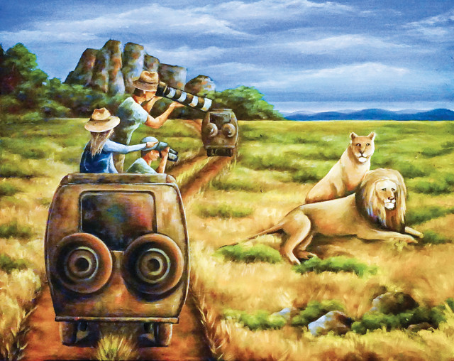
Jill Peterson, an Adams State student on the trip, painted this representation of the field trip. Credit: Jill Peterson.
We stop next to a wide, dry, creek bed on the floor of a steep canyon near Tarangire National Park in northern Tanzania. Elephants spray water on themselves and their companions. In the tall baobab trees on the far side of the valley, monkeys jump from limb to limb and tree to tree, over the heads of impalas that don’t seem to care. I am standing in the back of one of our open-top Land Rovers and, like the monkeys, I’m waving my arms this way and that as I discuss the geologic strata in the canyon walls. Like the impalas, the khaki-clad college students in the Land Rovers don’t seem to notice.
I explain to the group that this valley was formed by rifting, the pulling apart of continental crust that created the East African Rift Valley; they laugh because one of the monkeys has just fallen out of a tree. The fallen animal looks dazed, but rights himself and leads a procession of fellow monkeys toward the steep canyon wall. I continue my lecture about the graben in which we’re parked, a down-thrown block of rock that dropped when the land on either side pulled apart, and the flat landscape above the graben, called a horst. “Horsts and grabens are as common here as Klipspringers,” I tell the group while gesturing toward the small antelope. But all I get from my audience of predominantly biology students is a chorus of “ohs” and “ahs” in tune with monkey antics I missed while admiring the rocks.
We have come to northern Tanzania for an undergraduate level course offered through Adams State University in southern Colorado. My task, as the geology professor, is to convince the students that an interdisciplinary understanding of the relationships between geology, ecology and culture will enhance their knowledge of this place. In short, I have to get them interested in the landscape. This should be easy given that we’re in the East African Rift Valley, the textbook example of rifting. But as I speak, the students are currently focused on the dramedy of life on the savanna. And I can’t blame them.
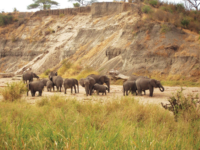
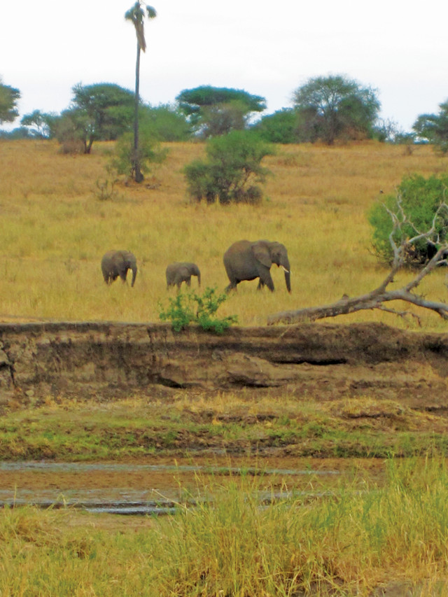
Elephants near the campsite in Tarangire National Park. Credit: Jared M. Beeton.
I’m co-teaching the course with my colleague and friend Tim Armstrong, a professor of wildlife biology. Our group also includes 20 students ranging in age from 17 to 82, three Tanzanian drivers, and a local guide, Nikos. Just outside of Tarangire National Park we sit under a canopy of brightly colored tropical plants and flowers. The buildings here, like many structures in the region, are constructed of laterite, a reddish-brown soil type commonly formed in equatorial and tropical regions through prolonged oxidation and weathering of iron-rich rock. Iron oxides build up in the soil and condense into a material that’s as hard as brick. Locals cut the laterite into large blocks and stack them to construct homes and other buildings. These buildings reflect a relationship between East African culture and geology that I’m hoping to discuss over dinner, but I barely get the word “laterite” out before a student yawns and asks Nikos to tell us another story from his encounters with wildlife. I let the moment pass. Nikos tells us that elephants are the most dangerous animals in the parks. He warns us that if we hear something prowling around at night on the open savanna we should not turn on our headlamps. If the noise happens to be an elephant, it may charge upon seeing a tent suddenly lit up.
With visions of trampled tents in our heads, we arrive at our first campsite in Tarangire National Park. The sun has set but there is just enough light to see that our tents, already set up by our porters, are surrounded by a herd of elephants. Apparently our porters pitched the tents under the juiciest acacias in the campground. We patiently wait for the giants to move along, and then race to get a tent that’s not beneath a tree that might attract elephants.
I sleep well and awaken just before sunrise. A few hours later, over breakfast, I learn that lions were roaring outside our tents during the night. A few students were too scared to sleep.
After a few days, the initial thrill of tent camping with lions and elephants has passed, and the students are warming up to conversations about the landscape. We leave Tarangire, and stay for a few days at the so-called crater of the Ngorongoro Conservation Area, misnamed because the “crater” is actually a caldera. We stop at a picnic area perched on the caldera rim 600 meters above the Ngorongoro floor and pull out boxed lunches while Kayla — one of the few geology majors on the trip — begins describing the caldera’s geology. Each student is required to give a presentation during the trip.
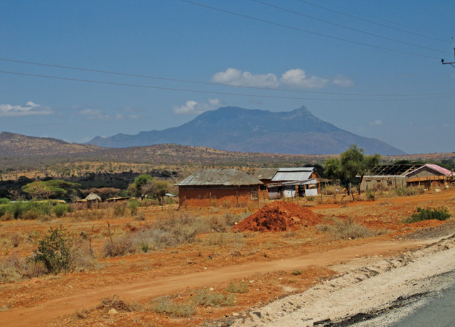
Many buildings in the region are constructed of laterite, a hard material formed from a reddish-brown, iron-oxide-rich soil. Credit: Jared M. Beeton.
Kayla begins her presentation with some background on the rift valley, including how it is actually a complex of related rift basins that have migrated southward over millions of years. As Kayla then explains how Ngorongoro Caldera formed 2.5 million years ago when a volcano erupted — with a force greater than that of Mount St. Helens’ 1980 eruption — before collapsing into the emptied magma chamber below, one of the students suddenly shrieks with a half scream-half laugh: A large predatory bird, a black kite, swoops down and attacks. Black kites (Milvus migrans) are aggressive, with sharp beaks and talons, and they’re dropping around us like pyroclastic bombs in a volcanic eruption, probably drawn by our lunches. Another group of large marabou storks (Leptoptilos crumeniferus) surround us and move in on our group. They stand about 1.5 meters tall and sport massive beaks, which have been naturally selected for by the African environment to aggressively and efficiently remove food from tourists. With kites falling from the sky and storks closing in, we escape to the safety of our vehicles. Once again, our focus on geology has been diverted by the wildlife.
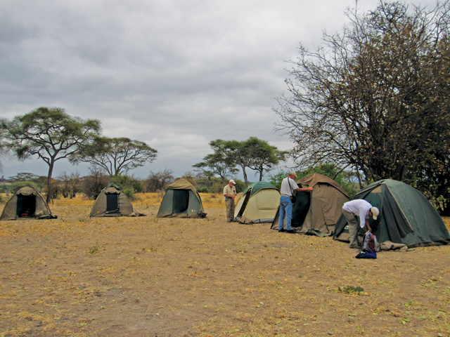
A campsite in Tarangire where elephants eating acacia leaves surrounded the tents. Credit: Jared M. Beeton.
Secure back in the Land Rovers, we drive into the caldera down a steep road with winding switchbacks, then onto a flat plain surrounded by volcanic walls. The 16-kilometer-long floor of the caldera is a diverse landscape of savanna grasses broken by riparian corridors of deciduous forest along streams that meander slowly toward central alkaline lakes. As we bounce along the caldera floor, I scan the landscape, determining what lessons I can chat with the students about that evening at camp.
Back at our campsite on the caldera rim, we relax and discuss the relationships between Ngorongoro geology and the dispersal patterns of wildlife. I explain how the geology affects the climate, including the strong precipitation gradient that creates a rainy forest on the rim and drier savanna on the floor of the caldera. And Tim explains that the caldera, being a physical boundary to some animals but not to all, is home to more than 20,000 hyenas, elephants, zebras, wildebeest and some of the last black rhinos on Earth, making this one of the most densely packed wildlife viewing areas in the world. Our message appears to be getting through to the students, who seem interested in both parts of the discussion.
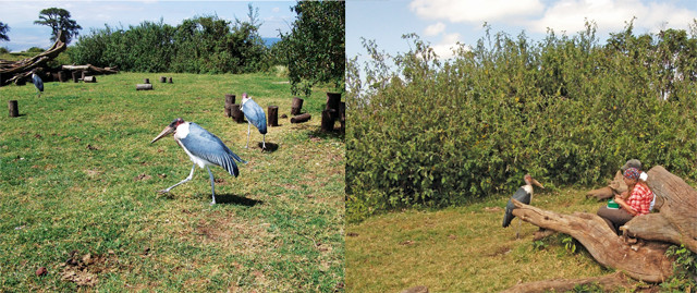
Lunch was interrupted by marabou storks and black kites. Credit: both: Jared M. Beeton.
The next day, we head for the true wilderness of Serengeti National Park, the “endless plain” — a diverse and energetic tallgrass ecosystem — arriving in time to set up camp and hit the sack. At 5:30 a.m. we head out on safari. We drive along a dirt road surrounded by savanna grasses until we come upon a lion kill. A pride killed a large water buffalo during the night and they’re still eating. Five lions fight for placement on the kill while two others are already sleeping off the feast. Hyenas circle quietly, keeping their distance, hoping they’ll get a crack at the leftovers.
All of this is happening about 6 meters from our vehicle, and just as the sun rises, I notice something I’ve been looking for the whole trip: A cutbank, a 1.5-meter-high scarp cut by the outside bend of an ancient meandering river that provides a window into the stratified subsurface sediments of the Serengeti. We haven’t talked yet about the soils that provide the structural framework of this productive ecosystem. The same eruptions that oozed from the Rift Valley as the ground pulled apart and violently constructed the Ngorongoro Caldera also deposited layers of lava and ash on the landscape. This nutrient-rich ash developed over hundreds of thousands of years into a thick, organic-rich soil, and now provides the foundation for Serengeti’s tall, lush grasses — a direct link between geology and ecology.
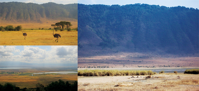
Ngorongoro geology affects the dispersal patterns of wildlife in the caldera. Credit: above and top left: Jared M. Beeton; bottom left: Dan Armstrong.
This seems like the perfect time to chat about the relationship between Serengeti soils and ecosystem productivity, but the students are fixated on the lions. As I open my mouth to discuss the soils, I hear “Look at them ripping the flesh from those ribs!” and “Did you see the size of those teeth?” and “One lion just slapped another!” So, like the hyenas, I wait for a more opportune moment; it’s all about picking the moments when your crowd will be most receptive.
That evening on safari I spot on the horizon a massive kopje — the peak of a mountain jutting out above the layers of lava and ash that have mostly buried the ancient range. This was one of my moments. I thrust my arm out of the vehicle and point.
“Hey everyone, look, it’s a kopje!” I say as I explain that, based on the ages of mountain building here, it appears to have cooled and crystallized from magma beneath Earth’s surface more than 500 million years ago.
This 1.5-meter-high cutbank of an ancient meandering river provides a window into the stratified subsurface sediments of the savanna. Credit: Jared M. Beeton.
Despite the students’ protestations — they thought I was pointing out a new bird or animal — I manage to capture their attention as I point out the way it’s peeling like an onion, thanks to weathering from continuous daily and seasonal cycles of heating and cooling that generate thermal expansion and contraction.
I convince our group that kopjes are worth their time, partly because a colorful local lizard, the rock agama (Agama mwanzae), lives in the outcrops. Lions and other large mammals also frequent the kopjes as they seek shade and rainwater collected in rock hollows, another relationship between rock and life. The kopje that we have found is a small mountain of granite and gneiss, rising prominently from the flat expanse of the Serengeti. It looks to be about 15 meters high and 60 meters in diameter. The round and sleek rock surface is streaked black and white, with dark vertical lines created from minerals that precipitate out of water that is flowing and dripping down the face of the rock. Dense thickets of trees and woody plants grow on and around the isolated rocky hill, flourishing here because windblown sediments trapped by the rock outcrops provide important minerals and nutrients for soils.
The next morning we head to Olduvai Gorge, one of the most important archaeological sites on Earth. In a small museum in the visitor’s center, there’s a scale model cast of the Laetoli Footprints, discovered just north of here in the late 1970s. About 3.6 million years ago, the Sadiman Volcano erupted and deposited grey ash on the landscape. Soon after, a couple of early hominins (Australopithecus afarensis) walked across the landscape, possibly in the rain because the ashes settled around indentations of their footsteps. Later, another burp of the volcano buried the tracks with fresh ash, preserving and fossilizing the footprints of the early hominin. The students are fascinated.
After visiting the museum we stroll back outside to an overlook of the stratigraphy of Olduvai while we chat about depositional and erosional landforms; I explain how the layers in the canyon wall are depositional and the gorge itself is an erosional landform. We talk about how archaeologists such as the famous Leakey family and geologists such as Richard L. Hay used potassium-argon dating to construct a 2-million-year record of changing environments, dating the hominin finds and providing important pieces of the puzzle of human evolution, while other animal bones provide biological evidence of climate change. It’s one of the great stories of geologists, archaeologists and biologists working together to better understand relationships between humans and landscape. I’ve got them hooked now!
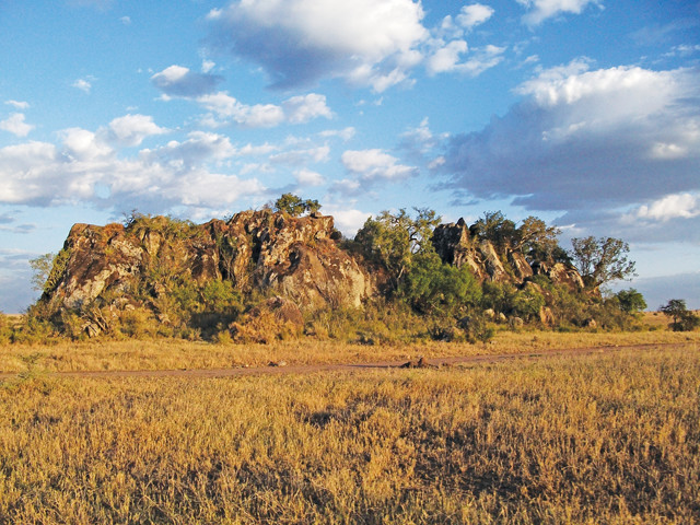
A massive kopje — a rocky hill jutting out of the flat plains — in Serengeti National Park. Credit: Jared M. Beeton.
For the past two weeks, we have been cooped up in our vehicles during the day. Wildlife populations are dense and the ecosystem fragile, so groups are not allowed to travel on foot except in campgrounds and picnic areas. This is fine for watching wildlife, but it’s difficult to get students excited about any but the largest scale geological features and processes. But here at Olduvai we are allowed to walk. We can touch the East African earth.
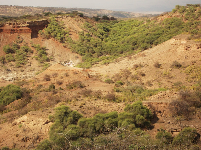
The Laetoli Footprints and remains of early hominins have been found in and near Olduvai Gorge — one of the most important archaeological sites in the world. Credit: Jared M. Beeton.
I pick my moments to talk about laterite buildings and Serengeti soils. Our students, after a two- or three-day adjustment period, showed interest in everything from the slow southward migration of the East African Rift to seasonal migration patterns of wildebeest.
Now back in Colorado, reflecting on our trip, I recall stepping out of our tents at Tarangire to see a parade of giraffes, wildebeest, elephants, warthogs and zebras — hundreds of them walking by our tents in one line. None of us could speak; we just sat down on the rocks and watched them go by. They were huddled close together, and Tim later told me that each individual species has its own unique ability to sense predators, so they have adapted to stay close to each other and pool their senses. They’re like us, biologists and geologists, pooling our ideas in order to learn about the natural systems of East Africa. Lions may be toothier than landscapes, and it’s difficult to think about anything else when lions are prowling around your tent at night. But one cannot be fully understood without the other, and hopefully our students now have an interdisciplinary understanding of the East African landscape in their heads.
© 2008-2021. All rights reserved. Any copying, redistribution or retransmission of any of the contents of this service without the expressed written permission of the American Geosciences Institute is expressly prohibited. Click here for all copyright requests.