
by Rick Saltus Wednesday, September 4, 2013
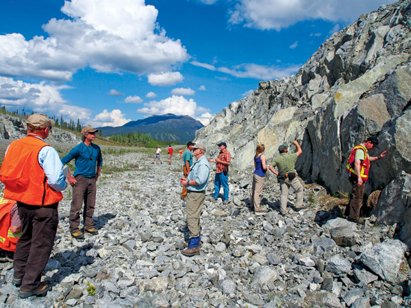
The group examining the Ruby batholith along the Alaska Highway near Beaver Creek, Yukon. Melanie Werdon, DGGS
Our two dusty trucks roll across the airstrip, casting long, late-May shadows down the runway. We spot our colleagues from the Yukon Geological Survey and realize we’ve found the right place after an exhausting 12-hour drive from Anchorage punctuated by several U-turns to find the right unmarked access driveway off the Alaska Highway at the south end of Kluane Lake. The evening air is crisp, and the towering peaks to the south are capped with snow. It’s 8:30 p.m., an hour later than we think (we crossed a time zone at the Alaska-Yukon border) but still not dark, a benefit of being this far north in the late spring. We are happy to find pizza and, better yet, in the cooler, Yukon Gold beer.
We’re gathering in this remote corner of southwestern Yukon right on top of the Denali Fault (the research station manager jokes that it runs right through the dining hall) to deal with a very different kind of “fault” — one created by geologists.
We’re referring to a “quadrangle boundary fault,” a mapping discrepancy that occurs at a boundary between two or more geologic maps, or quadrangles. This is a well-known concept to field geologists, but perhaps little appreciated by others. It helps to bear in mind what a geologic map really represents: Geologic maps are testable hypotheses. They are visual representations of theory, not statements of fact.
The reproducibility and accuracy of these maps are functions of the number and quality of geologic observations (including everything from analytical to paleontological data) available to the mapper, the experience and expertise of the mapper, and current geological thinking. When geological paradigms shift — for example, before or after the plate tectonics revolution in the 1960s — and understanding increases over time, maps change. If you think about it, it seems unlikely that two different mapping teams working in adjoining areas at different times would ever produce maps that match up. And they usually don’t. What’s worse is that maps created by researchers in different countries frequently don’t match up — this is the case with maps of the boundary area between the Yukon and Alaska produced by Canadian and American scientists.
These map discrepancies are more than just academic conundrums; they have real-world implications for our fundamental knowledge of tectonics and for everything that depends on an accurate understanding of geology, including estimations of seismic hazards, as well as energy and mineral resource assessments and exploration. For example, current maps from the Yukon side show a rock assemblage (called the Klondike schist) that is, at least circumstantially, associated with important gold deposits within the Yukon Klondike and White Gold districts. Maps from the Alaska side don’t show this at all.
This border “dispute” provided the impetus and set the stage for our onsite meeting of geologists from four government surveys. Seven of us from the U.S. Geological Survey (USGS) have come to the Kluane Lake Research Station to meet up with others from the Yukon Geological Survey (YGS), the Geological Survey of Canada (GSC) and the Alaska Division of Geological and Geophysical Surveys (DGGS). Altogether, we are 15 scientists holding workshop sessions and visiting road-cut outcrops back and forth across the Alaska-Yukon border on a caravan trek from Kluane Lake, Yukon, to Tok, Alaska, to Dawson City — the historic center of the Yukon’s Klondike Gold Rush that began in 1896. The group has a wide range of career experience, individual expertise and familiarity with the Yukon-Tanana region. The workshop and field trip were instigated by USGS, but were actively supported by all four agencies. The ultimate purpose of the trip is to inform the ongoing USGS Mineral Resources Program in the region and to organize and initiate cooperation between the agencies.
We spend the first couple of days in a classroom and on field trips, exchanging information and looking at rocks together. (The evenings are spent in collaborative, jovial discussions around the beer cooler.)
We examine the current published maps of Alaska and the adjacent Yukon, at scales from 1:250,000 to 1:2,500,000, which don’t match up at the border. This artificial discontinuity is partly the result of different generations of mapping on the two sides, but it is also due to the complexity of the geology and the lack of adequate rock exposure on both sides. On top of that, it turns out that there really are some fundamental differences in the overall tectonic history and rock assemblages as one follows along the Yukon-Tanana terrane from Yukon northwestward into Alaska.
On day four, we rearrange the dining tables in the open area of the central log cabin and start looking at maps. We spend the morning putting the map issues into a more regional tectonic context. In the afternoon, it is time to get some plans on paper — to outline an approach to eliminate the boundary faults and come to a common understanding of the Yukon-Tanana region that makes sense on both sides of the border.
We try to wrap our heads around the complex terranes, which get all the more complicated the more we delve into the details, and discuss a careful explanation of the tectonic assemblages. On the Canadian side, the Yukon-Tanana terrane was first defined as a “suspect terrane,” a fault-bounded region where the rock assemblages are distinctly different from those on the other sides of the faults. But what was mapped as “Yukon-Tanana terrane” in the past is actually made up of two parts, western and eastern, in which the older Devonian-aged basement rocks are similar in both parts, but the later Devonian geological character is substantially different.
As the afternoon wears on, we struggle to capture all the ideas and proposals flying around the room. There is a great energy among the group and a lot of excitement about interesting work to be done in this spectacular area — an area where very fundamental geologic questions are still in play. Some great suggestions emerge regarding strategic sample collection for a wide range of analyses, from geochemical to geochronological, but we keep coming back to the fundamental need for “boots on the ground” bedrock geologic mapping.
Recent programs by YGS and GSC have resulted in new mapping at 1:250,000 scale on the Yukon side of the border. On the Alaska side, some of the published 1:250,000 maps date from 1970 and are based on early reconnaissance-style mapping. Since then our geologic understanding has been updated by some newer observations and analysis, but no new systematic mapping.
Two days later we conclude our trip after crossing the swollen Yukon River on a struggling ferry. The high river has washed out the loading ramps on either side and the ferry dodges huge logs and other detritus en route. We ascend Midnight Dome, the rocky top of the mountain overlooking Dawson City, and take in the spectacular views up and down the Yukon River.
The collaborative effort exceeded our initial expectations and, even weeks later as I write this article, the group is excited about the prospect of aligning the interests and strengths of the four government surveys to create the next, and hopefully seamless, generation of geologic understanding of this complex and fascinating area.
Already, outcrop observations made during the trip have led to some new thinking about the Denali Fault in the region around Kluane Lake. Scanning electron microscope analysis of samples has revealed intriguing clues to the sequence of horizontal versus vertical movement of the fault. Building on the rich information exchange and enthusiasm of the workshop, our next steps are to update project plans within USGS to better focus on the border issues and to encourage further collaboration among the four government agencies. And on the scientist-to-scientist level, we are preparing joint abstracts and presentations for the Geological Society of America meeting in late October.
© 2008-2021. All rights reserved. Any copying, redistribution or retransmission of any of the contents of this service without the expressed written permission of the American Geosciences Institute is expressly prohibited. Click here for all copyright requests.