
by Mary Caperton Morton Friday, September 7, 2018
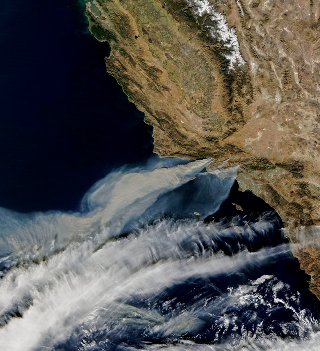
This NASA satellite photo taken in December 2017 shows fires burning last winter in Southern California. The fires were started by downed power lines and illegally set fires, and were exacerbated by dry vegetation and the Santa Ana winds. Credit: NASA.
Coastal Southern California is famous for cloudless blue skies all summer long, but it hasn’t always been that way. A new study indicates that cloud cover has decreased dramatically over the beaches between Los Angeles and San Diego since the 1970s. And that could affect fires in the region.
People who love clear blue skies over the beach have the urban heat-island effect to thank for Southern California’s cloudless skies: Heat radiating off pavement and buildings and generated by human activities tends to raise urban temperatures. “As you warm Earth’s surface, you need to go higher in the sky to find a place that’s cool enough to support clouds,” says Park Williams, a bioclimatologist at Lamont-Doherty Earth Observatory at Columbia University and lead author of the new study, published in Geophysical Research Letters. But in Southern California, clouds are trapped by the marine boundary layer, a kilometer-thick layer of wet air over the ocean that resists cloud formation. “As you force clouds to rise in altitude, they can’t rise indefinitely as they get squeezed out by the marine boundary layer,” he says.
To study cloud trends over coastal Southern California, Williams and his colleagues turned to detailed meteorological records kept by the 26 airports in the region. “Coastal California is a fantastic place to study clouds because there are so many airports [in such a small area], due to the high population density and the legacy of military and naval bases,” he says.
By tracking airport weather station records of cloud cover and surface radiation — the amount of solar irradiance reaching Earth’s surface as measured by the airports using a pyranometer — from the 1970s to today, the team developed a statistical model to quantify how changes in cloud cover affect the amount of solar radiation reaching Earth’s surface. “With that information, we determined how changes in cloud cover affect the temperature of Earth’s surface, the humidity,” and the amount of soil moisture lost to the atmosphere through evaporation, Williams says.
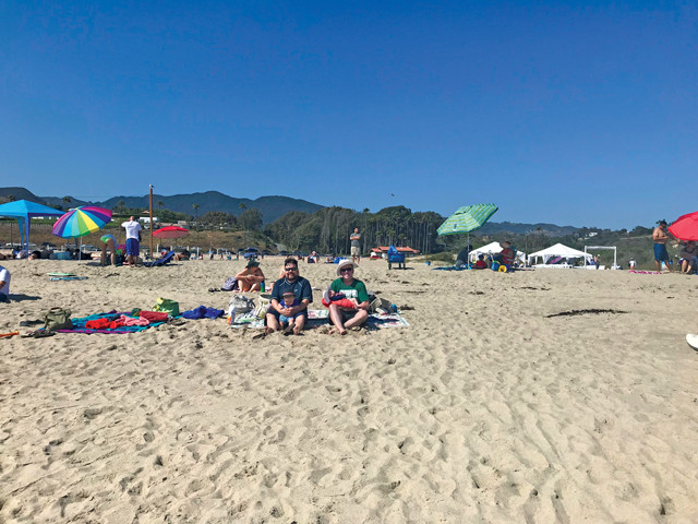
Cloud cover has decreased dramatically over the beaches of Southern California since the 1970s. Credit: Megan Sever.
The researchers found that from 2008 to 2017, the greater Los Angeles/San Diego region saw a significant increase in average solar radiation, between 17 and 31 watts per square meter, during the summer months, as compared to measurements collected between 1973 and 1982. “That’s quite high,” Williams says, equivalent to the difference in solar radiation between an averagely sunny year and an averagely cloudy year. The team also estimated the amount of water evaporated into the atmosphere due to the increase in sunlight over the same two periods: On average, between 2008 and 2017, plants and soils were losing an equivalent of 16 to 29 millimeters of water to the atmosphere between May and September. “That’s quite a bit in a place that only gets 300 millimeters of rain a year, and almost none of that in the summer months,” he says.
That kind of drying effect on vegetation may be promoting fire in the region, Williams says. “The records of year-to-year cloudiness correlated better with year-to-year burned area in coastal Southern California than any other climate variable. In years with more cloud cover, you have less summer fire, but summertime cloud cover didn’t have that big of an effect on fire the following fall.” The team also found that summer cloud cover correlated well with fuel moisture, which has been measured by foresters since the 1990s by clipping vegetation and determining how much water is stored in plants.
The new study confirms what fire managers already know about coastal Southern California: It’s a tinderbox, says Jon Keeley, a fire ecologist with the U.S. Geological Survey at the Sequoia and Kings Canyon Field Station, who was not involved in the new study. “Nobody has done this kind of study before, attempting to quantify these effects, but the results aren’t surprising,” he says. “As a general rule, cloud cover is associated with reduced fire danger. It all makes sense.”
Historically, annual climatic variations and fire trends are linked in other parts of California, such as forested and mountainous regions. However, they have not been linked in coastal California because the region tends to be so dry every summer that it’s primed to fuel fires every year, Keeley says. Climate comes into play mostly in the form of the Santa Ana winds — strong air currents that blow from inland mountains toward the coast in the fall and winter months. “Santa Ana winds don’t set fires, but they sure do spread them,” he says.
To reduce fire in coastal Southern California, he says, communities need to focus on educating people about the potential for small sparks to start fires, as well as aggressively investigating suspected arson cases. That’s because more than 99 percent of coastal California fires are set by people, he says, directly through arson or indirectly by faulty power lines, cigarettes, camping fires or car troubles.
In 2017, some of the biggest fires in the region were traced to downed or faulty power lines, Keeley says. “There has also been a lot of interest in modifying power line distribution and construction to reduce the incidents of power lines causing big fires. If we can alter the potential for power lines to start fires, I think we have a better chance of reducing these big fire events.”
© 2008-2021. All rights reserved. Any copying, redistribution or retransmission of any of the contents of this service without the expressed written permission of the American Geosciences Institute is expressly prohibited. Click here for all copyright requests.