
by Josh Knackert Thursday, May 4, 2017
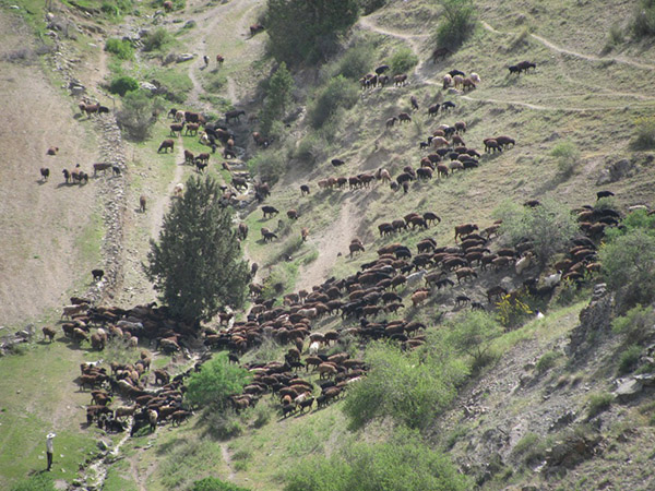
A herder leads sheep through mountainous terrain in Uzbekistan. The routes established by ancient nomadic herders through the highlands of Central Asia may have paved the way for Silk Road paths, according to recent research. Credit: Michael Frachetti
The Silk Road — the ancient trade route that stretched thousands of kilometers from China to the Mediterranean — often calls to mind images of large camel caravans trekking for months across deserts and over mountains, carrying luxurious linens, spices and gems between distant lands. In reality, the “road” comprised a network of many shorter relays between neighboring areas, with goods often changing hands many times in cities, rural villages and even remote trading outposts. The webbed nature of the network has long complicated archaeological efforts to map exactly where and how the Silk Road developed. In a new study in Nature, researchers have illuminated likely routes of Silk Road travelers through a region of particularly challenging terrain — mountainous Central Asia — with the help of an innovative mapping method.
The scientists who conducted the study, which compared sophisticated mapping of high-altitude grasslands in Central Asia and satellite imagery to the locations of known Silk Road trading stops, posit that mountainous stretches of the road may have been paved by the stamping feet of sheep, goats and their nomadic herders for centuries before exotic luxuries were ever hauled over them. “Just like big cities, small herding villages during this era understood that regional trade was a way to increase quality of life and economic standing,” says Michael Frachetti, an archaeologist at Washington University in St. Louis and lead author of the study. “These people didn’t see these mountains as obstacles; traversing them was a normal part of life.”
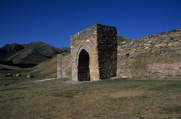
Tashrabat, at 3,500 meters elevation in the mountains of Kyrgyztan, was a stopover, or caravansersai, for Silk Road travelers. Credit: Michael Frachetti
For several thousand years, nomadic herders, or pastoralists, in Central Asia have migrated their herds to higher elevation grasslands during the hot, dry summer months to access more, and better, forage for their animals. Frachetti and his fellow researchers used satellite imagery and geographic information system (GIS) mapping tools typically used to model streamflows based on gravity and topography. But instead of streams, they modeled seasonal fluctuations and patterns in the quantity and quality of highland grasses. Based on grassland locations, they predicted the likely routes that ancient herders would have used each year to traverse the mountains in parts of present-day Afghanistan, China, Kazakhstan, Kyrgyzstan, Pakistan, Tajikistan, Uzbekistan and elsewhere.
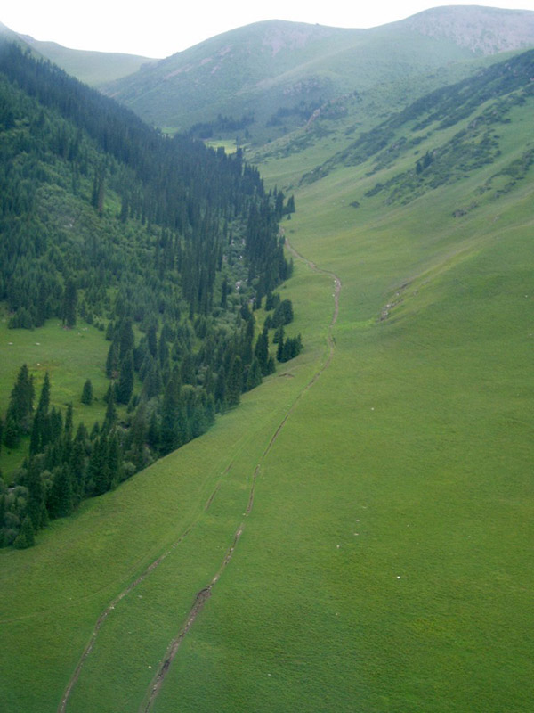
A grassy route through the Tian Shan Mountains in Kazakhstan at about 3,000 meters eleventation. Credit: Michael Frachetti
After 500 unique model simulations, each representing one year, likely routes became pronounced, establishing a web of trails and roads. These routes were then compared to the locations of 258 sites associated with the Silk Road and within the altitude range of these highland grasslands. With the datasets overlaid, the researchers found that the routes likely to have been used most by herders connected 74 percent of the known Silk Road locations. “This correlation suggests this vast network of regional connectivity was significantly influenced, and even somewhat established, by these small mountain communities,” Frachetti says.
He and his colleagues noted several reasons why following the pastoralists would have made sense for Silk Road traders. Local pastoralists tend to have an intimate knowledge of safe routes through mountains and how these routes can change seasonally. Also, they would’ve naturally moved between outposts to keep themselves and their flocks supplied with necessities like water, and for protection from predators. “Sections of these mountains can be incredibly barren, making these small outposts essential infrastructure for passage,” Frachetti says.
Another reason is that “there’s a strong relationship between topography and grassland,” says Joshua Wright, an archaeologist from the University of Aberdeen in Scotland who wasn’t involved with the study. “Grass is only going to grow in flatter areas of the mountains — the flatter the terrain, the easier it is to travel and build outposts,” Wright says, so, in that sense, “the correlation is not much of a surprise.” The work is a good start, but “not an end to research on this topic,” he says.
This animation shows 10 iterations of the flow-accumulation model produced in the new study. Shifting lines indicate routes potentially used by nomadic herders descending from grassy highland (lighter shading) pastures to the lowlands (darker shading). Routes in red are predicted to have been most traveled. (Click on image to animate) Credit: Michael Frachetti
Wright says he sees the technique in this study potentially opening a new avenue for Silk Road mapping, using grass instead of gravity to predict flows through the mountains, and adds that it could be applied to model lowland pasture areas as well, or modified by taking different herding methods into account. Additionally, finding previously unknown Silk Road sites or other evidence by searching along grass-defined routes would make a good case for the model’s predictive abilities.
“Modern archaeology is seeing a florescence of testable mapping models,” Wright says, thanks to the improving resolution, scale and availability of satellite data and regional surveys like those used in this work. “This is good for the field — different ideas offer routes to study and compare.”
© 2008-2021. All rights reserved. Any copying, redistribution or retransmission of any of the contents of this service without the expressed written permission of the American Geosciences Institute is expressly prohibited. Click here for all copyright requests.