
by Mary Caperton Morton Monday, June 23, 2014
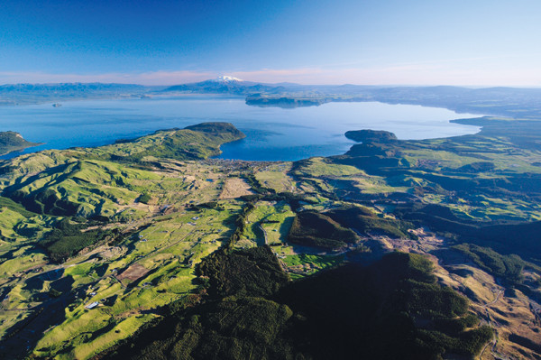
New Zealand's Lake Taupo is all that remains of the volcano that gave rise to one of the world's most explosive volcanic eruptions, but new research may downgrade the infamous blast. Credit: Dougal Townsend, GNS Science, New Zealand.
Today, all that remains of the Taupo Volcano is a lake-filled caldera on New Zealand’s North Island that was blasted out during the Oruanui eruption about 26,500 years ago. The most recent eruption, known as the “1800a” Taupo eruption, is considered to be the largest volcanic event in the past 5,000 years and one of the most explosive eruptions in Earth’s history.
“This eruption is iconic just because of its extreme size,” says Bruce Houghton, a volcanologist at the University of Hawaii in Honolulu and lead author of the new study, published in Geology. “But many people have long suspected that its size may have been overestimated.”
Taupo was crowned Ultraplinian in 1980 by geologist George Walker on the basis of the distribution of pyroclastic fall deposits from one phase of the 1800a eruption. Measurements of the footprint of the deposit led to an estimated plume height of 50 kilometers, more than 10 kilometers higher than any other observed or estimated eruption. To date, Taupo is the only volcano to have met the criteria for an Ultraplinian event.
“It’s been more than 30 years [since Walker’s study] and we haven’t found another example of an Ultraplinian eruption. That’s enough to make people wonder if it does deserve its own separate category,” says Larry Mastin, a geologist with the U.S. Geological Survey based in Vancouver, Wash., who was not involved with the new study. But despite the suspicion, few studies have been done on the Taupo deposits. “As far as I know, [Houghton] is the first to look at the deposits in this kind of detail.”
Houghton and colleagues subdivided the 1800a deposits into 26 subunits and measured their individual thicknesses and clast sizes. They found that deposits from south of the caldera had larger pyroclasts near the base of the sequence, whereas in the north, the coarser clasts lie on top. The pattern indicates shifting winds during the eruption suggesting that the large footprint of the deposit was more likely due to high winds during the eruption, rather than extreme eruptive vigor. Earlier studies, including the landmark 1980 report and another in 1986, were based on the total thickness of the deposit, which would have masked the wind effects, Houghton says.
“Initially, we were just interested to see how much variability there was in the different layers, but the sequence we found confirmed our suspicions that this might not have been as explosive as previously reported,” Houghton says. Once they accounted for the influence of the wind, Houghton and colleagues calculated an estimated plume height between 35 and 40 kilometers. That is still an impressive eruption, Houghton says, but is also more in line with other Plinian events, like the 1991 eruption of Mount Pinatubo in the Philippines.
The new estimates make sense in light of current plume modeling scenarios, which suggest that plume heights top out at about 45 kilometers, Mastin says. “Above 50 kilometers, you’re up into the stratosphere, where the temperature is dropping and the air is thinning. It’s very difficult to get eruptive materials up that high, since the eruptive mixture itself is denser than air.”
Since Taupo is the only known eruption thought to be worthy of the Ultraplinian category, the term may now be obsolete or at least purely theoretical, Mastin says. “Until we have good evidence that plumes have gone higher, we should probably assume that 40 to 45 kilometers is as high as they go.”
© 2008-2021. All rights reserved. Any copying, redistribution or retransmission of any of the contents of this service without the expressed written permission of the American Geosciences Institute is expressly prohibited. Click here for all copyright requests.