
by John (Jack) Shroder Friday, January 20, 2012
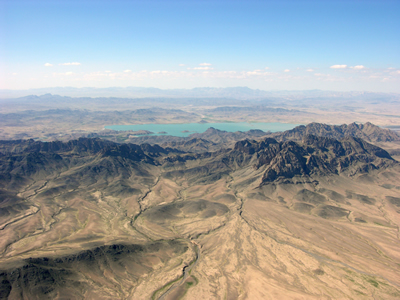
The Kajaki Dam and reservoir on the Helmand River in southern Afghanistan has provided water for irrigation and electricity for decades, but war and the Taliban insurgency in the area are limiting water supplies. USGS
In his campaign and early in his presidency, U.S. President Barack Obama has said he plans to make Afghanistan a priority, calling the resurgence of al Qaeda and the Taliban in Afghanistan and Pakistan “the greatest threat to [U.S.] security.” Fortunately, military might isn’t the only focus of Obama’s plan; he also intends to dedicate more resources to revitalize Afghanistan’s economic development. Finally! After nearly 40 years of my geoscience work on Afghanistan, some of it seems to be paying off, and my life’s work — along with the work of many others — might at last actually help this long-benighted place.
Ever since geographer Chris Jung and I first started the Afghanistan Studies Program at the University of Nebraska at Omaha in 1972 — then and now the only such only program in the United States — I have been working on various geoscience issues for that country. Why geosciences? Because quite simply, Afghanistan has more geo-action — earthquakes, floods, landslides, droughts, windstorms, dust storms and the like — than just about any other place in the world, or at least any place where I have ever worked. The country also has interesting possibilities for development, with its relatively rich resource base. And with the ongoing conflicts and drastic need for aid and development, the geosciences can help.
UNO International Studies and Programs Dean Tom Gouttierre and I (as his assistant dean) have just graduated the ninth class of U.S. and coalition military members to take our intensive immersion classes on Afghanistan culture, history, language and geosciences. The class first started in 2002 in the form of guest lectures to military brass at Fort Leavenworth in Kansas; it has now developed into a formal three-week course for soldiers and contractors on our campus. Our military apparently finds what we are teaching them to be very useful: After an initial trial period (when we thought some military people might have been skeptical of what is commonly perceived as the bit-too-liberal academic world), they keep coming back for more. We must be doing something right. But there’s a ton more to do.
I took my first trip to Afghanistan in 1972. I began working there because of a desire to learn more about a beautiful, intriguing and geologically fascinating place. Like many geoscientists, I seem to be drawn to the wilder shores of the world, and especially to big mountains. Afghanistan certainly fits that bill.
From 1972 until late 1978, I served as director of the National Atlas of Afghanistan, where I was in charge of writing letters to get people to donate maps and information, as well as collecting early satellite imagery and any other mappable data that we could find from published sources. In that role, I became familiar with the country’s rich mineral resources, such as gemstones, coal and natural gas. The U.S. Geological Survey had also made me the chief paymaster of the Kabul University Seismic Station, which meant I could distribute cash to the Afghans who ran the seismic station for USGS, pick up the earthquake records once a week, and deliver all those records to the U.S. embassy.
The fact that the seismograms contained detailed records of nuclear tests north of Afghanistan in Semipalatinsk, Kazakhstan, then part of the USSR, did not escape the notice of the Soviets, and neither did the many detailed large-scale maps of the topography and natural resources that I was collecting. These things got me into a bit of trouble when the Soviets invaded Afghanistan. Thankfully, before I was deported back to the United States, I gave my cook the important papers. He successfully bicycled everything to the U.S. Embassy, and from there the papers arrived safely at UNO, where they reside to this day.
Through the 1980s, as the Cold War turned hot in Afghanistan, I worked with Voice of America to broadcast anti-communist messages in Afghanistan about Soviet exploitation of Afghanistan’s rich natural resources to the detriment of the people of Afghanistan. VOA also asked me, repeatedly, to broadcast explanatory messages about the many earthquakes that kept devastating parts of the country. Rural Afghans commonly believe that whenever the ground shakes, Allah is sending them an important message. As their former National Atlas director, I felt that it was my job to try to explain how earthquakes happen.
Just like every army that has ever invaded Afghanistan, the Soviets ultimately were defeated, and they left the country in 1988 to 1989. As they withdrew, the U.S. Agency for International Development asked me to report on Afghanistan’s mineral wealth, with the goal of helping rebuild the country after the disastrous decade of war.
But the United States pulled out of Afghanistan as the Soviet Union withdrew. Later, Secretary of State Madeleine Albright even opined that “a wall should be built around Afghanistan and we should forget about it.” Bad idea.
Right after the withdrawal, the Soviet Union collapsed, and Afghanistan descended further into civil war and chaos. In the late 1990s, the State Department brought a visiting delegation of Taliban to UNO to see if they wanted to learn about our satellite-image technology for assessing their resources, but they weren’t interested. At the same time, an American company, UNOCAL, hired UNO to educate Afghans who were going to construct an oil and gas pipeline across western Afghanistan to tap into the rich resources of the regions of the north. The Taliban in power were desperate to get their hands on some of the hydrocarbon transit fees, but their corrupt and inept rule prevented such development from occurring, and the country slid ever deeper into darkness and despair.
Meanwhile, the world was starting to learn about climate change and its potential effects. In the mid-1990s, NASA and USGS initiated the Global Land Ice Measurements from Space project to assess how much freshwater was stored in the world’s ice.
Considering that Afghanistan gets 80 percent of its water from mountain glaciers and snowfields, we thought the Afghan government might be interested in participating in GLIMS. But when we offered, neither the Taliban nor the neighboring government of Pakistan exhibited the slightest interest in the project. By default, our Remote Sensing Applications Laboratory at UNO, which had been taking satellite images of the two countries’ mountains and glaciers since the early 1970s, became the GLIMS Regional Center for Southwest Asia (Afghanistan and Pakistan).
This gave us access to plentiful, free, high-resolution satellite images of the glaciers and water resources of both countries. In connection with this, in July 2001 we pleaded with the State Department and Colin Powell’s science advisor, Norman Neureiter, to provide us with some support in our attempts to find out more about Afghanistan’s reduced water supplies, destabilizing changes and other terror threats potentially coming from there.
“Sorry, there’s no money for that sort of thing,” was the rather surprising reply from the administration, via Neureiter. Only two and a half months later, the 9/11 horror happened.
For the past eight years, scientists have continued to study the ever-diminishing glaciers and declining water resources in drought-ravaged Afghanistan, while the U.S. military and the International Security Assistance Forces have struggled to keep a resurgent Taliban at bay. Meanwhile, hardy opium poppies have now become a dominant crop that funds the Taliban and al Qaeda.
But the military coalition now knows that it must do things very differently, in the face of the knowledge that it is a distinct possibility that we might win every battle but still lose the war. This is where we come in.
During our three-week Afghanistan training program, we start with teaching the students — about three-quarters of whom are soldiers from bases around the country; the rest are various types of contractors hired to do specific jobs for the military — about Afghanistan culture and history. We then move on to discuss the geosciences and how the soldiers and contractors can help the locals. (Most of our students are quite sympathetic to the plight of normal Afghans who are just trying to live their lives and not be killed by the Taliban or the military.) Recently, we have begun working with personnel who are part of the military’s new strategy: new development teams, known as the Provincial Reconstruction Teams and the Agricultural Development Teams; and the Human Terrain System personnel, who deal with subtle issues of physical and cultural geography and anthropology.
With the ADT teams, such as one from the Nebraska National Guard that I taught in May 2008 before its deployment later that summer, we cover everything from assessment of soils and use of the plentiful mineral resources in local development where possible, to environmental issues dealing with pervasive desertification, deforestation, groundwater pollution and soil salinization. Basically, we are providing the military and contractors with enough details of geology and physical geography to make intelligent decisions in these arenas, or to seek appropriate advice about such matters from their official subject matter experts when they need to. Here are some of the issues we have been addressing, and the issues that, long term, our government, military and anyone involved in redevelopment need to consider.
Geoscientists need to get involved in the fight to redevelop Afghanistan. Afghanistan has relatively rich mineral resources that have not been developed. Developing them could raise significant wealth for the country, not only through jobs but also through exports. We also need to help them understand the natural hazards they face.
As recent assessments have shown, Afghanistan has the world’s largest deposit of copper in the Aynak lode, located only a few tens of kilometers south of Kabul. It is estimated that $88 billion worth of ore lies in the ground. The country also has the large Hajigak deposit of high-grade iron, vast deposits of coal, three times more natural gas and 18 times more oil than any previous assessment had indicated, and it has many fine gemstones, including some of the world’s best emeralds.
These deposits have been studied and mapped by many geologists over the years. They were extensively studied by Soviet geologists in the 1970s and 1980s, and are now being studied further, using modern technologies, by USGS and British Geological Survey geologists helping their Afghan counterparts.
Developing Afghanistan’s resources can help pay the expenses of rebuilding the country. China, for example, has purchased exclusive mining rights to the Aynak copper for $3.5 billion, which will enable construction of new transportation routes from China to Afghanistan and presumably will provide many jobs. Resource and transportation development in China’s neighboring countries to the west offer interesting speculations about the future of development and the environment in that region. The Chinese also might just be strong enough to deal effectively with any possible Taliban opposition. The Hajigak iron deposit is presently being readied for external bidding as well.
Water presents another interesting challenge. Water is the be-all and end-all of agriculture and life in drought-ravaged Afghanistan. Technically, there is plenty of water in the country: Afghanistan sits at the top of the watersheds of three great river systems, all of which exit the country into surrounding nations. We can help Afghanistan develop sustainably by mapping groundwater and surface water deposits, tracking dwindling glaciers, installing sustainable agricultural systems that don’t waste water, and increasing environmental awareness (coupled with advanced technology). But before serious development (dams, irrigation canals and the like) is undertaken by redevelopment teams, the 25- to 50-year-old cross-border water treaties that Afghanistan has signed with its neighbors need to be renegotiated.
The notoriously high and rugged, geomorphically complex country faces numerous natural hazards, ranging from strong earthquakes — such as those that struck southeastern Afghanistan in mid-April and killed a few dozen people — to dust- and windstorms, droughts, floods and landslides. Accordingly, we are actively engaged in building a large-scale geomorphologic and hazard map of the country with formalized terrain categories that will provide new approaches to understanding problems and solutions to access and development.
Our new maps of Afghanistan are based on the excellent work USGS has undertaken to utilize all of the old, high-quality Soviet-era geologic information and bring it up to modern standards with publication of large-scale geologic maps. These are combined with large-scale digital elevation data from several sources. And even though some of these new data are still unavailable, the superb and unclassified new hyperspectral data acquisition over most of Afghanistan obtained by NASA and USGS last summer offers prospects for even better advanced mapping projects we would like to do.
Recently, NATO contracted with us at UNO to evaluate their new map of Afghanistan’s flooding potential. Because they utilized new equations, and did not rely much on the customary long-term prior flood data to build a statistically reliable predictive model, we doubted the meaningfulness of the map. But our own computer models seem to confirm some of their predictions. In the future, thanks to such maps, we trust that at least most of the military will not be caught in flash floods and other such hazards in this region.
Another hazard in Afghanistan is the notorious “wind of 120 days” that screams down central Asia in summer. These winds are like the “black dusters” of Dust Bowl days in the 1930s that drove so many people from their farms and homes in the United States — yet these are annual occurrences in Afghanistan, and they last a third of the year. The great wind velocities (at more than 185 kilometers per hour) strip soil from the ground, stir up huge dust storms, and produce all sorts of eye and respiratory diseases. During other seasons, frontal storms from the westerly winds or monsoon deluges from the south unleash rapid, catastrophic, wet debris flows that overwhelm bridges, houses and agriculture on the widespread alluvial fans.
The people of Afghanistan (and our military) have to learn to live with the hazards that strike the country. But we can help lessen the effects. To help with part of this, UNO is co-sponsoring the Second Hindu Kush Conference in Kabul in late September that features symposia and workshops for geoscientists, engineers, planners, archaeologists and investors from around the world. A primary focus of the conference is geosciences issues, from hazards to resource development. For those who cannot travel to Afghanistan, we will have electronic links to allow virtual participation.
Afghanistan is a hard place with a tough people, but we cannot abandon it as we did so shortsightedly in the 1990s. Problems in Afghanistan tend to become problems from Afghanistan, and we can never let that happen again. Instead, we must help our military coalition keep the pressure on the Taliban and on al Qaeda, and not walk out on the people of Afghanistan who want us there to keep the terrorists at bay. One of the ways to help our military is to give them the skills to help build up the country and minimize the suffering from natural hazards, much less the resurgent Taliban. Environmentally sound resource exploitation might be a key to eventual reconstruction and even marginal pacification of that struggling place.
© 2008-2021. All rights reserved. Any copying, redistribution or retransmission of any of the contents of this service without the expressed written permission of the American Geosciences Institute is expressly prohibited. Click here for all copyright requests.