
by David B. Williams Thursday, January 5, 2012
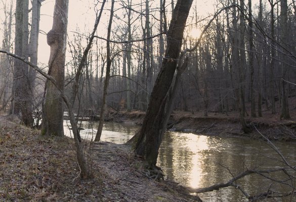
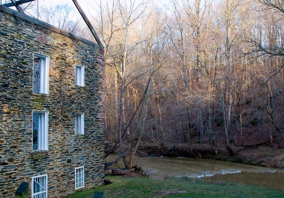
Great Seneca Creek in Germantown, Md., looking upriver from the remnants of Black Rock Mill. The floodplain shows the typical forest-stabilized landscape that emerged after the milldam removal. Christopher M. Keane
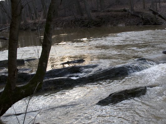
The remnants of the milldam for Black Rock Mill on Great Seneca Creek in Germantown, Md., are only visible through residual riffle. Christopher M. Keane
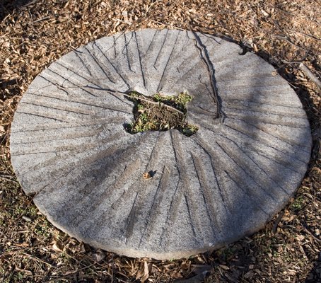
A millstone commonly used in the mid-Atlantic region of the U.S. Christopher M. Keane
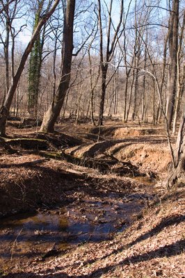
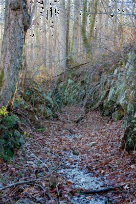
A meandering stream near Seneca Creek in Maryland. Christopher M. Keane
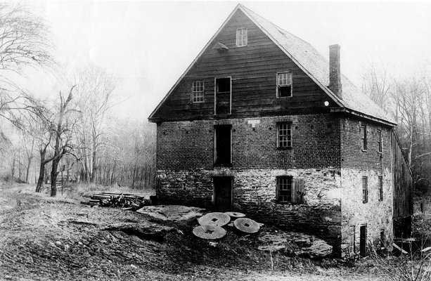
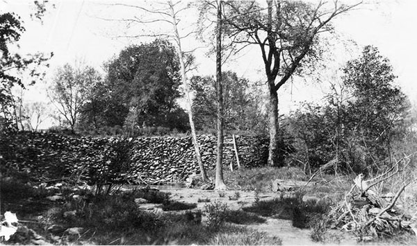
Black Rock Mill along Seneca Creek, as seen today. Christopher M. Keane
The mill race that was blasted out of the bedrock connected the millpond to Black Rock Mill itself. Christopher M. Keane
Clopper Mill, a saw- and gristmill, was erected in the early 18th century. Courtesy of Frank Ierardi
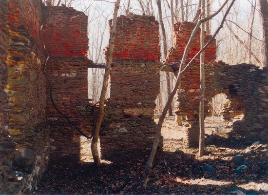
Like many rivers in the mid-Atlantic, Seneca Creek hosted numerous mills and their dams for more than a century, including Clopper Mill. Courtesy of Frank Ierardi
A milldam on the West Branch of the Little Conestoga River in Lancaster County, Pa., circa 1919. Pennsylvania Department of Environmental Protection
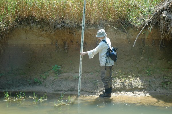
Dorothy Merritts surveys along a streambank in Watkin's Mill Park on Great Seneca Creek in Montgomery County, Md. Robert Walter
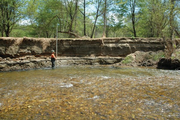
Mike Rahnis holds a stadia rod by a streambank on Mountain Creek in Cumberland County, Pa. Robert Walter
In 1702, Francis Chadsey and his family bought 200 hectares of meadow and upland on the banks of the Brandywine Creek in southeastern Pennsylvania. Within a year, he built a mill for grinding wheat, oats and barley. Like other landowners in the region, Chadsey also built a small dam on the creek. He most likely used local stone to erect the 2.5- to 3.5-meter-high structure, behind which a small pond sprang up. From the pond, a conduit carried water that spilled over a wheel to produce power to run the mill.
Chadsey was not alone in building his dam and mill. Before the development of the steam engine, mill owners needed water for power, and throughout the mid-Atlantic region from the 1600s to the early 1900s, they erected small dams on creek after creek. Many of the structures were made of stone, but builders also fashioned timber crib and earthen dams. None was larger than a couple meters, but most still formed ponds that often filled much of an entire valley. The dams mainly provided power to a variety of mills — saw, grist, grain, paper, oil and fulling (for cleaning and thickening wool). But they also fueled other industries, running forges, furnaces and mines.
Water-powered mills were so important to early American industry that by 1840, more than 65,000 mills had been built in the eastern United States. The mid-Atlantic region, with its shallow gradients and good ports, saw the greatest concentration of dams, with as many as 0.19 dams per square kilometer. By the 1860s, for example, Chester County in Pennsylvania, home to Chadsey’s early mill, had at least 377 dams that powered 379 mills.
The mills sat so close together that the pond of one dam would back up to the foot of the next one upstream.
With the development of the steam engine, such milldams became obsolete. Owners abandoned them and the ponds filled in with sediment, creating one- to three-kilometer-long staircases across the landscape, with each wedge made of sand and silt. Later still, forests and towns developed on the old milldam sites. Slowly the dams and their impact were mostly forgotten, until Franklin & Marshall College geologists Dorothy Merritts and Robert Walter began to examine the sediments. What they found, which they described last year in Science, sparked a broad controversy that may revolutionize the science of fluvial geomorphology and the field of riparian restoration.
Merritts began to look at the streams near Lancaster, Pa., in 2002, because she wanted her students to focus on geology close to the college. Surprisingly, the fine silts and clays she found in the layering along the streambanks did not look like material deposited by running water; the sediments were too thick and too laminated, plus they were underlain by a black, organic layer rich with seeds, pollen, roots and woody debris. The organics in turn rested on a gravelly bed. When Merritts showed them to her colleague, Robert Walter, he thought they looked more like pond sediments. The pair also wondered how the three-meter-wide, ankle-deep streams the students studied could deposit banks of sand and silt six meters deep.
Walter, who had grown up in the area, suggested that the sediments accumulated behind a dam. Despite finding stream after stream with similar sediments, Merritts says that she was initially skeptical that human-made dams could have such a widespread impact. To better understand what happened, she and Walter consulted historic maps, early census studies, county records and diaries. They also examined aerial photos and light detection and ranging (LiDAR) data (which removes ground cover to more easily reveal topography) and walked riverbanks in more than 20 watersheds, such as the Brandywine River, Seneca Creek and Watts Branch. All the data pointed to the same culprit: dams.
Walter and Merritts concluded that as the early settlers cleared the forests and converted the land to farms, millions of tons of clay, silt and sand washed into streams and collected behind thousands of dams. The two geologists were seeing these “legacy sediments,” through which the streams eroded down after the dams were breached.
But Walter and Merritts were about to make a potentially bigger discovery that went beyond solving the mystery of the unusual sediments. They also noticed something odd about the sediments left behind by the original, pre-dam (or pre-settlement) streams. Walter and Merritts had initially suspected that the pre-settlement streams formed classic meandering waterways, because that’s what traditional stream-morphology models stated. But instead, they found gravels, clays and organics at the base of the streambanks that suggested that the streams flowed in many channels through a series of low, vegetated islands within the floodplain. “We realized that there was a very interesting story emerging here that had nothing to do with what we thought and how we thought these streams originally formed and functioned,” Walter says. “We realized we were potentially overturning some long-held views about how streams formed.”
Those long-held views developed from work — including studies on Seneca Creek and Watts Branch — in the 1950s, primarily by M. Gordon “Reds” Wolman, now at Johns Hopkins University in Baltimore, Md., and the late Luna Leopold, who worked at the U.S. Geological Survey and the University of California at Berkeley. In a series of landmark papers, followed by their seminal book, “Fluvial Processes in Geomorphology,” co-written with John P. Miller, a geomorphologist at Harvard University in Cambridge, Mass., they established the classic models on how streams evolve, flow and mature.
Their work centered on the meandering river form, a single channel that develops most often on a coastal plain, such as the mid-Atlantic region, but is found in any area with fine sediment and low gradient. Sediment erodes at the outside of a bend, where the current is strongest, and deposits on a point bar at the inside of a bend. Over time, this erosion-deposition pattern causes a meandering river to migrate both sideways and downstream. In the geologic record, meandering leaves behind a characteristic pattern of cross bedding, gravelly point bars and fine-grained flood deposits. Yet Merritts and Walter found none of these classic features in their work on millpond sediments.
Since the publication of “Fluvial Processes” half a century ago, the meandering stream model of Leopold, Wolman and Miller has become an archetype. By showing how water hydraulics and sediment transport interact, the model has helped researchers piece together past environments, as well as predict how a river will transform a modern landscape. In the past few decades, the meandering stream has also become the template that guides river restoration. On thousands of projects that cost more than a billion dollars annually, workers use concrete, bulldozers and boulders to force rivers back to the ideal of a sinuous waterway winding within its floodplain.
But what if the underlying basis for the model is wrong? That is the message of Merritts and Walters’ Science article. It “was like a bomb, in a good way,” says Frank Pazzaglia, a geology professor at Lehigh University in Bethlehem, Pa. Earlier generations of geomorphologists had recognized the widespread nature of legacy sediments but had attributed them solely to high post-settlement erosion, he says. “More recent workers had focused on the processes, such as how does sediment move, and less on the history. Now we have both pieces. Furthermore, by adding the hard data on milldams, Merritts and Walter have made this legacy better understood.”
The study has ruffled a few feathers in the trade, Pazzaglia says. Some are upset that Merritts and Walter didn’t go far enough in acknowledging past work, but the real controversy lies in the field of restoration. Knowing the widespread role that milldams and millponds had in the accumulation of sediments is important, but of greater implication in restoration is what makes a natural stream. Is it the sinuous single channel studied by Leopold and Wolman or the multiple, wetland-type channels found under the legacy sediments? “They knew they were entering a big issue,” Pazzaglia says, “but they have the data.”
At the heart of restoration is what defines a healthy river. “There is a very big cottage industry in civil engineering, regulatory and hydrological circles trying to answer this question because the answer will direct how, and if, one restores a river,” Pazzaglia says. But what if restoration efforts are trying to return rivers to pre-settlement conditions that never existed? This question has made Merritts and Walter’s work controversial.
Two processes drive river morphology along the Atlantic seaboard: erosion and sedimentation. As streams cut into those thick banks of sediment seen by Merritts’ students, the water carries away millions of tons of silt and sand, much of it laced with an agricultural effluvium rich in nitrogen and phosphorus, as well as antibiotics, insecticides and pesticides. Increased erosion also weakens roads and bridges, damages habitat, and degrades water quality. And most concerning is the ultimate endpoint for many streams: the highly vulnerable and extremely valuable habitat of the Chesapeake Bay.
Previous researchers focused on urbanization, poor farming practices and deforestation as causes for increased erosion and sedimentation. Merritts and Walter found that milldams bear more of a responsibility. When a dam is breached, the stream becomes a “power washer,” scouring out the fine-grained legacy sediments and pre-settlement gravels and organics. For the environment as a whole, Walter says, the best thing to do in terms of restoration is to try to remove as much of this sediment as possible and get back to the original wetland condition.
But not everyone agrees with this. “The perception is that we’ve found the smoking gun in the floodplain sediments. Therefore if we remove these sediments or reconnect to the floodplain, we will solve the problem” of erosion and sedimentation, says Peter Wilcock, a specialist in river sedimentation at Johns Hopkins University. But, he asks, if the milldam sediments have been there for a hundred years, then how fast are they eroding? Wilcock also questions the cost, as well as the amount of disturbance required to remove tons of sediment, particularly if one has to cut down forest to dig up the material. In addition, does reducing sediment loading in one spot have the same effect downstream? “One pound dug out is not one pound prevented from reaching Chesapeake Bay because of intermediate deposition,” he says.
Furthermore, Wilcock questions Merritts and Walter’s suggestion to restore streams to their pre-colonial environment of marshy streams and wetlands. He doesn’t question their interpretation of what streams originally looked like, but suggests that it is impossible to do so because the drivers of stream dynamics, such as forests, riparian vegetation and beavers, no longer resemble historic conditions — not to mention all the cities, farms and people sitting on these sediments. “So much has changed and we don’t have the science and money to return the mid-Atlantic streams to their earlier conditions,” Wilcock says.
For their part, Merritts and Walter say that restoring the streams to pre-settlement wetlands does make sense. Ecologists, geologists and planners all recognize the importance of wetlands to a healthy ecosystem in the mid-Atlantic. “A lot of federal money is spent to create wetlands where wetlands didn’t exist, when we know there are buried wetlands under these sediments,” Merritts notes. In addition, she and Walter point out that there is a viable seed bank in the buried organic-rich layers just waiting to be taken advantage of. “We might not be able to restore exactly to the pre-settlement conditions,” Walter says, “but at the same time, there is every reason to think that a wetland is a very good thing.”
Merritts and Walter also caution that their data should not be applied universally. Not all streams in the East had milldams — or at least quite so many — and it is hard to compare the tectonically active western United States, with its steep mountain streams and high rates of erosion, with the “geriatric landscape” of the East and its gentle slopes and erosion. But “it is important for all regions to re-evaluate,” says David Montgomery, a geomorphologist at the University of Washington in Seattle. “No matter how well we think we understand what works we may need to study it better.”
Ultimately, Wilcock and others agree that Merritts and Walter have done good work and made a significant contribution to the field. “They have given a platform to pose new questions and new experiments. It was like a shot in the arm,” Pazzaglia says. Or, as Walter says: “It is very gratifying to hear people say, ‘I will never look at streams the same way again.’”
© 2008-2021. All rights reserved. Any copying, redistribution or retransmission of any of the contents of this service without the expressed written permission of the American Geosciences Institute is expressly prohibited. Click here for all copyright requests.