
by John (Jack) Shroder Thursday, August 15, 2013
courtesy of John F. (Jack) Shroder Jr.
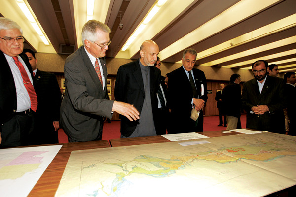
The author shows a map of the geomorphology of northern Afghanistan to Afghan President Hamid Karzai and others at the University of Nebraska in Omaha in 2005. The author created the map in the summer of 1978, between the communist coup in May and his deportation from Kabul that fall. The map was an early “trafficability” type (including active sand dunes and shifting rivers, as well as active tectonics [rising anticlines and piercement salt domes]). Right after the coup, he says, he knew his days were numbered so he loaded his truck with food and headed out of Kabul in the north to field-check this map. When he ran out of supplies, he returned to Kabul, where Afghan communist officials found him and pressured him to turn over all his maps. However, his cook, Abdul Waheed, surreptitiously took the maps to the U.S. embassy — on his bicycle — and they were shipped back to the U.S. in a diplomatic pouch. This is one of the few maps to make it out. The author was house arrested after this for three months and was finally deported on a few hours’ notice, driven to the airport and put on a Lufthansa jet to Germany.
© 2008-2021. All rights reserved. Any copying, redistribution or retransmission of any of the contents of this service without the expressed written permission of the American Geosciences Institute is expressly prohibited. Click here for all copyright requests.