
by Mary Caperton Morton Tuesday, May 12, 2015
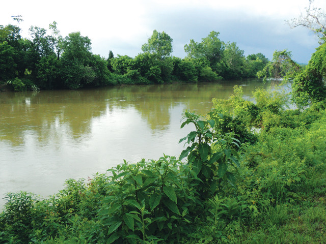
Researchers quantified background landscape erosion rates in the southeastern U.S. prior to European settlement by studying sediments along 10 major rivers, including the Dan River. Credit: ©MarmadukePercy, CC BY-SA 3.0.
Humans are one of the most powerful erosive agents on Earth, moving copious amounts of sediment to and fro, mainly through agriculture and development. But quantifying how much we actually move — often a necessary step for developing sustainable land management practices — hinges on determining erosion rates in an area before humans intervened. A new study using surface exposure dating to estimate pre-colonial erosion rates in the southeastern U.S. has now clarified the natural background rate in more detail than ever before, revealing the dramatic human impact on the regional landscape.
“People make a mess of the landscape,” says Paul Bierman, a geomorphologist at the University of Vermont in Burlington and co-author of the new study, published in Geology. But quantifying how big a mess we make is tricky, Bierman says, in part because finding ways to calculate background erosion rates that are independent of human influence is difficult.
To determine average pre-settlement sediment erosion rates in the southeastern U.S., Bierman and his colleagues focused on 10 large drainage basins in the region, including those of the Roanoke, Dan and Savannah rivers. All of the basins are in an area that was cleared of native forest and used intensively for agriculture beginning in the 1800s. These practices tend to increase erosion by destabilizing hillslopes, removing vegetation and loosening sediment, which then flows down waterways into low-lying river basins.
One way to study surface erosion involves using the rare isotope beryllium-10, which is produced when cosmic rays strike oxygen-16 atoms in rocks and sediment at Earth’s surface. Measuring beryllium-10 concentrations in these materials can thus give scientists an idea of how long the current land surface has been exposed. “The beauty of beryllium isotopes is that we can use them to look back into the past, before people impacted a certain landscape,” Bierman says.
Analyzing beryllium-10 in sediments from each river basin, Bierman and his colleagues found that, before European settlement, the landscape was eroded by wind, rain and ice at a rate of about 8 meters every million years. Drawing upon previously published rates of post-settlement erosion and river-sediment yields for the same basins, the team showed that the peak rates of erosion that occurred in the late 1800s and early 1900s were more than 100 times higher than the background rate. However, in the past 75 years, improved agricultural practices — such as no-till farming, the planting of crops without tilling the top layer of soil — have reduced erosion rates.
The background rate calculated by Bierman’s team aligns “with the numbers we get by calculating long-term rates of erosion of sedimentary rocks on much longer time scales,” says Bruce Wilkinson, a sedimentary geologist at the University of Michigan in Ann Arbor, who was not involved in the new research. “The really interesting next step for this line of research is the question: Where did all that sediment go?”
Previous studies have estimated that only about 6 percent of soils eroded from modern agricultural lands is transported downstream all the way to the ocean. “That means 94 percent is still sitting in valleys and behind dams,” Wilkinson says. “Over the next couple of hundred years, this huge load of sediment will reach a tipping point [at which it’s no longer stable] and start moving downstream.” How the transport of hundreds of years’ worth of eroded sediment — called legacy sediment — might affect the health of waterways is unknown, he says.
Because agricultural run-off can carry nutrients, hazardous heavy metals and toxins with it, the Environmental Protection Agency regulates sediment in rivers as a pollutant. Bierman says he hopes his group’s efforts to establish more accurate background erosion rates may factor into better regulations designed to conserve soils and improve stream health. “We have an academic interest in studying how landscapes erode over long time scales, but it’s important that such findings are factored into land management practices as well,” he says.
© 2008-2021. All rights reserved. Any copying, redistribution or retransmission of any of the contents of this service without the expressed written permission of the American Geosciences Institute is expressly prohibited. Click here for all copyright requests.