
by Mary Caperton Morton Tuesday, August 16, 2016
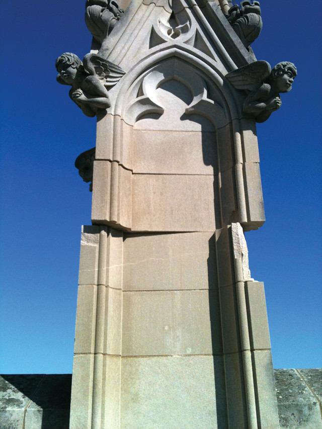
In 2011, a magnitude-5.8 earthquake in Virginia damaged buildings in Washington, D.C., including the National Cathedral. Credit: William Leith, U.S. Geological Survey.
On Aug. 23, 2011, a magnitude-5.8 earthquake struck near Mineral, Va., shaking the Piedmont region and damaging several historic buildings in Washington, D.C. The quake caught many people by surprise because the eastern U.S. lies in the interior of the North American Plate, more than 1,500 kilometers from the nearest plate boundary. In a new study, researchers peering beneath the southeastern portion of the North American Plate may have found an explanation for why parts of the region experience more quakes than expected.
Earthquakes typically occur at the margins of tectonic plates where one plate dives under another, such as the Cascadia Subduction Zone off the coast of the Pacific Northwest, or where two plates scrape past each other, such as the San Andreas Fault in California. Intraplate earthquakes do sometimes strike, most often along ancient rift zones like the New Madrid Seismic Zone in Arkansas, Missouri and Tennessee. But earthquakes have also been observed in parts of the Southeast, such as central Virginia and near Charleston, S.C., which are far from plate boundaries and have no recent history of rifting.
“There are other regions in the world that experience earthquakes in the interior of plates, but the southeastern U.S. is notable because the earthquakes tend to be clustered into zones,” says Berk Biryol, a geophysicist at the University of North Carolina-Chapel Hill and lead author of the new study, published in the Journal of Geophysical Research: Solid Earth.
To study how the underlying plate geometry might be causing these earthquake-prone zones, Biryol and his colleagues used seismic tomography — which maps differences in rock density based on the speed at which seismic waves travel through the subsurface — to create a three-dimensional image of the bottom of the North American Plate, from east of the Mississippi River and south of the Ohio River all the way to the coast. They found that the plate thickness varied widely across the region, with thicker areas of dense, older rock interspersed with thinner zones of less dense, younger rock.
“This was a somewhat surprising finding because we didn’t expect to see significant variations in plate thickness in the interior of the plate,” Biryol says. The patterns of thick and thin regions suggest, according to the researchers, that the region’s history of multiple episodes of rifting and accretion since the Late Proterozoic created areas of denser crust. Over time, these denser areas were pulled downward by gravity, and some fragments of crust eventually broke off and sank into the asthenosphere, where they can still be seen using seismic imaging. The voids in the crust created by this peeling, or delamination, were then filled by warm, upwelling asthenosphere from the mantle, portions of which eventually cooled to form the thinner, younger zones of rock.
This process of delamination and infilling takes place over millions of years and is not the direct cause of earthquakes, Biryol says. Rather, “we think that when plates become thinner through delamination, this changes the stress distribution in the plate,” he says. “This might result in clustering of earthquakes above the weaker or thinner zones and helps explain the zonation we see in the region.”
The study is the most comprehensive look to date at the mantle processes underlying the eastern U.S., says Thomas Pratt, a geophysicist with the U.S. Geological Survey in Reston, Va., who was not involved in the new study. “This paper is going to spark a lot of dialogue over the next few years as people look for ways to test the ideas offered up by this group.”
The findings also speak to the question of the longevity of these active seismic zones: Biryol and his colleagues suggest that the delamination under eastern North America could date back as far as 65 million years. “One of the questions we have about these unusually active zones is whether they will remain active in 10,000 years or a million years. Or will they diminish or migrate?” Pratt says.
Paleoseismic records of earthquakes around Charleston and in the New Madrid Seismic Zone in Missouri suggest relative stability of these zones over the past 5,000 years, with earthquakes occurring in the same places at regular intervals, but few paleoseismic records have been found for central Virginia or Tennessee. “If these seismic zones are strongly influenced by mantle processes as [this study] implies, it seems like they would be pretty stable since mantle patterns are processes that evolve over millions of years,” Pratt says.
© 2008-2021. All rights reserved. Any copying, redistribution or retransmission of any of the contents of this service without the expressed written permission of the American Geosciences Institute is expressly prohibited. Click here for all copyright requests.