
by Mary Caperton Morton Tuesday, May 28, 2013
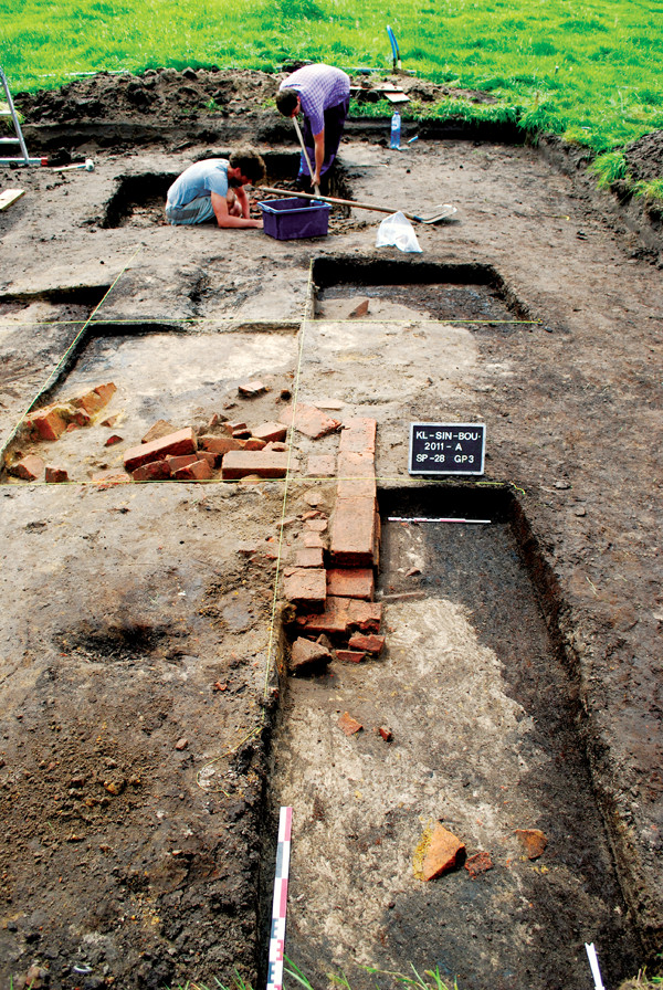
After an electromagnetic induction survey, two small-scale excavations were undertaken at Boudelo to further interpret the data and create a 3-D model of the site. Ghent University
Archaeology has come a long way from the days when the only way to find something was to dig it up. These days, in addition to shovels and brushes, many researchers also use noninvasive imaging techniques to look into the past without disturbing a site. Now an old technique, updated with new technology, is giving scientists a more complete picture, not just of old buildings and man-made structures, but also of what the landscape looked like at the time it was inhabited.In northern Belgium, near Flanders, a team of soil scientists working to map the topography of a 10,000-year-old paleolake discovered evidence for a long history of wetland reclamation on the grounds of an abbey, abandoned in the 16th century. The abbey, known as Boudelo, was excavated extensively in the 1980s, but the focus was entirely on the buildings, says Philippe De Smedt, a geophysicist at Ghent University in Belgium and lead author of a new study published in Scientific Reports.
“A lot was already known about the religious buildings on this site,” De Smedt says, “but we knew practically nothing about the history of reclamation here, which is equally important for understanding the functionality of the place.” The team found networks of ditches, accumulations of peat and lake sediments, and evidence for repeated flooding. The extent and layout of the ditches indicated a considerable investment in reclaiming the surrounding wetland, De Smedt says. In addition, historical records attest to the long history of building embankments and drainages, as well as mining of peat and clay at the site. Between the 13th and 16th centuries, Boudelo expanded to more than 1,000 hectares, making the community one of the leading cultivators in Flanders. Boudelo is known to have been abandoned in 1578 due to military conflicts and successive floods.
“The landscape is missing from a lot of archaeological studies,” says Chris Gaffney, an archaeological geophysicist at the University of Bradford in England who was not involved in the new study. “In order to understand the history of a site, you have to understand what kinds of changes have occurred over time in the landscape.”
Wetland reclamation projects have been widespread in Belgium and around Europe from the Middle Ages on, as cities like Ghent and Bruges expanded into the countryside. Abbeys in particular were often built in lowlands to help reclaim marginal areas for cultivation and development, De Smedt says.
Surveying the area using electromagnetic induction (EMI) allowed De Smedt and colleagues to paint a more complete picture of the medieval landscape surrounding the abbey. The technique works by simultaneously mapping the electrical conductivity and magnetic susceptibility of soils, which not only saves time, but also produces a more complete 3-D image of the terrain, he says.
“EMI itself is not new, but the technology has advanced tremendously in the past few years,” Gaffney says. “With one sweep of this machine we get the two most commonly collected archaeological parameters for noninvasive investigation: earth resistance and magnetometry.”
To date, the primary use for EMI has been agricultural surveys and soil mapping, Gaffney says. “[De Smedt’s] research group is a bit unusual as they’re coming at this from the perspective of soil scientists, not traditional archaeologists,” Gaffney says. “It’s a slightly different perspective and a very interesting one.” So far, EMI has not been widely used for archaeological applications, he says, but that’s changing rapidly, mainly due to recent technological advancements made by agriculturally focused technology companies.
Like all imaging techniques, EMI works better in some environments than others, De Smedt says. “EMI works best in wetland environments with high clay content,” he says. Dry, sandy areas with low electrical conductivity in the soil usually do not show up as well.
The tool may prove especially useful when surveying for new road and construction projects, Gaffney says. “Often we have limited time and resources when scanning for archaeological remains in the way of building projects. Being able to sweep an area for both electrical and magnetic signals at once could be a boon for discovery and preservation of hidden sites.”
Already, the newly improved EMI sensors are being deployed at other archaeological projects around Europe, such as the Stonehenge Hidden Landscapes Project, on which Gaffney is an investigator, as well as at a recently discovered gladiator school built around A.D. 150 in Austria.
“I, for one, went out and bought [an EMI sensor] as soon as I could,” Gaffney says. “I really think this tool is changing how we analyze archaeological landscapes.”
© 2008-2021. All rights reserved. Any copying, redistribution or retransmission of any of the contents of this service without the expressed written permission of the American Geosciences Institute is expressly prohibited. Click here for all copyright requests.