
by Julia Rosen Friday, July 18, 2014
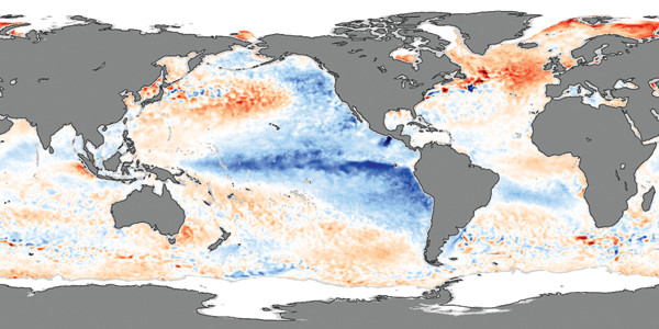
El Niño years are characterized by warm conditions in the eastern tropical Pacific while in La Niña years, like 2007 (shown here), the tropical Pacific is cool. Credit: NASA.
Many La Niña events last just one season, but historical records reveal that nearly half linger for two years or more, a phenomenon scientists have long struggled to explain. Now, new research has identified a potential mechanism behind such enduring La Niñas that may provide a blueprint for the kinds of long-range predictions needed to mitigate the economic impacts of associated events like the devastating Texas drought.
La Niña — the cooler sister of the better-known El Niño pattern — is characterized by anomalously cold sea-surface temperatures in the tropical Pacific. This pattern develops when the boundary between frigid deep waters and warmer surface waters, known as the thermocline, rises to shallower depths, allowing cold waters to be mixed upward into the surface of the ocean. Like with El Niño, the full effects of La Niña spill far beyond the Pacific. Temperature changes in the surface ocean alter atmospheric circulation patterns across the planet, leading to wetter conditions in Australia, cooler temperatures in the American Northwest, and winter drought across much of the American South and parts of South America.
During years in which this climate pattern only lasts one season, the thermocline returns to deeper depths at the end of winter, terminating La Niña and alleviating its far-flung effects. This is because “each event contains the seeds of its own destruction,” says Pedro DiNezio, an oceanographer at the University of Hawaii and an author of the new study, presented at the annual meeting of the American Geophysical Union last December in San Francisco.
The terminating mechanism involves ocean waves, but not the surficial kind that break on the coast, DiNezio says. Instead, he says, it’s better to think of these waves as undulations in the interface between the warm surface waters and the cold abyssal waters of the thermocline. In the case of La Niña, stronger trade winds kick off one of these waves, which moves westward across the Pacific, bounces off the coasts, and then a year later, returns to the central Pacific where it causes the thermocline to plunge by tens of meters. This pulls cold waters away from the surface and has a warming effect that ends La Niña and ameliorates its global climate impacts.
But for one out of every two La Niña events in the last 50 years, this mechanism did not succeed in ending the event, and La Niña persisted. In contrast, El Niño events always last just one season. “Usually, people have thought about La Niña and El Niño as mirror images of each other,” DiNezio says. “However, this [difference in duration] shows they are not.” Teasing out the cause of this asymmetry is the subject of the new study by DiNezio and co-author Clara Deser, a climate modeler at the National Center for Atmospheric Research in Boulder. The study is currently under review for publication in the Journal of Climate.
Using a new model that allowed the researchers to isolate the effects of different oceanic and atmospheric processes involved in generating two-year La Niña events, the researchers found a likely explanation. Their results suggest that the sensitivity of sea-surface temperatures to the depth of the thermocline changes, depending on whether the thermocline is getting shallower or deeper. “As the thermocline gets closer to the surface” — which happens at the end of El Niño — “it is easier for [the cold water below] to influence the surface,” DiNezio says, meaning the wave can cool El Niño’s anomalously warm temperatures, effectively terminating the El Niño.
Deepening is another story; whereas it usually warms the surface by pulling cold water away — thus ending La Niña — at some point, he says, additional deepening won’t have any further effects because the thermocline plunges below the depth at which winds and surface currents can mix the cool water upward. In other words, there comes a point where no cold water is being mixed into the surface layer, so making the thermocline deeper won’t warm it anymore. In the case of the coldest and strongest La Niña events, which kick off the largest subsurface waves and so eventually experience a proportionally large deepening of the thermocline, the warming effect reaches its maximum capacity, but still cannot terminate these exceptionally cold events.
DiNezio and Deser conclude that this feature of the thermocline explains the frequency and occurrence of long-lived La Niña events, but other scientists are not ready to rule out other mechanisms. “The authors seem to emphasize [the importance of] the subsurface ocean,” says Dietmar Dommenget, a climate modeler at Monash University in Melbourne, Australia, who also studies La Niña events, “but they have not really shown strong support for this.” He thinks that wind patterns could also play a strong role in causing the asymmetry between El Niños and La Niñas, but notes that it is difficult to untangle the atmospheric and ocean processes in such a tightly coupled system.
However, Dommenget and DiNezio agree that a better understanding of the processes in play will improve predictions of which events are coming and when they will end, a task that has proven challenging so far. As the Texas drought of 2011 illustrated, accurate prediction has immense societal implications, a fact not lost on DiNezio, whose brother is a farmer in his native Argentina. Every spring, DiNezio says, “my brother texts me asking, ‘Is there going to be an El Niño next year?'”
© 2008-2021. All rights reserved. Any copying, redistribution or retransmission of any of the contents of this service without the expressed written permission of the American Geosciences Institute is expressly prohibited. Click here for all copyright requests.