
by John Stenmark Wednesday, April 23, 2014
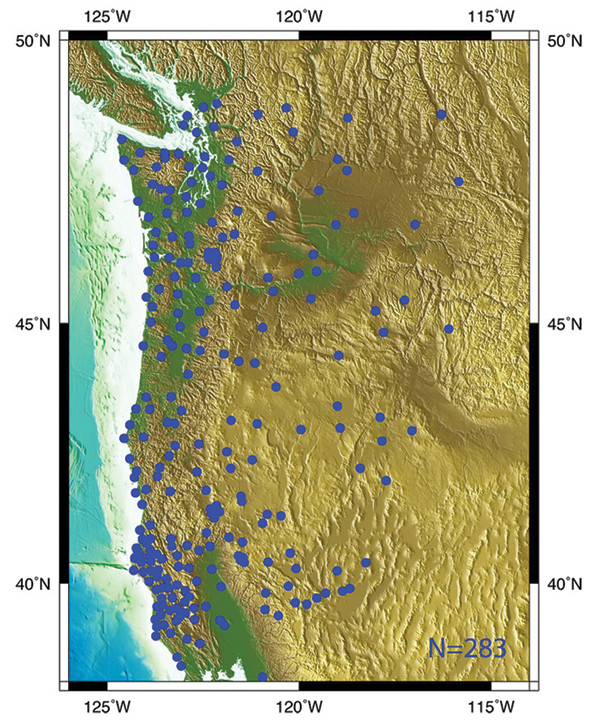
Credit: UNAVCO
More than 280 continuous GPS (cGPS) stations in Cascadia are part of the U.S. Plate Boundary Observatory (PBO), a component of EarthScope, which includes more than a thousand cGPS stations arrayed across the western United States and Alaska. Operated by UNAVCO, PBO provides continuous data to researchers studying tectonics and earthquakes. Each PBO station operates autonomously to record and transmit up to one sample per second. In addition to PBO, the U.S., New Zealand, Japan and Canada have implemented similar networks of cGPS stations with the intent of capturing both slow and rapid motion. By combining simultaneous data from multiple receivers, scientists can use cGPS networks to produce positioning and ground motion data with millimeter precision. Data from continuous stations can be blended with campaign studies, many of which share a fleet of GPS receivers managed by UNAVCO, to provide an effective tool for seismic research.
© 2008-2021. All rights reserved. Any copying, redistribution or retransmission of any of the contents of this service without the expressed written permission of the American Geosciences Institute is expressly prohibited. Click here for all copyright requests.