
by Mary Caperton Morton Thursday, November 8, 2018
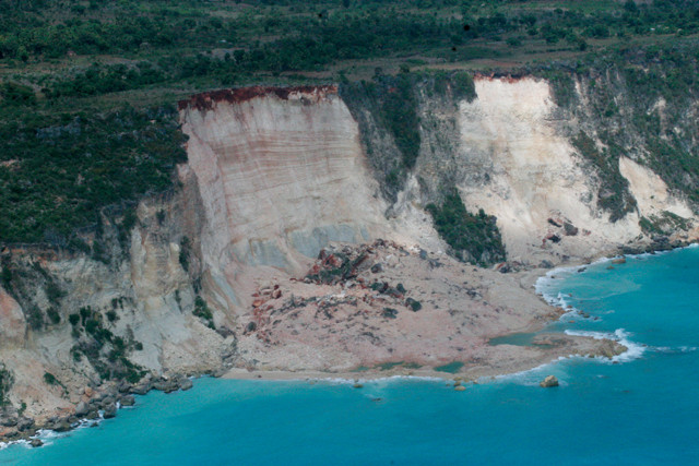
The January 2010 magnitude-7 earthquake in Haiti triggered tens of thousands of landslides throughout the island. Landslides are the third-leading cause of death in earthquakes. Credit: Randy Jibson, USGS.
Landslides are the third-leading cause of death in earthquakes, after building collapses and tsunamis. Unlike tsunamis, however, which usually arrive minutes to hours after an earthquake, earthquake-triggered landslides tend to occur simultaneously with ground shaking, so a landslide warning system is not possible. But a new model that predicts where landslides may be triggered during earthquakes could help emergency aid and rescue efforts.
Geoscientists have the necessary knowledge for assessing regions at high risk for landslides, says Michael Hamburger, a geophysicist at Indiana University in Bloomington and a co-author of a new study published in the Journal of Geophysical Research: Earth Surface that describes the model. Four key factors are known to determine a slope’s likelihood of failing: slope angle, rock type, land coverage and soil moisture. And “landslide risk assessments are common practice among engineering geologists,” he says.
Geologists also have access to U.S. Geological Survey (USGS) ShakeMaps, which are produced immediately following every significant earthquake as part of the Prompt Assessment of Global Earthquakes for Response (PAGER) system. However, Hamburger says, “in its current manifestation, the PAGER system does not assess any of the secondary effects of earthquakes, including triggered landslides.” So Hamburger and his colleagues developed a new landslide model that adds an earthquake trigger to their landslide risk assessment models. The resulting tool assesses the likelihood and spatial distribution of landslides after an earthquake anywhere in the world.
The model works in real time: Within minutes after an earthquake, data describing the ground motion produced by the event gleaned from the ShakeMap tool are plugged into the landslide model to determine the probability that landslides will strike in a given region. “Strong ground shaking in a region with steep slopes composed of unstable rocks that are covered by little vegetation and wet soils is typically a recipe for slides,” Hamburger says.
The goal is “to provide regional estimates of landslide probabilities really soon after an earthquake, so aid agencies can have some idea of the overall scale of landslides that might have been triggered by the earthquake,” says Anna Nowicki Jessee, lead author of the new study. Unfortunately, she says, the model output is only as accurate as the input, and initial ShakeMaps are often hampered by a lack of data in the immediate aftermath of an earthquake. As a result, the landslide model sometimes underestimates the initial landslide potential following a quake, as it did right after the Sept. 5, 2018, earthquake in Hokkaido, Japan. The magnitude-6.6 event was initially expected by the model to result in “little to no landsliding,” but in fact, the quake triggered hundreds of slides.
“The initial ShakeMap is produced automatically, as soon as an earthquake happens, but the initial reports are not as accurate as the later reports,” says Kate Allstadt, a geophysicist with the USGS in Golden, Colo., who was also a co-author of the new study. “As we get more seismic data, the ShakeMap evolves quite a bit over the first couple of hours after an earthquake.” Accordingly, within a few hours after the Hokkaido event, the landslide tool was predicting that “significant” landslides would be triggered. “Going forward, we have to think about the best way to share this information,” Allstadt says. “Do we release data right away? Or do we need to wait a little bit?”
The new landslide model is expected to be fully integrated with the PAGER system soon, says Randy Jibson, a landslide specialist at USGS in Golden, who was not directly involved in the new study but who is working on integrating the model into the PAGER system. Eventually, the model will be fully integrated with the PAGER system, under the Ground Failure menu, along with a separate model assessing liquefaction hazards being developed by a team at Tufts University in Massachusetts.
“Every event is a learning opportunity. Some earthquakes behave strangely, and those give us an opportunity to tweak the model. As we accumulate more observations, we will keep making it better,” Jibson says. “Given how complicated both earthquakes and landslides can be, I’d say the [new landslide] model is performing pretty well.”
© 2008-2021. All rights reserved. Any copying, redistribution or retransmission of any of the contents of this service without the expressed written permission of the American Geosciences Institute is expressly prohibited. Click here for all copyright requests.