
by Alex Lopatka Tuesday, October 3, 2017
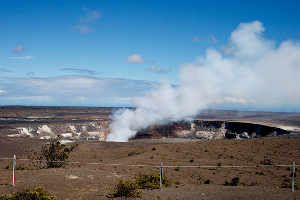
Steam rises from Kilauea's Halema'uma'u Caldera. Credit: Nathan Forget, CC BY 2.0
Kilauea Volcano, on Hawaii’s Big Island, has been erupting continuously since 1983, mostly releasing relatively slow-moving lava flows, although rare violent eruptions have occurred. Both explosive and nonexplosive eruptions pose risks to tourists, roughly 2.6 million of whom visit Kilauea annually, as well as to island residents whose safety and property have at times been put in jeopardy by flowing lava.
Despite Kilauea’s hazards, much remains unknown about how the volcano operates, including deflation-inflation events linked to underground magma movement. Lasting hours to days, the ground surface contracts and expands during these events, which have been a challenge to monitor effectively. In a recent study published in Science Advances_, _researchers describe a new way to continuously monitor and make sense of Kilauea’s short-term expansions and contractions, which could help scientists better forecast the volcano’s behavior.
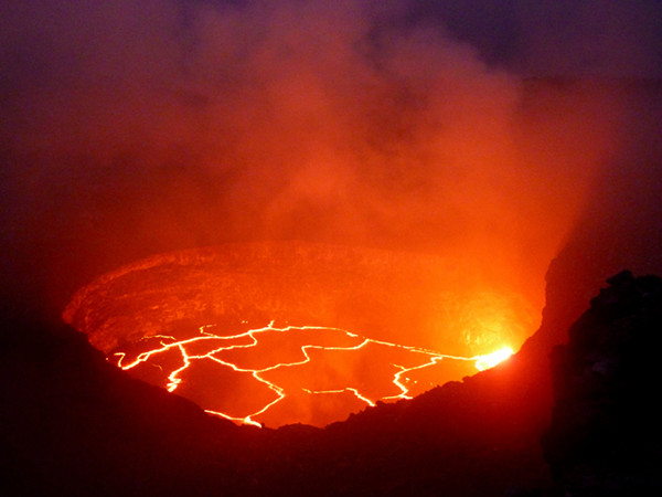
The lava lake in Halema'uma'u Caldera glows at night. Spattering and degassing of this lava produces seismic noise, which can be detected by seismometers and is useful in monitoring the volcano's activity. Credit: Clare Donaldson
“Kilauea is a laboratory volcano” with a “plethora of different datasets” available that make it ideal for monitoring research, says Weston Thelen, a geophysicist at the U.S. Geological Survey’s Cascades Volcano Observatory and a co-author of the new study. In the study, the researchers used data from 27 seismometers positioned around Kilauea’s broad summit, with most near the lava lake-containing Halema’uma’u Caldera. These instruments record seismicity near the volcano, including seismic noise produced by Earth’s background vibrations. The noise detected at Kilauea is generated from shallow tremors produced by degassing and spattering of molten rock in the Halema’uma’u lava lake.
“[Seismic] noise is happening all the time,” says Clare Donaldson, a doctoral student at the University of Cambridge in England and lead author of the study, so it can be used as a “continuous monitoring tool” at volcanoes. Donaldson and her colleagues used a technique known as passive, or seismic, noise interferometry to begin piecing together a detailed look at Kilauea’s activity. In the technique, scientists look at the times it takes for seismic noise waves to travel from their source to different pairs of seismometers at the surface. After determining these times, the relative velocities of the seismic noise waves can be calculated and compared to each other to better understand subsurface magma movement and its composition.
Seismic noise interferometry has been studied before as a potential method to measure variations in magmatic activity at volcanoes such as Piton de la Fournaise on Réunion Island in the Indian Ocean, Merapi in Indonesia and Miyakejima in the Philippine Sea, but with a different source of noise. “The noise generated by ocean swells [is] commonly employed for this technique,” says Florent Brenguier, a geophysicist at the Institute of Earth Sciences in France who was not involved in new the study. However, results from these studies showed inconsistent variations in seismic wave velocities during different types of magmatic activity. By contrast, the authors of the new study used volcanic tremor, which offered “robust” results, Brenguier says. Donaldson says that using volcanic tremor produced a “clean, clear signal” and proved more “illuminating” than oceanic noise has in the past.
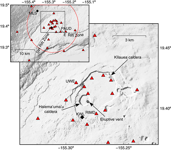
Red triangles indicate the locations of seismometers on Kilauea used in this study. The tiltmeter was co-located with seismic station UWE. Credit: Donaldson et al., Science Advances, June 2017, CC BY 4.0
To determine how seismic wave velocities through the volcano change during Kilauea’s short-term expansions and contractions, the team then compared the velocities to independent measurements collected by a tiltmeter positioned near the caldera. The tiltmeter detected when the angle of Kilauea’s flank changed, indicating when deflation or inflation of the magma reservoir 1 to 2 kilometers below the surface was occurring. “No studies have yet comprehensively compared velocity to other geophysical observables on a short-term scale at a volcano over a significant length of time,” Donaldson and her colleagues wrote.
Results from multiple volcanic events over the study period from 2011 to 2015 showed that when magmatic activity inflated the land surface, both tilt and relative seismic wave velocities increased in tandem; similarly, during episodes of deflation, both measures decreased together. These correlations were observed over periods of days to weeks. The researchers suggested that increased magma pressurization beneath Kilauea inflates the land surface, increasing the tilt while compressing cracks and fractures in the rock, which allows seismic waves to travel faster through the rock.
The strong correlation between seismic velocities and deformation of this study haven’t been seen before, Donaldson says. With the observed connection, Donaldson adds, scientists now have a better understanding of deflation-inflation events at Kilauea. The results also suggest the potential of seismic noise interferometry as a volcanic monitoring tool; however, she says, the work “is not revolutionizing [eruption] forecasting” just yet. Thelen agrees, noting that “we need more instances” of well-documented short-term deflation-inflation events to begin improving volcanic eruption predictions.
© 2008-2021. All rights reserved. Any copying, redistribution or retransmission of any of the contents of this service without the expressed written permission of the American Geosciences Institute is expressly prohibited. Click here for all copyright requests.