
by Lucas Joel Wednesday, June 15, 2016
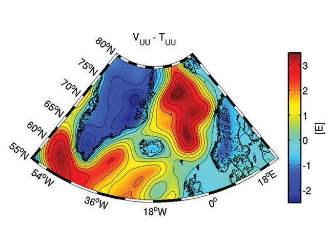
This portion of the new whole-Earth gravity map shows gravity gradients in the North Atlantic. Credit: Johannes Bouman/TUM.
Gravity differs from place to place around Earth because of the uneven distribution of mass across and within the planet. Scientists can study the variation in gravitational pull by measuring the gravity field at different places on the surface of the planet. In a new study published in Scientific Reports, gravity field data collected over the entire planet between 2009 and 2013 by the European Space Agency’s Gravity Field and Steady-State Ocean Circulation Explorer (GOCE) satellite has been mapped, revealing many of Earth’s internal features, such as magmatic plumes welling up toward the surface.
The data have “helped us to map the Earth’s gravity field with great precision. And now … we can use the measurement values to see deep beneath the surface of our planet,” said Johannes Bouman of the German Geodetic Research Institute at the Technical University of Munich in a press release.
For example, one portion of the map shows a wide, high-gravity-anomaly stripe through the North Atlantic between Greenland and Scandinavia that represents the difference in gravity between continental and oceanic crust in the region. “With the gravity field measurements we can provide additional information to the plate tectonic model, as we can draw conclusions regarding density and thickness of the different plates,” Bouman said.
© 2008-2021. All rights reserved. Any copying, redistribution or retransmission of any of the contents of this service without the expressed written permission of the American Geosciences Institute is expressly prohibited. Click here for all copyright requests.