
by Sam Lemonick Friday, June 16, 2017
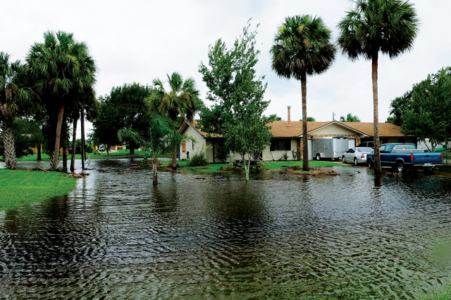
As sea levels rise, more frequent nuisance flooding events will become a costly burden in some coastal areas. Credit: FEMA.
Devastating storms like Hurricanes Katrina and Sandy dominate public attention when they hit, causing massive amounts of damage from high winds and waters. But small floods driven by rising seas may end up costing some coastal areas more in the long run. According to a new study published in the journal Earth’s Future, the cumulative property damage from these so-called nuisance floods could eventually match or exceed costs from rare extreme storms.
Nuisance flooding refers to small flood events that have relatively minor impacts and are minimally disruptive to everyday life. Although these floods typically involve inundations of half a meter or less of water, they can still close roads, damage homes and businesses, and even threaten public health by, for example, overwhelming sewer systems.
“If they only happen once or twice, [their effects] might be negligible,” says Hamed Moftakhari, a postdoctoral researcher studying coastal flooding at the University of California, Irvine, and lead author of the new study. When they happen more often, or if they’re considered in aggregate, he says, the costs of nuisance events over several decades or a century might exceed those of multibillion-dollar extreme storms, including major hurricanes.
Global warming is melting ice and causing seawater to expand, both of which contribute to rising sea levels. According to the Intergovernmental Panel on Climate Change’s Fifth Assessment Report, oceans could be 25 to 75 centimeters higher on average in 2100 than they were in 2000, which will only make nuisance flooding more common.
The U.S. is particularly vulnerable, with more than half of Americans living near a coast. Washington, D.C., offers an example of how small flooding events are likely to increase, Moftakhari says. Between 1930 and 1970, the nation’s capital experienced an average of 19 hours of nuisance flooding each year. Over the last 20 years, that number has increased to 94 hours. And by 2050, the city could see between 100 and 700 hours of nuisance flooding each year, according to a study he and his colleagues published in Geophysical Research Letters in 2015.
That much flooding would probably get people’s attention. But currently, it is hard for the public and policymakers to grapple with and plan for unknown costs of nuisance flooding that may not materialize for decades, Moftakhari says. That’s why in the new study, his group developed a metric called the Cumulative Hazard Index (CHI), which is intended to capture these long-term costs in an easy-to-understand way, he says.
The CHI is a ratio that subtracts projected costs of extreme flooding events from costs of minor ones, and then divides that difference by the combined costs of both. A CHI of zero means projected costs from minor and extreme flooding events for a given area are the same. A positive CHI means nuisance flooding is likely to be more expensive than extreme storms; a negative CHI means extreme storms are likely to be costlier.
The group projected costs from extreme and nuisance events using historical water-level data from NOAA tide gauges, estimates of the frequency of different flood sizes, and information about property values in flood-prone areas assembled in Climate Central’s online Risk Finder tool. They then calculated CHIs for 11 coastal U.S. cities.
Seattle and San Francisco had the highest CHIs, in part because both have relatively low risks of extreme storms. On the other end of the spectrum were Galveston, Texas, and Norfolk, Va., which are both susceptible to hurricanes and have expensive coastal infrastructure supporting the oil industry and the military, respectively. Low-lying Washington, D.C., also had a positive CHI, with 18 kilometers of roads and 15 bridges, as well as five monuments and museums, less than half a meter above sea level.
The new index “is important because it puts a socioeconomic cost on the recurrent flooding that we’re currently witnessing and documenting,” says William Sweet, a NOAA oceanographer who studies nuisance flooding. Sweet was not involved in the research, but has worked with this group in the past.
Moftakhari says he hopes that the CHI will help elected officials and others in coastal communities decide how best to act with respect to flood hazards. “It helps them to understand [whether or not their] community is under serious threat of nuisance floods,” he says.
Right now, the CHI calculations are based on a broad-strokes model of property values and risks, Moftakhari says, adding that future versions will ideally include information like expected monetary losses for businesses when flooding closes nearby roads. Sweet says higher-resolution flood models will also help refine the tool.
“We need these data to characterize the actual costs of nuisance flooding,” Moftakhari says, and one aim of the study is to encourage public officials to start collecting and sharing that information.
© 2008-2021. All rights reserved. Any copying, redistribution or retransmission of any of the contents of this service without the expressed written permission of the American Geosciences Institute is expressly prohibited. Click here for all copyright requests.