
by Julie Freydlin Tuesday, April 19, 2016
Scientists have known for decades that the Madden-Julian Oscillation (MJO) — a massive gathering of thunderstorms that forms intermittently over the Indian and western Pacific oceans — impacts regional and global weather. Predicting the impacts, however, has been more difficult because relatively little is known about the phenomenon, at least compared to El Niño and some other weather patterns. But in a new study, scientists have devised a mathematical model that clarifies how the MJO develops and progresses, which may pave the way for more accurate predictions of its effects.
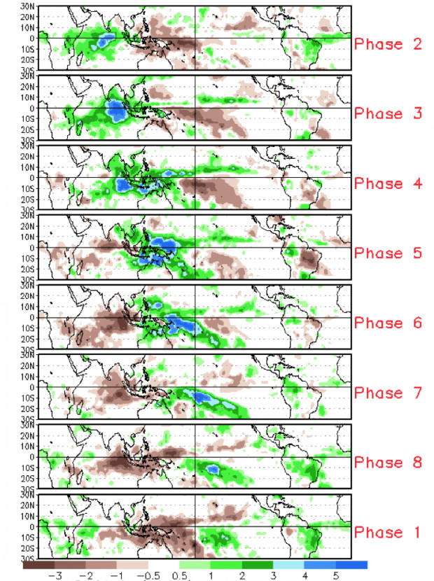
The progression of a cycle in the Madden-Julian Oscillation: At top, a new rain-producing storm system (green and blue shading) develops in the Indian Ocean before progressing eastward along the equator toward the Pacific. Credit: NOAA, climate.gov
When it’s active, the MJO develops about every six weeks in the tropical Pacific “warm pool,” which stretches along the equator roughly from the western Indian Ocean to the central Pacific. “The amount of moisture there is so large, and the area is so wide, that it makes it possible for huge clusters of thunderstorms to develop,” explains Ángel Adames, a graduate student at the University of Washington and lead author of the new study, published in the Journal of the Atmospheric Sciences. The thunderstorms can form year-round, but usually intensify during the winter and spring, with each system lasting about 20 to 25 days before weakening and eventually giving way to the next burst of storms. The rate at which “the cycle repeats has to do with how long it takes the atmosphere to collect enough moisture to create a large region of rainfall,” Adames says.
In India, Indonesia, Southeast Asia and northern Australia, the MJO can intensify or weaken monsoon conditions, adding to precipitation totals or suddenly halting steady rains. And farther east, in Papua New Guinea, the Solomon Islands and other equatorial islands, the MJO determines which types of clouds abound and whether rain may fall for days on end or not at all.
Adames and Daehyun Kim, also at the University of Washington, first developed a “series of simplified equations … [that] describe wind, temperature, pressure and humidity” in the tropical atmosphere. In their new model, they then tested how these variables relate to moisture, and solving the equations provided predictions for how the atmospheric moisture would behave over time. The theoretical solution from the model “describes the observed MJO” well, Adames says.
Previous models of the MJO had already explained that the storms head eastward because rainfall in the region causes changes in wind patterns, which then cause moisture to increase to the east of the rainy area and decrease to the west, Adames explains. “The rain area follows the moisture, so the system moves eastward,” he says. But, the new model incorporates additional atmospheric aspects, he notes, thus offering more realistic pictures of the phenomenon’s behavior.
The MJO “is basically a giant blob of humid air that moves itself along” from west to east, says Adam Sobel of Columbia University, who was not involved in the new study but who developed an earlier model of the MJO that served as a basis for the new work. The new research expounds on previous work by accounting for “the north-south component of the wind,” Sobel says, which also influences the path of MJO storms, as well as by offering a better view of how cloud growth during MJO cycles is affected by infrared radiation.
“The top of the [storm] cloud, called the anvil, often spreads tens of kilometers from the rain area,” Adames says. “This anvil works like a blanket,” trapping infrared radiation rising from Earth’s surface. The trapped radiation then feeds more energy into developing thunderstorms, which in turn trap more radiation and lead to even bigger storms.
Although researchers have made great strides in understanding the MJO, current theoretical models can’t be used for precise weather forecasting because they are based on simplified equations, Adames says. But he says he hopes that insights obtained from his team’s modeling will soon be incorporated into the more precise simulations run by forecasters.
Because the MJO affects other weather patterns beyond itself, such as tropical cyclones and El Niño, “improved forecasts of the MJO could help in anticipating major weather events,” Adames says. “If we can forecast them sooner, we would have more time to prepare for them, and thus possibly reduce their impact.”
© 2008-2021. All rights reserved. Any copying, redistribution or retransmission of any of the contents of this service without the expressed written permission of the American Geosciences Institute is expressly prohibited. Click here for all copyright requests.