
by Mary Beth Griggs Thursday, January 5, 2012
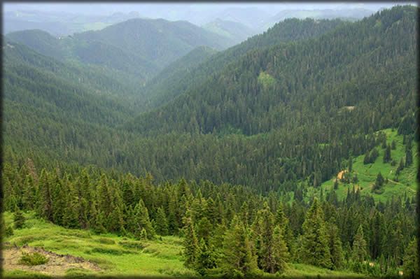
Calapooya Mountains as viewed from Fairview Peak Lookout in the Umpqua National Forest in Oregon. U.S. Forest Service
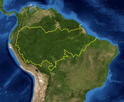
The Amazon Basin cover most of the width of South America (delineated in yellow). New research on global forest canopies helps quantify the amount of carbon the Amazon rainforest might hold. NASA
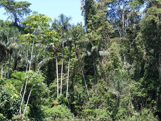
Amazon rainforest in the upper Amazon basin in Peru. Shao, Creative Commons Attribution ShareAlike 3.0
Satellite maps can show everything from city blocks to inaccessible mountain peaks from the comfort of our living rooms. Now, they can show us yet another dimension of the natural world: the heights of the world’s forests.
Michael Lefsky, an expert in remote sensing from Colorado State University in Fort Collins, used NASA satellites to compile a map that displays the height of all the world’s forest canopies. “The goal [of the research] was two-fold: to create a map that would allow us to map above-ground biomass, and simply to show that it can be done,” Lefsky says.
The mapping project made extensive use of LiDAR taken from NASA’s ICESat satellite. LiDAR (Light Detection and Ranging) is similar to radar, except it uses light instead of radio- or microwaves to measure distances. ICESat normally measures the topography of ice masses at the North and South poles, but Lefsky used data collected on ICESat’s journey between the poles, focusing on forested areas around the planet over the last seven years.
The satellite mapped 2.4 percent of Earth’s forested area, which itself comprises less than a third of the planet’s total land area. Lefsky used a stringent definition of the term forest, taking it to mean any area that was at least 70 percent covered with trees. The data, combined with aerial images and field measurements, produced an estimate for canopy heights around the world, as Lefsky reports in an upcoming issue of Geophysical Research Letters.
The map shows that the temperate forests of the U.S. Pacific Northwest have among the tallest canopies at 40 meters — perhaps no big surprise for the home of the sequoia and those redwood forests of song. Most tropical rainforests and temperate forests proved to be about the same height at 25 meters, whereas the northern boreal and primarily evergreen forests tended to be about 20 meters in height.
The map also provides more accurate data about areas of forest that were previously inaccessible, like the depths of the Amazon. Previous maps of the Amazon rainforest canopy, created using traditional survey techniques, were often contradictory and very difficult for researchers to utilize, Lefsky says. With this new method, a baseline has been established that should provide far more accurate information about the area.
The heights of world’s forest canopies could contribute to ongoing estimates of the world’s biomass, says Richard Houghton, a deputy director of the Woods Hole Research Center in Massachusetts, whose research focus is terrestrial ecosystems. Height is just one of the factors that determine how much matter is in any given area, but it is a starting point. “If you have tree height and tree density then you can figure out the amount of carbon per hectare,” he says.
The amount of carbon contained in any given vegetated area could be key to explaining a mystery that has long puzzled scientists. Carbon released by human activity or natural emissions can go into the atmosphere, the oceans or land. Although the amount of carbon that goes into the atmosphere or oceans can be estimated, the way that carbon is reincorporated or stored in land-based environments is more difficult to figure out. What happens on land “is a mystery and has been for the past 30 years,” Houghton says.
Lefsky’s new map will hopefully be a first step in figuring out where that carbon goes. He and other researchers in the field are looking ahead to the next step. In 2017, NASA is scheduled to launch a new information-gathering satellite named DESDynI that will do more detailed remote-sensing work on hazards and environmental change — and Lefsky’s work could influence the mission design, Houghton says.
© 2008-2021. All rights reserved. Any copying, redistribution or retransmission of any of the contents of this service without the expressed written permission of the American Geosciences Institute is expressly prohibited. Click here for all copyright requests.