
by Doug Prose Tuesday, April 7, 2015
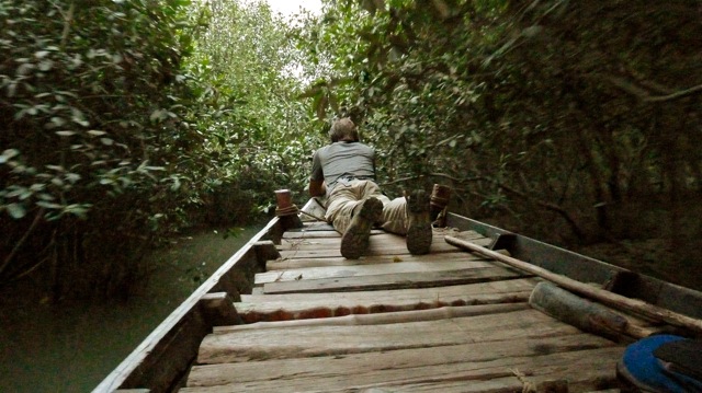
Doug Prose lays low at the prow of a small rowboat as he and his group navigate the dense mangrove forest of the Indian Sundarbans. Credit: Diane LaMacchia
Doug Prose, formerly a geologist with the U.S. Geological Survey, and his wife, Diane LaMacchia, have produced documentaries showcasing Earth and the geosciences through their nonprofit Earth Images Foundation since 1992. Recent films have included “Earth: The Inside Story” and “Italy’s Mystery Mountains,” both released in 2014 and aired on PBS. Currently at work on their next project, Prose is blogging for EARTH about the filmmaking process, as well as the work of the scientists they’re covering, while on location in India. Read other posts in this series here.
March 30, 2015
KOLKATA, India — Kolkata, known until 2001 as Calcutta — an anglicization from its days as a British colonial capital — was a comfortable 32 degrees Celsius (90 degrees Fahrenheit) when we arrived on March 27. The city is huge and bustling, with a population of about 4.5 million. Yet it’s also green with trees and parks. Originally home to several small villages, the area where the city sits was built up during British occupation into a metropolis of trade, culture and politics on the banks of the Hooghly River, a distributary of the revered Ganges River, or Ganga as it is commonly called here.
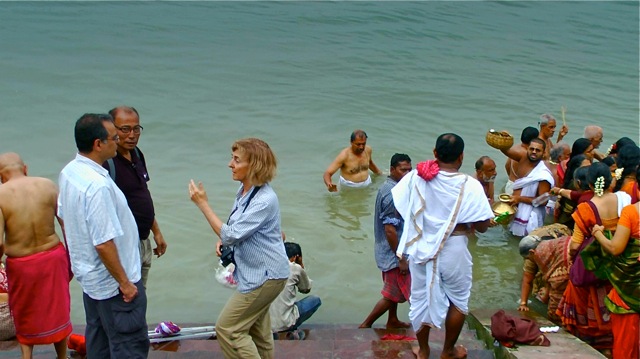
Diane LaMacchia speaks with Mike Steckler and Humayun Ahkter before shooting a scene along the Hooghly River in Kolkata. Credit: Doug Prose
Diane and I wanted to film Mike Steckler and Humayun Akhter on the Hooghly riverbank discussing the shifting geography of the Ganges, which runs 2,500 kilometers from the Himalayas to the Bay of Bengal, draining roughly one-fourth of India and supporting hundreds of millions of people in the fertile basin that surrounds it. The main branch of the Ganges actually occupied the river channel here in Kolkata until the late 1600s. It then changed course about 200 kilometers north of here, and since then has flowed into central Bangladesh, where it joins the Brahmaputra River for the final 150-kilometer stretch to the Bay of Bengal. Looking at a great river like this, it seems a permanent fixture on the landscape, but that’s not the case in the hyperactive Ganges-Brahmaputra river delta (GBD).
We found a great spot for an interview on a “ghat,” a series of steps leading down to the river, where people come to bathe, take walks and perform traditional burial rituals. Surprisingly, everyone we spoke to said they consider this river in Kolkata to be part of the Ganges, the holy river. There are even signs above the walkways that say “Ganga river walk.” “Once the Ganga, always the Ganga,” Mike noted. As he talked, there was a great deal of activity at the river’s edge — with locals wading into the water behind him — making the interview even more visually interesting than we could have hoped.
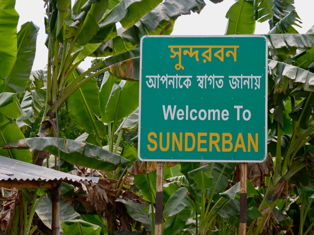
The Sundarbans comprise an enormous tidal mangrove forest along the Bay of Bengal southeast of Kolkata. Credit: Diane LaMacchia
From the banks of the Hooghly, we headed southeast to the Sundarbans, an enormous tidal mangrove forest and UNESCO World Heritage Site that straddles the border of Bangladesh and India. It was a three-hour journey of stop-and-go traffic (including a flat tire along the way) until we suddenly stopped on the side of the road, seemingly in the middle of nowhere. Our guide, A.J., hopped out of the car. “Grab all the bags and equipment, and let’s start walking,” he directed. “We’re going a few hundred meters to catch a ferry into the Sundarbans, and we’re late for the last boat of the day.”
We rushed to a boat packed with people and squeezed on for the chug across a river; I managed to set up the tripod in time to get a few shots of the riverbanks gliding by smoothly. On the other side, we hustled through a village to a line of motorized bicycles pulling little flatbeds — without shocks — jumping on for a spine-wrenching half-hour ride to yet another ferry stop and river crossing. Finally, we arrived at our “eco-lodge” at the forest’s edge. Utterly worn out, we were dropping our things into our rustic little cabin when A.J. popped in: “Come on!” he said. “We have just enough light for a short boat trip into the forest.”
Like zombies, we ambulated our way to a small rowboat. Slipping silently into a quiet channel hidden by mangroves, we quickly became human again as thousands of unseen birds found their voices, chirping loudly all around us. (Diane reached for the digital recorder and was able to capture some fabulous audio.) So clogged was the channel with the tangled roots and low-slung branches of mangroves that we had to lie down and let the boatman slowly push and pull us through in places. It was magical.
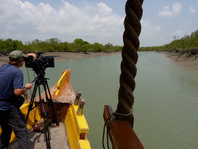
Prose films a river channel and its shorelines during a boat cruise in Sundarbans. Credit: Diane LaMacchia
The next morning we boarded a larger, motorized boat before sunrise for a cruise into the heart of the Sundarban Tiger Reserve. The reserve covers about 2,600 square kilometers within the larger Sundarban forest, and is thought to be home to roughly 300 Bengal tigers. After paying hefty fees to lug in our video cameras — photo cameras were free, curiously — we sailed into the reserve.
Peering intently into the trees, we all hoped to spot one of the highly endangered tigers living in the forest around us. Only a handful of sightings have occurred so far this year according to the postings we saw at the ranger station, so our prospects seemed dim. But to our surprise and pleasure, our guide was informed by cell phone about an hour into the cruise that a tiger had indeed been spotted by another boat a mere 20 minutes ahead of our position! All eyes were firmly glued to the left bank where the reported sighting had taken place. Alas, as we passed by, there was nothing ashore but the forest to greet us.
Despite our keen interest in spying a tiger — and disappointment at missing out on the opportunity — we hadn’t traveled here solely for that end, and there was plenty of fascinating nature to behold and scientific observations to make. Just before meeting up with us on this trip, Mike had spent two weeks sailing through the Sundarbans in Bangladesh, and he was eager to compare his study of sediment transport and tidal processes there with those occurring here in the Indian Sundarbans.
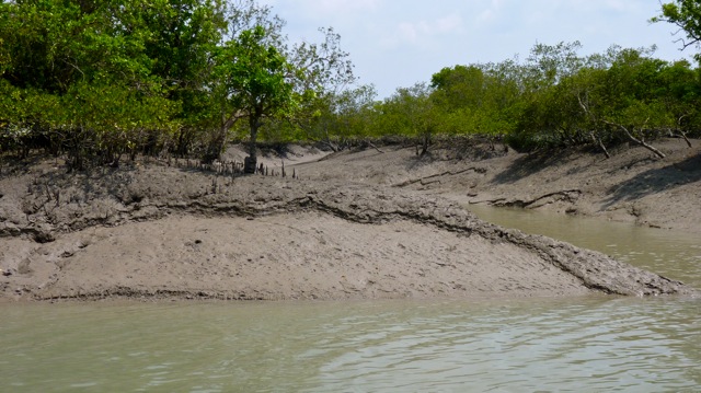
Erosion of the exposed riverbanks could be seen clearly at low tide. Credit: Diane LaMacchia
With the tide rushing out at a good clip, the water level beneath our boat had soon dropped an impressive 3 meters, leaving many side channels empty. Mike and Humayun were pleased because they could then collect observations of bank erosion. Sediment, they could tell, was being removed from this tidal zone faster than it was being replenished by new sediment washed down from the Himalaya Mountains by the Ganges and its distributaries.
Situated in a beautiful channel, we decided to interview Mike again, positioning him on the carved prow of the boat. He compared erosion and sedimentation in the Indian and Bangladeshi Sundarbans, having now seen both over the past few weeks, and noted how the Bangladesh side is receiving more sediment from the Ganges than it loses because it is much closer than Indian side to the main river channel. Ever since the Ganges River abandoned its former channel — leaving that to become the Hooghly River — the Indian Sundarbans have been losing ground and slowly subsiding. At the same time, global sea level is rising, compounding the rate of land loss and increasing the flooding hazard here.
Over in Bangladesh, on the other hand, these concerns are not nearly as severe. Mike, Humayun, and their colleagues, particularly Steven Goodbred and Carol Wilson of Vanderbilt University, are documenting how erosion, sedimentation and subsidence are staying approximately in balance in the Bangladeshi Sundarbans. However, to the north of the Sundarbans there have been massive efforts in the country in the last half century or so to build levees, called “polders,” and drain the land to increase agricultural production. This has had the unintended effect of cutting off sediment transport behind the levees, which has greatly increased subsidence and flooding hazards. Now, the scientists are for the first time collecting comprehensive data on the extremely dynamic processes at work here in the GBD, the world’s largest river delta. It is highly valuable information for land-use planning, as many millions of people call this ever-shifting landscape home.
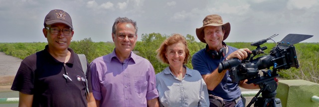
From left to right: Humayun Akhter, Mike Steckler, Diane LaMacchia and Doug Prose. Credit: courtesy of Diane LaMacchia and Doug Prose
At the conclusion of our amazing tour through the tiger reserve and the Sundarbans, the boat took us directly back to the dock near where we’d left our car after the drive from Kolkata. There had been no tiger sighting unfortunately, but Diane and I had gotten terrific footage of the undisturbed geologic setting, and of Mike and Humayun making their observations from the boat.
Returning to Kolkata, we whisked Mike — with his 23-kilogram share of rocks from Mizoram in tow — to the airport in time for his evening flight back to New York. Humayun left the following morning for Dhaka, and Diane and I departed that afternoon for one last location: the banks of the Ganges River (it’s time to film the real thing!) at one of the most important spiritual centers of India, the ancient city of Varanasi. I’ll write once more about our adventures there before we call the trip a “wrap” and head back to San Francisco.
© 2008-2021. All rights reserved. Any copying, redistribution or retransmission of any of the contents of this service without the expressed written permission of the American Geosciences Institute is expressly prohibited. Click here for all copyright requests.