
by Doug Prose Thursday, April 9, 2015
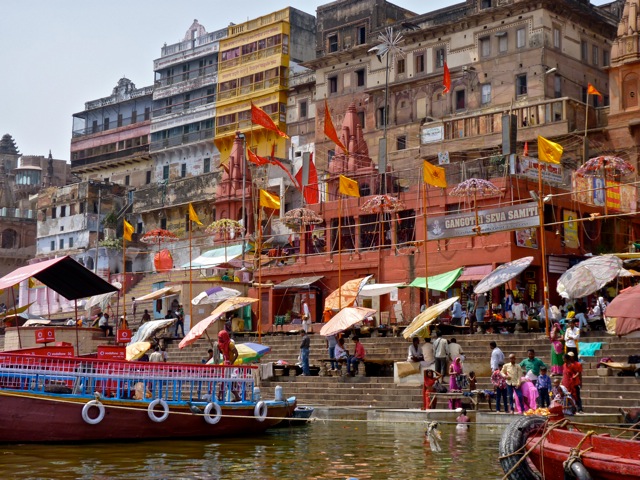
The colorful Indian city of Varanasi is considered sacred in Hindu religion and culture. Locals and pilgrims alike visit the famed ghats, or steps, along the banks of the Ganges in the city to partake of the river's revered waters. Credit: Diane LaMacchia
Doug Prose, formerly a geologist with the U.S. Geological Survey, and his wife, Diane LaMacchia, have produced documentaries showcasing Earth and the geosciences through their nonprofit Earth Images Foundation since 1992. Recent films have included “Earth: The Inside Story” and “Italy’s Mystery Mountains," both released in 2014 and aired on PBS. Currently at work on their next project, Prose is blogging for EARTH about the filmmaking process, as well as the work of the scientists they’re covering, while on location in India. Read other posts in this series here.
April 2, 2015
Nothing can prepare you for Varanasi. The airport, deceptively low-key and located in the countryside, gives little indication of the crowded, colorful menagerie just 16 kilometers away in the “old city.” But on our drive into town, the road became progressively more congested until we were embroiled in a massive traffic jam. Our driver beckoned to us to get out and follow four porters, who, as if by magic, appeared carside out of the surrounding chaos. Hoisting our heavy luggage and cases on their shoulders, they struck out on foot through a confined, two-meter-wide passageway packed with people, bicycles and cows. The porters moved forward effortlessly while we tried in vain to keep up, hesitating here and there to avoid being trampled or mowed down by bikes, and to gaze into the fascinating little shops lining the alley and selling everything imaginable. Half an hour later, sweating and frazzled, we tumbled through a nondescript door into our hotel’s cool, welcoming lobby. In our room at last, we stepped out onto the balcony and were greeted with a view of the Ganges. It was too dark to film, but the river — and myriad boats still plying its waters into the evening — was beautifully illuminated by a nearly full moon, and from the lights of the city. And, oh, what a river it is!
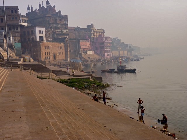
An early-morning view downstream along the Ganges. During the monsoon season when the river swells, these ghats are often under water. Credit: Diane LaMacchia
Varanasi, in the north Indian state of Uttar Pradesh, is one of the world’s oldest continuously inhabited cities, established on the northwest bank of the Ganges more than 3,000 years ago. This age attests to the stability of the mighty river’s channel at this location, roughly the halfway point in its 2,500-kilometer-run from the Himalaya Mountains to the Bay of Bengal in Bangladesh. Varanasi is situated on the Indo-Gangetic Plain at an elevation of 80 meters above sea level, high enough to escape the extensive flooding that occurs downstream where the river enters the low-lying delta. In Varanasi, the Ganges, the third largest river on Earth by volume behind the Amazon and Congo rivers, did not appear as wide as the Hooghly had in Kolkata, but this is the dry season; it swells to several times its present size during the monsoon period, flooding Varanasi’s network of riverside ghats.
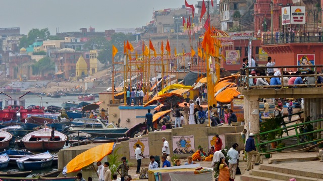
Varanasi is widely regarded as a sacred city, and the Ganges is the center of religious attention. Pilgrims come to its banks to bathe, wash clothes, pray and immerse deceased loved ones before cremating remains at one of the riverside “burning ghats.” Diane and I set out filming along the ghats early the next morning, and it has to be one of the most colorful, unique, vibrant urban scenes I have ever experienced. We let the camera absorb the scenes on film and enjoyed our many interactions with the warm and hospitable people we encountered. Diane arranged an impromptu ride aboard a rowboat, piloted by a man and his 12-year-old son, so we could shoot some footage of the shore from the river. The river current was quite strong, requiring the boatman to pull hard on his thick wooden oars going upriver while barely making headway. “Hard to row against the current?” I asked. Smiling widely, he replied, “Sure, but life is hard, so it’s no problem.”
The Ganges carries an astounding load of sediment eroded from the Himalaya Mountains to the Ganges-Brahmaputra river delta. Credit: Diane LaMacchia
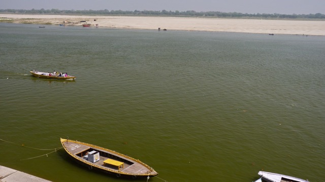
The river runs a muddy brown color, transporting enormous quantities of Himalayan sediments to the Ganges-Brahmaputra Delta. Mike Steckler’s group has measured the sediment load passing through the delta: It averages a staggering one billion tons per year, the highest annual yield of any river on Earth. A billion tons! That’s about the weight of 2,740 Empire State Buildings! This water, and the sediment supply, provides the basis of life — from farming and fishing to spiritual fulfillment — in this fertile region, which is home to 1,000 or more people per square kilometer in some places. No wonder this river is held in the highest regard by so many.
When our boat ride ended, we realized, somewhat to our dismay, that we’d filmed everything that we had set out to in India. Reluctantly, it was time to call this trip a “wrap.” We also had the first flight in our long journey back to San Francisco — leaving in a few short hours (yikes!) — to catch, and we still had to pack the equipment and make it through traffic back to the airport.
***
After wrapping up filming on their trip in Varanasi, it was back to the Bay Area for filmmakers Doug and Diane to begin post-production work on the project. Credit: Diane LaMacchia
Thankfully, we made it, and now we’re halfway home, staring out the window of a massive Airbus A-380 jet at the frozen white expanse of the Arctic Ocean about 11.5 kilometers below. (The flight tracker on my video screen shows us directly over the North Pole!) On the flight, I’ve been organizing the footage we collected on my laptop and logging scenes. We did well, capturing great scenics and crisp shots of our scientists working in key locations across the world’s largest and most active river delta, and among lithified sediments being swiftly thrust and folded by tectonic forces into the beautiful mountains of Mizoram at the northern tip of the Burma Arc.
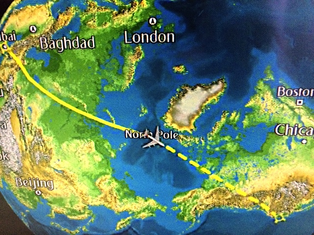
Flying over the North Pole! Credit: Diane LaMacchia
At dinner one evening back in Mizoram, Diane and I and the scientists sat around marveling at the superlative features and processes of the Ganges-Brahmaputra Delta region that result from the hidden collision of the Indian, Eurasian and Burma plates below: the formation of the Himalayas, Earth’s tallest mountains; the creation of Earth’s largest river delta, which receives more sediment annually than any other; the highest population density on the planet. I threw out one more to the group to see if it would fly: The most dangerous land on Earth. We debated the moniker for a while, and eventually agreed that because the Burma and Himalayan arcs — the sources of many devastating megaquakes and tsunamis in recorded history and before — are so seismically active, and because the crowded area is subject to frequent severe flooding, this is indeed Earth’s most dangerous, or risk-prone, region.
The risk is magnified by the fact that a large quake has not struck the most populous part of the area for decades, and infrastructure has been developed with little or no protection against seismic hazards. This situation deeply concerns the scientists with whom we’re working, and clearly stokes their determination to keep studying the area’s geologic and hydrologic hazards so that people here can be better-informed.
It also drives us. With the new footage collected on this trip added to material previously filmed in Bangladesh, Nepal and Mongolia that’s already “in the can,” our goal is to move on to the post-production phase of this project as soon as we return to home base in Oakland. Then we can complete the film and help spread the word about the astounding geology and critical hazards in this dynamic part of the world, as well as the science underway to learn more about each.
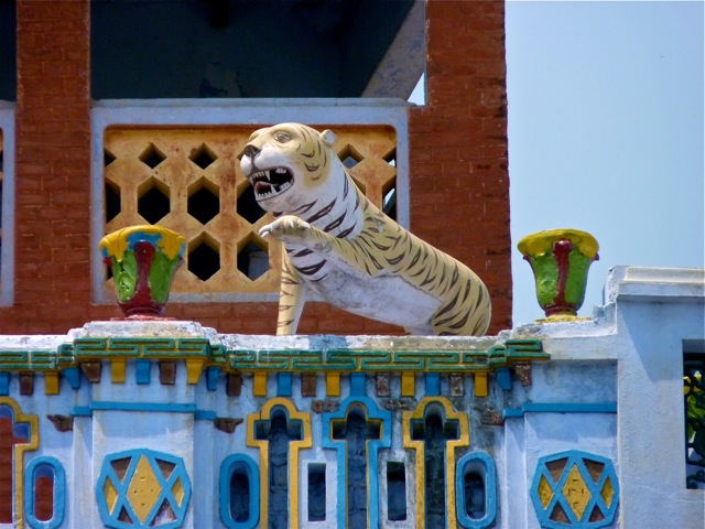
There is an analogy that keeps floating through my mind when I think of the place we just filmed. It’s the Bengal tiger. Its presence, mostly unseen, in the Ganges-Brahmaputra Delta is a source of deep pride and ancient reverence among local residents, and the tiger attracts many visitors from around the world hoping for a glimpse. No one, though, would want to face this animal without adequate defense. The delta is a lot like the tiger. The collisions of three great crustal plates hidden below its beautiful surface have built the surrounding mountains. The mountains, in turn, spur monsoon rains, which erode the uplifted rock and transport sediment to construct this fertile delta environment that has attracted so many inhabitants for millennia. Like the tiger, however, no one knowingly wants to encounter the perilous consequences of the plates’ collisions without being prepared.
© 2008-2021. All rights reserved. Any copying, redistribution or retransmission of any of the contents of this service without the expressed written permission of the American Geosciences Institute is expressly prohibited. Click here for all copyright requests.