
by David B. Williams Thursday, January 5, 2012
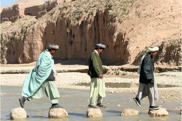
Locals cross a stream in Faryab Province in northern Afghanistan. Kristin Enstad
Fieldwork in Afghanistan is not like most geology fieldwork. “When I landed, the first thing I had to do was to put on a bulletproof vest,” says Tom Mack. He was part of a U.S. Geological Survey team that evaluated water resources in the Kabul Basin, in the north-central part of eastern Afghanistan, a couple of years ago. “It was strange to wear the vest, but eventually you get used to it.” There was a lot to get used to, he says. No matter where Mack went, he had to get special permission to be there. His team also always had to travel with a special security team in a reinforced vehicle mainly limited to the city of Kabul.
Working in collaboration with the Afghanistan Geological Survey and Ministry of Energy and Water, USGS began to study the Kabul Basin in 2004. Kabul, the capital of the country, sits at an elevation of 1,791 meters at the confluences of the Kabul River, Logar River and Paghman Stream. Roughly 3 million people live in the sprawling city. “Our goal was to develop a better understanding of how much water is available, how much is being used and what the quality is,” Mack says.
Despite the inflow from the three rivers, Kabul relies principally on groundwater for drinking and irrigation. With already limited water supplies, the basin’s residents have suffered as a result of a decade-long drought, when the Kabul River has stopped flowing during parts of the year. Also lurking on the horizon is global warming, which has shrunk many of the glaciers that provide water for these aquifers.
Further exacerbating the problem is long-running warfare in Afghanistan. First, the Soviets invaded in 1979, then civil war ensued, with the Taliban taking over in 1996, and then the United States moved in after 9/11. Military operations have ruined irrigation systems and dams, increased thefts of parts necessary for irrigation, reduced the number of people with in-country expertise and restricted access to experts studying water resources. Since 1980, all 18 of the country’s meteorological and hydrological stations have been destroyed. In addition, tens of thousands of refugees have fled from unsafe, drought-wracked areas to the water-starved Kabul Basin. All of these factors conspire to heighten not only concerns for future water availability but also for security in one of the harshest environments on Earth. But USGS and the U.S. military and coalition forces are working to more efficiently use the region’s water.
Geologically, Afghanistan consists of numerous crustal blocks that began to be sutured together between 100 million and 5 million years ago. Millions of years of continental collisions have created complex and varied geology, as well as topography. More than half the country is greater than 2,000 meters above sea level, with rugged mountains and high deserts with little vegetation accounting for much of the land, making the terrain difficult to impossible to pass through, says
John “Jack” Shroder, co-founder of the Afghanistan Studies Center at the University of Nebraska at Omaha, who has been working in Afghanistan on and off for 40 years. The highest summits are in the Hindu Kush, part of the Himalayas, which rise to nearly 7,500 meters.
Because of the ongoing continental collisions, Afghanistan is riddled with faults that produce strong earthquakes. Thanks to the topography and geology, the country also faces flooding events, severe soil degradation and desertification, and frequent severe droughts, which only intensify the use of its limited natural freshwater supplies. Snowfields and glaciers cover much of the higher mountain ranges, especially in the Hindu Kush, and provide 80 percent of the country’s water resources.
Three great river systems run throughout the country: the Amu Darya River in the north, the Helmand River in the southwest and the Kabul River in the east. The water in these rivers comes primarily from runoff from snow and glacial melt in the high mountains. After dropping from the peaks, rivers flow into valleys and desert plains that surround the centrally located mountains. Some rivers continue into surrounding countries, such as Iran, Pakistan and Tajikistan, creating a potentially volatile water situation, Shroder notes.
Afghanistan also has a sizable supply of groundwater in many of the desert basins, including the Kabul Basin. Groundwater sits beneath the surface at depths ranging from about 1.5 to 68 meters. The groundwater is exploitable, even at those depths, and the Afghans have been using these resources for millennia.
For more than 3,000 years, Afghans have relied on an ancient system of hand dug, horizontal tunnels known as karez, for important sources of water. After digging down into the alluvial fans at the base of the mountains, the Afghans then dug out the horizontal tunnels that carry groundwater gently downslope from the alluvial fans to basins hundreds to thousands of meters away, where the water emerges laterally outward. Length and depth of the tunnels depend upon the amount of seasonal rainfall, with wetter areas generally having shorter, shallower “mother wells.”
In a 2002 study, Asad Sarwar Qureshi, acting director of the International Water Management Institute’s Pakistan office, found 6,741 karez systems in Afghanistan. These tunnel systems discharged at a rate of between 10 and 200 liters per second and irrigated 163,000 hectares, primarily in the south and southwest parts of Afghanistan. “Karez irrigation is environmentally benign because only the waters at the top of the water table are tapped, whereas borehole wells with pumps use much larger amounts of water and can over-exploit the resource,” Shroder says. Furthermore, he adds, in such an arid country, a subterranean system like the karez can significantly reduce water loss through evaporation.
However, although they have lasted millennia, by 2008 some 60 to 70 percent of the karez systems were “not in use, out of order, dried-up or with only low discharge due to drought conditions in recent years, low precipitation and consequently low groundwater discharge,” a report in the journal Water International noted last September. And now most of the country’s irrigation is done through open-water canals, which are much less water-efficient.
Afghanistan has been in a deep drought since 1997, and the inefficient use of water for irrigation is exacerbating the problem. This includes evapotranspiration, leakage and overwatering of crops. Since 1980, the total acreage under irrigation has dropped in half with a subsequent national food deficit of 30 percent, according to Qureshi’s 2002 paper.
One of the few benefits of drought has been a reduction in opium poppy production. Suppressed during the reign of the Taliban, poppy cultivation exploded again after the U.S. military moved in in 2001, with Afghanistan becoming the world’s largest producer of opium. After the U.S. and coalition forces arrived in Afghanistan, the Taliban did an about-face and began to support opium production, finding that it was not only a source of money but also a useful recruitment tool. Whenever outside forces destroy a field of poppies, the Taliban “offers” to protect the crop in the future in return for control in the area — thereby gaining a new recruit or at least a supporter. But this tactic may not withstand the lingering drought: An annual United Nations assessment of Afghan poppy cultivation reports a 19 percent drop in total poppy acreage in 2008 from the peak in 2007, and predicts further reduction in 2009.
Of course, this drought also ruins other crops, including fruit and nuts, and with only 12 percent of the land even remotely arable, that does not portend an auspicious future.
Warming will not help matters either. At the fall meeting of the American Geophysical Union last December in San Francisco, Calif., Shroder described a study of 30 randomly chosen glaciers in the Great Pamir, in the country’s northeast corner. Working with the Global Land Ice Measurements from Space program (which involves 60 institutions worldwide, from government agencies to universities), he found that 28 of the glaciers retreated from 1976 to 2003, with the largest retreat rate of 36 meters per year. What Shroder and others have not determined, however, is exactly how much water is coming out of the streams. The country is too dangerous to put people on the ground checking discharge, he says, so researchers rely on less-detailed technology such as satellite data and aerial photography.
Aerial photography shows that tributary glaciers have separated from main glaciers, high-altitude lakes have formed, and proglacial lakes (formed by a retreating glacier) have increased in size and frequency. Even without the hard data, Shroder says, climate change means reduced water availability for irrigation. In particular, less glacial ice, smaller snowpacks and more precipitation falling as rain than snow results in two problems: Spring melt comes earlier and less water is available in summer to supply late season crops.
Dams and diversions further reduce the water available for drinking or irrigation — and this is becoming a more pressing issue. “The water treaties with surrounding governments have not been renewed since the 1930s,” Shroder says. “They need to be renegotiated because if the Afghans want dams — and they do for irrigation and power generation — the countries around them will freak out.”
Tensions are already high. In May 2008, Shroder says, an unidentified group of Iranians crossed into southwestern Afghanistan and bulldozed a diversion of the Helmand River to their benefit. Nobody responded because no American troops were present, and the Afghans didn’t want a fight that could escalate, Shroder says. The story did not appear in the news.
Any increased exploitation and consumptive use of these precious water resources inside Afghanistan could “be a destabilizing influence” due to the age of the cross-border water treaties, Shroder says. Such issues need to be renegotiated before serious development can be undertaken in Afghanistan. That necessitates a strong and sovereign functioning national government.
Of course, Afghans aren’t the only ones relying on the country’s water supply right now. When the United States invaded Afghanistan following 9/11, the military moved in and set up camp throughout the country. “The military needs water,” Shroder notes, so at their bases and camps, “the U.S. Army Corps of Engineers pops a well down and pumps out water, which is clean and good.” The problem arises when the military pumps water indiscriminately — “without too much thought” about possible adverse effects on a nearby karez, which might be supplying water to local villages, he says. In a few short weeks, such a well can suck a karez dry. “And if you screw up the karez, you make more enemies.”
Although U.S. forces may not have considered potential impacts on water supplies during the early days of the war, by 2005 that was no longer the case, says Major Christopher Gellasch, a U.S. Army Environmental Science Officer who was deployed in Afghanistan from April 2005 to April 2006 as the commander of the 71st Medical Detachment (Preventive Medicine). A geologist by training, Gellasch’s duties included water sampling missions and water well evaluations for U.S. and coalition forces.
“The military knows it’s going to be in Afghanistan for a while, so we understand that we have to take care of water resources,” Gellasch says. But the military faces difficult challenges. The rugged terrain makes water acquisition challenging, and there is little to no infrastructure, such as water treatment plants and treated water distribution systems. Furthermore, each military base supports between 100 and 10,000 people. That means a lot of water is needed — somewhere between 50 and 120 liters per day per soldier, depending on the level of infrastructure, he says.
Because of concerns about contamination and availability, U.S. and coalition forces use well water primarily for nondrinking purposes, such as personal hygiene and laundry, Gellasch says. For drinking water, the military relies on bottled water. To supply the rest of the water necessary for the bases, however, the military is trying to get a better sense of the overall water situation.
Not surprisingly, Gellasch says, the U.S. and coalition forces generally lack a detailed understanding of local geologic conditions at U.S. forward operating bases (FOBs), which are smaller bases (100 to 1,000 troops) used to support tactical operations without setting up full support systems. When Gellasch and others in preventive medicine tried to bring in military well-drilling crews, they discovered that none were available to be deployed in Afghanistan. Furthermore, unfortunately, many of the local drillers, even those who have been working in the region for years, have a more limited understanding of the water situation than might be hoped — meaning they may know where to drill but not how that water source connects to other sources in the region — and there are few details on where old, existing wells may be located, virtually no records of any water testing of any recent (or old) wells, and no well log data.
So even though the military is working with locals, they may not seal well heads or properly case and screen wells. As a result, FOBs often end up with poorly built wells, which has regularly led to coliform bacteria contamination from nearby sanitation sources, at least according to the many tests Gellasch and his colleagues have run. This is easily treated by chlorination, he adds.
The groundwater itself tends to be of high quality, Gellasch says. One advantage of working in a country with little industry is a lack of industrial contaminants seeping into groundwater, he says. The local geology has left the groundwater with what appear to be minor amounts of boron, arsenic and sodium, but most concentrations are not high enough to cause adverse health effects. Furthermore, such contaminants are easily treated with water treatment programs, such as using reverse osmosis.
In the eight years that U.S. and coalition forces have been in Afghanistan, many issues have begun to change, Gellasch says. In particular, more advance planning is taking place. Specialists are now able to go in and conduct site assessments to determine what environmental needs should be addressed. These include water and sanitation issues, as well as checking for potential disease vectors such as mosquitoes and sand fleas.
Drought or no drought, “water is absolutely critical to peace in Afghanistan,” Shroder says. “Thirsty, starving people are very dangerous people, and we haven’t always been smart in Afghanistan.”
There is good news, though, he says. “The huge groundwater resources have not been properly exploited.” Asad Sarwar Qureshi estimated in 2002 that annual per capita water availability in Afghanistan is 2,500 cubic meters, as compared to 1,400 cubic meters for Iran and 1,200 cubic meters for Pakistan. At present, Afghans use only around 1,700 cubic meters per person each year. So there is enough water for the residents. Additionally, what is there is of generally high quality. However, much more information is needed, Shroder says.
Tom Mack and his USGS co-workers plan to publish the results of their study of the Kabul Basin’s water supplies sometime this year. The amount of water varies widely across the basin, as does recharge, so that some areas have plenty of water and others have little. For example, they found that recharge was very low at a refugee camp north of Kabul. “We hope that our data can lead to better management decisions,” Mack says. He adds that one problem throughout the valley was fecal contamination of water, due to poorly built wells and bad sanitation.
Mack and his colleague Ingrid Verstraeten, who works in the International Water Resources Branch of USGS, say USGS is determined to help Afghan scientists and resource managers be more self-sufficient and manage their own resources sustainably. “We want to empower our Afghan colleagues to make sound, informed science-based decisions on sustainable use of their water resources,” Verstraeten says. USGS employees have shown the Afghans how to use updated computers and software and how to collect water data. “I feel we have moved forward quite significantly in the last few years,” Verstraeten says.
Signs point to additional funding from the United States, Verstraeten says. Furthermore, U.S. President Barack Obama said during a recent speech at the State Department that he was emphasizing “soft policies,” such as science, to help drive decision-making regarding Afghanistan.
“If we — the U.S. and international community — curtail terrorism, we will have an increased opportunity to aid our Afghan colleagues in a very positive manner and lead them to a prosperous future,” Mack says. “Afghanistan is blessed with lots of natural resources, including water. If we can build capacity for the sustainable and wise use of these natural resources, we will move Afghanistan toward a prosperous future.” And a prosperous future for Afghanistan bodes well for a secure future.
© 2008-2021. All rights reserved. Any copying, redistribution or retransmission of any of the contents of this service without the expressed written permission of the American Geosciences Institute is expressly prohibited. Click here for all copyright requests.