
by Kathryn Hansen Tuesday, January 13, 2015
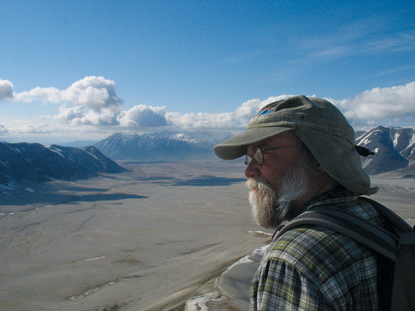
Volcanologist John Eichelberger, coordinator of the U.S. Geological Survey (USGS) Volcano Hazards Program, will become dean of the graduate school at the University of Alaska at Fairbanks this fall. Credit: Courtesy of John Eichelberger.
The 2010 eruption of Iceland’s Eyjafjallajökull showed that volcanic hazards are blind to international borders. After the eruption ended and air traffic returned to normal, discussion among the public of “ash” and “jet turbine blades” cooled. Not so for volcanologist John Eichelberger, who, as the U.S. Geological Survey (USGS) Volcano Hazards Program Coordinator, deals with volcanic hazards daily, while working to improve monitoring of the United States’ many dangerous volcanoes and to internationalize research and risk reduction.
While at the University of Alaska at Fairbanks in the 1990s and 2000s, Eichelberger recognized the benefit of international collaboration and established the International Volcanological Field School. This fall, Eichelberger returns to the University of Alaska as dean of the graduate school, where he hopes to continue inspiring the next generation of students. EARTH’s former associate editor Kathryn Hansen chatted with Eichelberger about the changing landscape of volcano monitoring and hazard risk reduction.
KH: How did you catch the volcano bug?
JE: When I was a kid, I was interested in chemistry because my father was a chemist, but then I got interested in hiking and mountains and I discovered that geology could be chemistry outdoors. Volcanoes are the most exciting part of geology, in my view. Many geologic processes are rather slow, but volcanism is not, and volcanoes provide a lot of information about what’s going on inside the planet. In fact, it’s remaking the planet.
KH: Early in your career you worked on research drilling projects. What can drilling tell us about volcanoes?
JE: I got into drilling into volcanoes when I was at Sandia National Laboratories in New Mexico. There had been much discovered by drilling in the ocean basins, an effort that led to the full development of plate tectonic theory. People began to talk about how we didn’t know much about the continents except in places where there are oil or mineral deposits, [and that discussion led] to the start of the U.S. Continental Scientific Drilling Program. The U.S. program was also motivated, like going to the moon, by what the Russians were doing — drilling the deepest hole ever drilled. At the time the drilling program got going, there was talk of a “super deep” hole in the Appalachians, but when the huge funding required did not materialize, the discussion turned to modest projects under several themes. One was volcanic activity, and I got interested in that because we had a poor, cartoon-like view of what really goes on inside active volcanoes. I was involved with drilling into a lava lake in Hawaii. … We learned how the magma crystallizes and how fast — basically, the first glimpse of how a magma chamber might work.
Then we looked at a young rhyolite volcano in California, on the other end of the chemical spectrum from the one in Hawaii. There we actually went in underneath the vent and intersected the conduit, the pipe that everyone draws when they draw a cartoon of the volcano. We went right through it and got a complete sample. We found that this chain of volcanoes, Inyo Domes, was fed by a sheet of magma, a dike, and not by a line of pipes. Magma rose toward the surface, and only when it got close did it break up into fingers that punched through to the surface.
Then I went for bigger game, to drill the youngest rhyolite volcano in the world, in Alaska. At the end of a laborious permitting process we failed to get permission to drill, but that took me to Alaska and its university in Fairbanks.
KH: How did you make the shift from drilling to hazard monitoring?
JE: At about the time the Katmai Scientific Drilling Project was dying, the monitoring of volcanoes in Alaska was growing, largely because of [Alaska] Senator Ted Stevens’ interest in aviation safety. It was about that time that we realized that volcanic ash clouds were a serious threat to modern aircraft. The big thing that precipitated attention to monitoring volcanoes in Alaska was the encounter of a passenger 747 with an ash cloud over Alaska from Mount Redoubt on December 15, 1989. All four engines went out and the plane fell [more than 5,000 meters] before the pilot restarted two engines and landed in Anchorage. That got USGS, the University of Alaska at Fairbanks and the Alaska Division of Geological and Geophysical Surveys together to form the Alaska Volcano Observatory. Senator Stevens had a lot of seniority and was able to direct a good deal of funding that way. Eventually, we ended up putting monitoring networks on 33 of the volcanoes.
The cool thing was monitoring all these active volcanoes and finding out what was really going on. Of course, I’d love to drill some of them, but we can learn a great deal from seismic instruments, GPS, and other observations. It was a very exciting time … There were many eruptions and near eruptions, and we also realized a lot of the ash was coming from Russia, from the Kamchatka Peninsula.
KH: Did that lead to your work with Russia?
JE: Kamchatka had been completely closed as a military security area. It was even not so easy for Russians to go there. But with the breakup of the Soviet Union, everything opened up and American scientists started going over there. The Russians had long been monitoring the volcanoes for scientific reasons, but they weren’t tied into communicating ash hazards to aviation. USGS volcanologists in Anchorage began working with Russian scientists on developing a Kamchatka counterpart to the Alaska Volcano Observatory for providing eruption warnings.
I became fascinated with Kamchatka — the people and the volcanoes — and we realized that we were in the same boat, a long way away from our national capitals and [officials’] attention when dealing with these huge eruptions and earthquakes. So, we thought we should get together, and with colleagues in Russia and northern Japan, we set up the Japan-Kamchatka-Alaska Subduction Processes working group, with meetings biennially in Petropavlovsk-Kamchatsky, Sapporo, and Fairbanks. One action the group took was for the Kamchatka and Alaska universities to establish the International Volcanological Field School, which my colleague and former student Pavel Izbekov and I have led ever since. I’d have to say that probably the most rewarding thing I’ve done in my career is to take American students to the Russian Far East and Russian students to Alaska to work together in the field.
KH: What do you think are the next steps toward reducing risk?
JE: I’m working right now [at USGS] on a government-to-government geohazards workshop to identify joint activities in disaster risk reduction that we can undertake in Kamchatka and Alaska. There’s a lot more to be done. Geophysically, [these areas are] about the most dangerous places in the world.
We can increase the exchange of real-time monitoring data, extend the amount of monitoring going on, and really take a big picture look at the big disasters, such as the Kamchatka Peninsula’s 1952 earthquake and tsunami and Alaska’s 1964 earthquake and tsunami. We can exchange experiences, develop best practices, and improve our ability to deal with these disasters. When there is a disaster in that shared region, the U.S. and Russia will need to work together.
On a more global scale, we got together with our Italian counterparts to hold a Volcano Observatory Best Practices meeting last year in Sicily. Observatory scientists from 27 countries attended, and we exchanged lessons of what works and what doesn’t in forecasting volcanic eruptions. I am hopeful that this kind of worldwide networking among volcano observatories will continue.
KH: What do you think are the biggest challenges in your job?
JE: It’s mainly a matter of trying to move the national program of volcano monitoring and disaster risk forward. It’s a big ship and there are always budget worries. Because we’re in hazards, it’s not a hard sell to the president or Congress on the importance of what we do. Nevertheless, there are limited resources. There’s not a whole lot of new money going into natural hazard risk reduction until there’s some kind of calamity; then sometimes there is more money than you can deal with, then it fades away. In a way, the money comes after you need it but you just have to change your thinking and figure that money is for the next crisis, and so the program is built up incrementally.
One of the other things I’ve been reflecting on is that in both the cases of the Japan earthquake/tsunami [in March 2011] and Icelandic eruption [in 2010], the responses were too driven by theory and models and not enough by simple observations. It was almost like we’ve gotten too smart for ourselves. In Europe, there was heavy reliance on ash dispersion models rather than simpler observations from satellites and from sampling of where the ash was. This was out of caution and because procedures hadn’t been worked out, but nevertheless, that’s what caused so much trouble. Then in Japan, the problem was the expectation of a magnitude-7.0 event [not the 9.0 event that occurred] based on earthquake theory, despite good geologic evidence of much bigger, huge [earthquakes and] tsunamis in the past. Both cases support a proper re-evaluation of where we’re headed and how we combine different types of information to end up with an appropriate response.
KH: Given infinite funding, what would you like to see happen in your field?
JE: Besides continuing to improve our monitoring systems, I guess a big thing would be the ability to hire more young people, because we’re getting pretty old as a group. And along with that, the ability to engage more partners, universities and state geological surveys that are neighbors of the federal observatories. I think that strengthens what the observatories do and ties them better to their communities. Also, one thing that doesn’t cost very much, but just requires awareness, is continuing to grow the international connections. There are wonderful things being developed all over the world and lessons we must learn from other countries’ experiences.
KH: Do you have a favorite volcano?
JE: Katmai, in Alaska. That’s where I teach the Alaska part of the field school. In fact, the 100th anniversary of the eruption was on June 6, and I took students in there as I have been doing every year for ages. It was the biggest eruption of the 20th century, about the size of Krakatau. It’s a serious adventure: 10 days long and we carry all of our food and everything in to some very primitive huts. From there we do day hikes to the caldera that formed in 1912 and to other incredible volcanic features.
KH: What do you hope to achieve upon your return to the University of Alaska?
JE: I am going back there this fall to become dean of the graduate school. I’ve enjoyed working for the government very much and learned a lot, but it will be nice to have students around again. They keep you young and remind you why you got excited about all this stuff in the first place. I intend to do everything I can to provide new opportunities for graduate students that will broaden their perspectives without slowing them down, which is what I feel my opportunities have done for me.
© 2008-2021. All rights reserved. Any copying, redistribution or retransmission of any of the contents of this service without the expressed written permission of the American Geosciences Institute is expressly prohibited. Click here for all copyright requests.