by Brian Fisher Johnson Wednesday, May 23, 2018

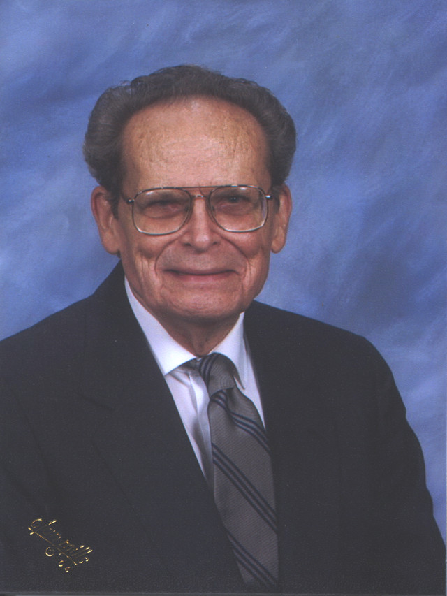
Maurice Terman. Credit: Courtesy of Maurice Terman
A general wants to advance his army of tanks, but doesn’t know if the terrain he plans to cross will allow it. Tanks can’t go up steep slopes, for instance. And they can’t knock down large trees or traverse soft ground like peat bogs. That’s where military geologists come in — earth scientists who scope out the terrain to determine its suitability for different types of movement and construction.
Recently EARTH reporter Brian Fisher Johnson chatted with Maurice J. “Ric” Terman, an emeritus geologist with the U.S. Geological Survey in Reston, Va., for a firsthand account of his career in the Military Geology Branch of USGS from 1951 to 1974.
BFJ: What kind of work did you do?
RT: At the USGS, most of our work was triggered by the Army Corps of Engineers. We covered the engineering geology aspects of all types of construction — whether it be an airfield or a tunnel. So essentially, military geology is the overall evaluation of terrain for man’s use. It’s just usually funded by the military because in times of stress, they are the people who suddenly have the largest need.
BFJ: What are some examples?
RT: The Strategic Studies Section was where a lot of us initiated our action in military geology. For instance, I was on a team that spent more than a year looking over all the source material available on Spain, trying to put together a complete geological analysis and its impact on military operations. We analyzed landforms, vegetation, surface drainage, and natural materials. … Then there was the Pacific Field Program. I was on a team that spent a year reporting on Pagan Island in the western Pacific … Then there was the European Field Program. Occupied five years of my life [1957 to 1962] but it was fascinating.
BFJ: Tell me more about that.
RT: My principal responsibility was to complete a series of maps for West Germany. But we also served as consultants to the U.S. Army Europe headquarters. Here’s a kind of silly story that represents how we could help answer specific problems: A general was complaining about how his bowling game was off. He was blaming the alley for his lousy scores. One thing led to another and the request came up for one of us to come down and look at the bowling alley. It turned out that it was built on Jurassic clay beds, and after a particularly dry season that summer, the clay was desiccated and the building was tilted. The general was absolutely right! So we installed several water measuring devices in the surrounding area and every time the clay got too dry, the alley’s overhanging roof, which had shower heads built in it, would come on and keep the ground at a certain moisture level. No more desiccation, no more tilting of the bowling alley. I usually got fruit baskets at Christmas after that.
BFJ: Our military budget at work.
RT: [Laughs] Right … Then there was the Nuclear Test Detection Program. The United States had been looking at signals of explosions from nuclear test sites and comparing them to seismic signals from earthquakes. The Department of Defense could decipher these things pretty easily here. But they were confused when they got something from halfway around the globe because the waves have to go through several major interfaces in the crust or mantle before they arrive here. So they asked us if we could do a crustal analysis of Russia and China to gain an understanding of where the major interfaces occurred. I spent three years with a team doing a tectonic analysis of China and Mongolia in the mid-‘60s. We probably went through 1,500 different documents that were available in Washington. After that, I think they felt they could not only identify a lot more explosions, but get some idea of the yield of the devices that the Chinese were testing.
In the last several years with the branch, I also contributed to the Special Intelligence Element. Most of that work is fairly classified.
BFJ: Were you ever in a dangerous situation?
RT: I wasn’t often in dangerous territory. I was a data collector and analyst. Pagan Island was an interesting exercise though. We had taken a radio trailer and were told that “The weather plane flies over about 4 o’clock every afternoon and if you ever have any needs, get on the radio.” On one occasion, we called desperately because one guy’s boots had been chewed up by fresh volcanic rock. We radioed out, “Help! Help! Help! We’ve got to have six pairs of boots and three cases of beer!” Sure enough, they came a couple of days later and dropped both. That’s the closest I ever came to danger.
BFJ: If you could watch one military leader use your work, who would that be?
RT: I’m told that I wouldn’t have admired the man in many ways, but the guy who would really utilize this type of terrain analysis to its best advantage was [U.S. Army General] Douglas MacArthur. He wasn’t a man I’d treasure as a friend, but he was a quick learner, and he never repeated a mistake. If you gave him data like this, he would use it properly.
© 2008-2021. All rights reserved. Any copying, redistribution or retransmission of any of the contents of this service without the expressed written permission of the American Geosciences Institute is expressly prohibited. Click here for all copyright requests.