
by Matthew DeMeritt Monday, January 26, 2015
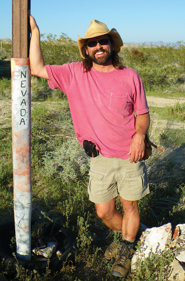
Kyle House. Credit: Courtesy of Kyle House.
Kyle House, a research geologist for the U.S. Geological Survey’s (USGS) Geology and Geophysics Science Center in Flagstaff, Ariz., gravitated to scenery at a young age when he moved from Oklahoma to western Washington and beheld the Cascade Range for the first time. He learned that rocks and landscapes can tell fascinating stories, and he developed a passion for explaining the events that shape them. While earning degrees in the geosciences, he became attuned to the value of collaboration. Any scientist working in isolation can tell only an incomplete version of a phenomenon or event, he says.
Last year, House volunteered as a parent chaperone for his kids’ school rafting trip through the famous San Juan River “goosenecks.” As the sole geologist on the trip, House enjoyed responding to the children’s vocalized wonder at the landscape by telling them how the structures formed. The majestic landscape, combined with House’s ability to explain how it took shape, had an explanatory power that mere words did not.
To House, a dynamic geologic map can have the same impact on his adult colleagues as that serpentine scenery had on the kids. As a research geologist, House relies on digital cartography to build sophisticated maps to better convey new findings to his colleagues. He holds a strong conviction that the best maps contain information from a variety of authoritative sources and sees great potential in collaborative mapping as a means of revealing geologic knowledge in a more efficient way.
House used this collaborative approach in the recently completed Nevada Digital Dirt Mapping Project (ND2MP), funded by the Clark County (Nevada) Desert Conservation program, the University of Nevada and the Nevada Bureau of Mines and Geology. ND2MP pooled a team of GIS-experienced geologists to collaboratively create the most accurate and complete surficial geologic map of Clark County, Nevada, to date. The project was a prototype for the geologic mapping of the entire state of Nevada.
House has been mapping for years. In fact, he once mapped floods around Reno using beer cans. Now, he relies more on higher tech tools for mapping. House talked to EARTH magazine contributor Matthew DeMeritt about the value of his latest mapping effort, the ND2MP, and the value of collaborative GIS in mapping, as well as his hopes for future mapping projects.
MD: You recently completed the Nevada Digital Dirt Mapping Project, which was based on a collaborative GIS methodology. Can you explain how that project started and why you opted for that approach?
KH: It was a prototype for the state — a surficial geologic map covering 20,000 square kilometers [of Clark County]. This was in 2009, when I was a research geologist at the University of Nevada. The goal was to ultimately build 14 layers into the map for people to perform analysis of the relationship of plant communities to geology and elevation [as well as other things]. That’s obviously a huge area and a large undertaking.
Existing maps didn’t have consistent coverage of the whole county. Plus, we were supporting a larger ecosystem-oriented project that included a layer of surficial geology — particularly the sedimentary deposits at the bases of mountains and along the rivers and desert valleys where the vast majority of the plants of interest grow.
We had a remarkably compressed timeline to complete such a large map, and so we were faced with sort of a new kind of a problem, and it needed a good solution. Obviously, the best way to deal with a map that large was to assemble and train a competent team to do various tasks related to developing such a product, not just the geologic interpretation but also the GIS work, the topological cleanup and layout, and so on. But that wasn’t possible.
When I attended the Esri User Conference a couple of years ago, I learned about collaborative, multi-editor GIS, and that it was implemented quite commonly in similar situations — not necessarily geological ones, but situations that needed a lot of data to be collected and maintained by a relatively large group. It was immediately obvious that the only way we could get our map finished [by the deadline] was to use this collaborative implementation of GIS.
From start to finish, it took only a year and a half, which is a remarkably fast turnaround for a map even a fraction of that size.
MD: How many were on the team?
KH: We had as many as 18 people at a single time editing that map and had to partition the [team] to prevent as much overlap as possible. Dealing with conflicts and redundancies in a map that large is really not ideal because it can waste a lot of effort and time, and so we had to develop our own set of protocols. At the very least, we needed GIS and a database administrator who really understood how digital maps are created to ensure efficient management and allocation of all this information.
MD: So GIS was the best framework to execute the project?
KH: It was absolutely the only framework to collaborate on this scale. There was no other way to do it. If you consider ways that multi-authored hard-copy geologic maps have been created over the years — how much of a tortuous, complicated, iterative process it is — you begin to see GIS is the only framework to get the ball rolling on a mapping project and maintain a consistent quality of output. The underlying concept is fundamental to the efficient and rapid delivery of good maps.
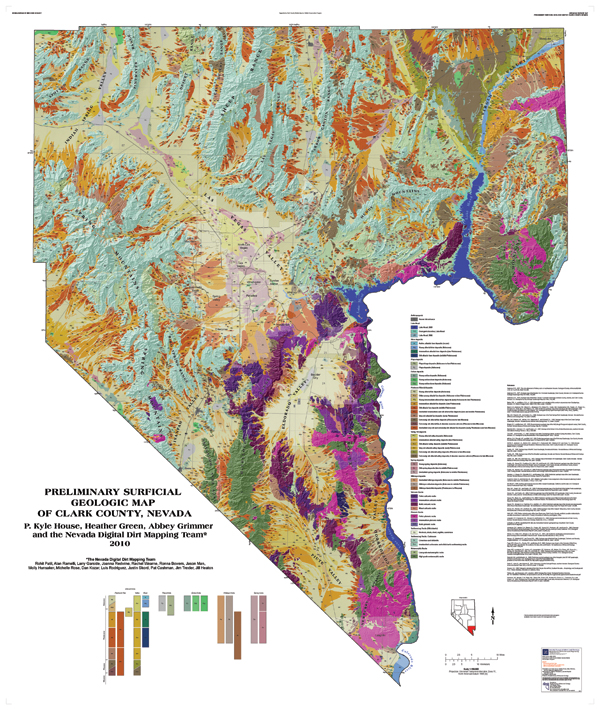
The fruits of the Nevada Digital Dirt Mapping Project — the most comprehensive surficial geologic map of Clark County, Nevada, to date. Credit:ND2MP.
MD: Since the completion of the Nevada Digital Dirt Map, you’ve become a strong advocate of combining authoritative data to produce better products.
KH: Yes. I’ve been using GIS to make geological maps for over a decade, but this is my first official foray into the real-time collaborative approach. It felt right and proved successful because the roles were well defined. Also, the technology is finally in place to allow a team to work on the same map, communicate in a centralized area, and improve the product together. I call it vetted crowd-sourcing, where you make sure the crowd you’re resourcing from is actually qualified to contribute the data, first and foremost, or to edit the data, and is familiar with the types of interpretive conclusions you can draw from different types of imagery.
If all that is in place, the scale of the map or size of the team really doesn’t matter. Just to be able to contribute and collaborate in real time, and see a map’s particular state at any given time, is a huge step up from borrowing a database on a thumb drive or looking at somebody’s scan in an email. That’s just incredibly inefficient, and, unfortunately, it’s still the way I see that many geologic maps are being made.
MD: I’ve heard you like to goad the “geo-luddites” in your field to use these tools.
KH: Yes, I do, but in a playful way. I’m self-sufficient and self-taught in using GIS for generating geological maps, and now the tools are even more capable and more user-friendly than ever, so there’s really no excuse not to investigate the new technology — especially if you want to advance your field and convey the importance of new discoveries. I have always been fascinated by maps and have managed to make a career out of making them in the field and in the office.
© 2008-2021. All rights reserved. Any copying, redistribution or retransmission of any of the contents of this service without the expressed written permission of the American Geosciences Institute is expressly prohibited. Click here for all copyright requests.