
by Harvey Leifert Wednesday, January 14, 2015
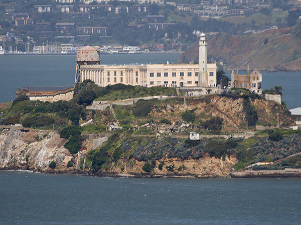
The former Alcatraz Federal Penitentiary on Alcatraz Island in San Francisco Bay. Credit: Jon Sullivan, public domain
Twenty-first century science is shedding new light on a 53-year-old mystery involving one of the country’s most notorious prisons: Did three convicted bank robbers survive their escape attempt from Alcatraz Island? New results, presented at the American Geophysical Union’s (AGU) annual meeting in San Francisco last December, suggest there’s a chance they did.
What is known about the caper is that three inmates — brothers Clarence and John Anglin, along with Frank Morris — dug their way out of the supposedly escape-proof federal penitentiary, located in San Francisco Bay, on the night of June 11, 1962. Leaving realistic-looking heads sculpted from papier maché, complete with real hair, in their bunks as dummies, the convicts made their way to the shoreline with a makeshift raft assembled mostly from several dozen rubber raincoats. They slipped off the island into dense fog and were never seen or heard from again.
Remnants of the raft, along with a paddle and a plastic bag containing personal items, later washed up on or near Angel Island, north of Alcatraz. In the ensuing investigation, the FBI enlisted the aid of the U.S. Army Corps of Engineers, which operated a large, physical scale model of the bay that could simulate its tides and currents. The FBI wanted to know which way a drifting raft would be carried at the presumed time of the escape, about 10 p.m. All indications from the Corps’ modeling were that at this time a raft would have been swept through the Golden Gate into the Pacific Ocean, and that the escapees likely would have drowned.
Fast forward to 2014, when researcher Olivier Hoes of Delft University of Technology in the Netherlands was working with a newly developed hydraulic simulation program to assess future flood risks for industries located along San Francisco Bay. The software, called 3Di, can account for detailed tide and current data for any chosen date and time.
When Rolf Hut, Hoes’ colleague at Delft, came upon a 2003 episode of the TV program “MythBusters” that discussed whether the Alcatraz escapees might have survived, he wondered whether 3Di could shed light on the mystery. “The only extra data we needed was the tide information for that night, which was quickly found,” Hut said in a statement.
Hoes and Hut then enlisted Fedor Baart, a hydraulic engineer at the Dutch research institute Deltares, who had experience using 3Di. As Baart explained at the AGU meeting, he used the software to simulate the “launch” of numerous small boats, representing the escapees’ raft, into the 3Di tide model for the night of June 11, 1962, to see where they would drift. Fifty virtual boats were released every 30 minutes between 8 p.m. and 4 a.m. the following morning from a variety of points along the Alcatraz shore (the actual launch site remains unknown). Baart ran simulations with and without the influence of paddling.
In the modeling, almost all of the simulated boats fared poorly. Many were swept out into the Pacific Ocean by a strong tide, just as the old Corps of Engineers Bay Model had suggested. “If the inmates left too late (say after 3 a.m.), they would not likely have reached the shore in time to avoid detection,” Baart told EARTH. And if they departed, at any time, heading in a direction other than north, they probably would not have fared well given the currents.
But that is not the whole story told by the new results, Baart says. Even without paddling, “we estimate that there was a narrow window where it was possible [for the escapees] to reach land,” he says. And “under the best-case scenario [with the trio paddling northward from Alcatraz], we estimate that it was possible to reach shore [if they left] after 9 p.m.,” Baart says.
During that window of opportunity, the best time for launch would have been 11:30 p.m., the researchers suggest, which could have brought the raft to shore inside the Golden Gate Bridge at Horseshoe Bay, in Marin County. From there, later currents could have carried debris toward Angel Island.
So, did it actually happen that way? The researchers acknowledge that even the best-case simulations do not prove anything, and many variables are still unknown. Did the prisoners have access to accurate tide information, or were they just lucky (or unlucky) in the launch time they chose? Did they have an accomplice in a boat who could have rescued them from their raft before reaching the Golden Gate? Did they release debris to mislead authorities? 3Di cannot answer those or other lingering questions — but the new work does add to the mystery.
© 2008-2021. All rights reserved. Any copying, redistribution or retransmission of any of the contents of this service without the expressed written permission of the American Geosciences Institute is expressly prohibited. Click here for all copyright requests.