
by Mary Caperton Morton Wednesday, March 19, 2014
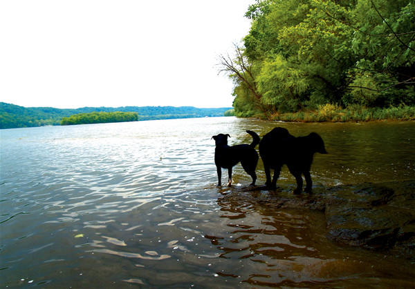
The Susquehanna River in eastern Pennsylvania is one of 150 major rivers that eventually flow into the Chesapeake Bay, transporting pollutants and nutrient runoff from six states. Credit: Mary Caperton Morton
The Chesapeake Bay watershed is the largest on the Atlantic seaboard, encompassing most of Maryland and Virginia, along with parts of Delaware, New York, Pennsylvania and West Virginia. More than 150 rivers flow into the system, carrying pollution and nutrient runoff from a 160,000-square-kilometer area into the bay ecosystem. A new study tracking long-term effects of the Clean Air Act has some good news about the often-poor water quality in some areas of the Chesapeake Bay watershed, but the overall picture may be complicated by hydrology.
Initially passed in 1963, the Clean Air Act was designed to reduce air pollution by requiring the Environmental Protection Agency (EPA) to enforce regulations limiting airborne contaminants. In 1990, amendments were passed to regulate the impact of stationary sources of air pollution, namely coal-fired power plants, to reduce the sulfur dioxide and nitrogen oxide associated with acid rain. According to the EPA, total human-caused nitrogen oxide emissions on the East Coast declined 32 percent between 1997 and 2005.
To study the effects of reduced nitrogen input on the Chesapeake Bay watershed, a team led by Keith Eshleman at the University of Maryland Center for Environmental Science tracked nitrogen levels in the waterways of nine forested areas in Maryland, Pennsylvania and Virginia over a 23-year period and found that water quality in at least some areas of the Chesapeake Bay watershed has improved since 1990.
That the Clean Air Act “brought such obvious improvements in surface water quality” was an unanticipated “side benefit,” Eshleman says.
In their study, published in Environmental Science & Technology, Eshleman and colleagues suggest that reducing the amount of nitrogen oxide being put into the atmosphere also cut down on the amount of nitrogen oxide particles landing on the forested regions in their sample area — a pollutant pathway known as atmospheric deposition — ultimately improving water quality.
“This study is a key piece of evidence for how we can affect the watershed through multiple pathways,” says Lisa Wainger, an environmental economist at the University of Maryland who was not involved in the new study. “It really showcases how effective the air quality regulations have been.”
Although the news is good for water in the forested, mountainous areas high in the watershed that Eshleman and colleagues studied, any overall watershed improvement may be masked or delayed by a phenomenon known as groundwater lag time, says Ward Sanford, a hydrologist at the U.S. Geological Survey in Reston, Va., and lead author of another recent Chesapeake Bay study, also published in Environmental Science & Technology.
The amount of time it takes for rain to work its way through the ground to a stream can vary from months to decades, depending on the underlying geology, which is quite diverse throughout the Chesapeake Bay watershed, Sanford says. “A wide range of return times is common in almost every terrain,” he says. For example, rain that falls on sandy soil will have a very different rate of return than water that falls in areas with a lot of limestone.
By developing a new model to quantify the variable rates of groundwater lag times in the Delmarva aquifer, part of the larger Chesapeake Bay system, Sanford was able to show that in some places, rain that fell before the 1990 Clean Air Act may just now be reaching streams. “We knew lag time was important, but nobody has made a substantial effort at quantifying how long that lag-time response is and what it means for how nitrogen cycles through the system,” he says.
“Even if we keep the nutrient loading at the land surface the same, with no additional cutbacks, stream concentrations are going to continue to go up 12 to 13 percent between now and 2050,” Sanford says.
The study is among the first of its kind, mainly due to past limitations of computer modeling, says Jim Tesoriero, a hydrologist at the U.S. Geological Survey in Portland, Ore., who was not involved in either new study. “Not many of these studies have been done, and this one takes it to a higher degree of rigor,” he says. “It’s one of the better demonstrations of the lag-time effect — the decades-long transport of nitrate into streams — that I’ve seen.”
Groundwater lag time was less of a concern for Eshleman’s study, since his team was working at the headwaters of mountain streams where flow rates are fast and groundwater storage is low, Eshleman says. “But when we move down into the valleys, the Cumberland Valley, Shenandoah Valley, these groundwater lag patterns might be very difficult to unravel,” he says.
Teasing out the effects of groundwater lag time is important in terms of setting future nutrient reduction goals for the health of the watershed, Tesoriero says. “In my view, the key contribution of [the Sanford] study is to make sure the [policy-makers] who are making changes at the land surface recognize what timescales they should consider when looking for related changes in streams.”
© 2008-2021. All rights reserved. Any copying, redistribution or retransmission of any of the contents of this service without the expressed written permission of the American Geosciences Institute is expressly prohibited. Click here for all copyright requests.