
by Sarah Derouin Friday, October 27, 2017
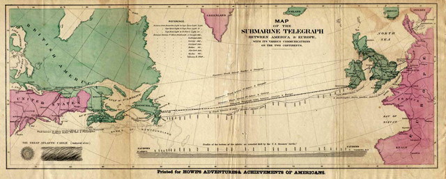
The first trans-Atlantic submarine cable was laid in 1858, from Newfoundland, Canada, to Ireland. Credit: public domain.
On the evening of Monday, Nov. 18, 1929, a magnitude-7.2 earthquake ruptured off the coast of Newfoundland, Canada. Those living on the Burin Peninsula, a foot of land that reaches into the Atlantic Ocean, reportedly felt five minutes of shaking — a confusing sensation, since no one in the area had experienced an earthquake before. “Suddenly this roar — this loud banging — [occurred] and the kettle and the plates started to dance,” Gus Etchegary, a resident of the Burin Peninsula who had experienced the quake, described in a documentary video produced by The Newfoundland and Labrador Heritage Website.
But the tremors were just the beginning of the earthquake’s impacts. The quake destabilized submarine sediments, triggering a massive underwater landslide that produced a series of tsunami waves that slammed into the already shaken Burin Peninsula and killed 28 people. As the landslide swept down the continental slope, it also snapped 12 trans-Atlantic cables in its path.
The event remains the worst earthquake-related disaster in the history of the province of Newfoundland. But two decades after it occurred, it resulted in the discovery and description of a theretofore unknown geological phenomenon: turbidity currents.
The 1929 earthquake was epicentered about 280 kilometers off Canada’s southeast coast at the mouth of the Laurentian Channel in the northwestern Atlantic Ocean. This region, called the Laurentian Slope Seismic Zone, aligns north-south along the southern edge of the Grand Banks near Newfoundland. The zone lies in a passive continental margin, and very little is known about its seismic activity and fault structure.
On the night of Nov. 18, 1929, a magnitude-7.2 earthquake on the Grand Banks off Newfoundland triggered a landslide-generated tsunami that killed 28 people on the Burin Peninsula and broke 12 submarine telegraph cables. The sequential breakage of six of the cables — over 13 hours and a distance of nearly 500 kilometers — later led to the discovery of turbidity currents. Credit: K. Cantner, AGI, after Heezen and Ewing, American Journal of Science, 1952; Fine et al., Marine Geology, 2005; and Ruffman, Newfoundland and Labrador Studies, 2006.
After the event, Canada’s Dominion Observatory collected information about the intensity of shaking by sending out questionnaires to local postmasters — an early form of the online “Did You Feel It?” surveys hosted by the U.S. Geological Survey and Natural Resources Canada. In 1929, however, it took weeks to collect the surveys and months to interpret the information. When the surveys were compiled, they found that shaking was felt as far away as Montreal and New York City. On Nova Scotia’s Cape Breton Island, about 400 kilometers west-southwest of the Burin Peninsula, there were reports of cracked and toppled chimneys after the earthquake, although the most substantial damage in the region was caused not by the tremors themselves, but by the giant underwater landslide.
Offshore, the seismic shaking destabilized Holocene and Pleistocene muds stacked above the epicenter. Over an area of approximately 20,000 square kilometers — just bigger than the state of New Jersey — dislodged sediments slumped down the continental slope, mixing into bottom waters to form a dense, turbid slurry. The dense, sediment-filled water rushed down the slope like an avalanche, picking up additional sediment and increasing in speed. This phenomenon, now known as a turbidity current, can erode large areas and deposit fans of sediment hundreds of kilometers away from its source. Turbidity currents also produce tell-tale, vertically graded deposits called Bouma sequences with layers of coarse-grained materials like gravel and sand, which settle out of suspension first, at the bottom, and fine-grained layers of silt and clay at the top.
The turbidity current on the Grand Banks reached estimated speeds of 60 to 100 kilometers per hour and carried an astounding 100 to 150 cubic kilometers of mud and sand. The massive volume of displaced sediment in the landslide also caused a tsunami, which radiated more than 4,000 kilometers across the Atlantic, making landfall in Portugal more than six hours after the quake. Those living closer to the landslide, however, including residents on the Burin Peninsula, were inundated faster and with greater intensity.
About two hours and 20 minutes after the earthquake, three pulses of tsunami waves, traveling an estimated 40 kilometers per hour, struck Newfoundland. At sea, the waves ranged from 3 to 7 meters high, but the long, narrow inlets and bays of the Burin Peninsula focused the waves, increasing them to heights of 13 meters.
The tsunami was described in the Nov. 26, 1929, edition of the St. John’s Free Press: “Up the narrow channel, between the islands … the wave swept with greater fury, flinging itself on the eastern part of Port au Bras, where it swept homes away and carried seven persons to destruction.”
Coastal cities were inundated. The waves smashed buildings and ripped houses off their foundations. Homes were later found stranded in meadows farther inland or washed out to sea. The area’s main industry — fishing — was decimated as wharves and other structures were damaged. Boats were lost or splintered and about 127,000 kilograms of salt cod were washed away. When the waves subsided, 28 people had died. Hundreds of people lost their homes and many had also lost their livelihoods. Property losses were estimated at CA$1 million in 1929 dollars — equivalent to more than CA$14.1 million today.
The Grand Banks tsunami didn’t just damage property and lives on land; it also created havoc underwater. The three waves were thought to have destroyed the seabed, leading to poor fishing during the following years. Furthering the fishing community’s misfortune, the collapse of the cod fishery in the early 1930s coincided with the onset of the Great Depression.
Additionally, the turbidity current snapped underwater telegraph cables off the eastern shore of Newfoundland.
Prior to 1858, transmitting a message between North America and Europe meant waiting for a ship to cruise across the Atlantic Ocean — a journey that lasted 10 days if weather was good, but could stretch to weeks if storms raged. The idea of a faster and more efficient means of trans-Atlantic communication had been floating around since the late 1830s and 1840s, spurred by the success of telegraph cable connections between Britain and France and along the east coast of North America. But spanning the Atlantic Ocean was another story.
Several individuals and companies advocated for cables stretching across the Atlantic, and teams started planning, consulting and fundraising for the endeavor. Out of these preparations came the first trans-Atlantic telegraph cable, which was completed — largely through the efforts of businessman Cyrus West Field — in 1858 by the Atlantic Telegraph Company. The first message sent via the cable was: “Glory to God in the highest; on Earth, peace and good will toward men.” The transmission wasn’t fast by today’s standards — it took each transmitted character two minutes and five seconds to traverse the ocean — but it was orders of magnitude faster than sailing. Unfortunately, this cable only operated for three short weeks before failing. A miscalculation made while increasing the voltage to help speed transmission led to a literal meltdown of the system when the cable’s insulation overheated. By the mid-1860s, new insulation and wire designs had been invented, and in 1866 a trans-Atlantic telegraph cable became a working reality.
By the late 1920s, numerous cables ran across the Atlantic from the Eastern Seaboard of Canada and the United States to Europe — with a high abundance concentrated off the coast of Newfoundland, where they lay across the continental shelf, the continental slope and the adjacent deep-sea basin. When the November 1929 earthquake and tsunami occurred, the telegraph companies who owned the cables noted that the first six of the 12 broken cables snapped simultaneously with the earthquake, while the next six — which lay at progressively deeper depths from north to south — then broke sequentially, from shallow to deep, over the next 13 hours and 17 minutes. In fact, the companies were able to record the exact times at which each cable snapped as communication through each was lost.
Previously, engineers and scientists had hypothesized that the breaks may have been caused by the fault rupture. At the time, not much was known about seafloor bathymetry and processes, but as the science of oceanography progressed through the 1930s, the idea of underwater, sediment-laden density flows emerged.
First suggested in 1936 by geologist and Harvard professor R.A. Daly, density flows were subsequently simulated in labs and observed in lakes. But it wasn’t until 1952 that marine geologist Maurice Ewing and then-graduate student Bruce Heezen, both at Columbia University’s Lamont Geological Observatory, put the data from the 1929 event together to prove the existence of such currents in the ocean.
“Although all the cables on the continental slope and on the ocean floor to the south were broken, not one of the large number of cables laid on the continental shelf was disturbed,” Heezen and Ewing wrote in the American Journal of Science. The progressive nature of the breaks led the team to rule out breakage from faulting, which would have broken all cables at roughly the same time. “All previously published explanations of these breaks are considered and rejected because they do not adequately explain this sequence,” they wrote.
To test the various hypotheses that had been floated in the decades following the earthquake, Heezen and Ewing conducted seismic refraction surveys and collected sediment cores on the seaward side of the Grand Banks. They found that gravels and sands overlaid Tertiary sediments in the bottom of the canyon, while adjacent areas had just “normal, blue silty mud” overlying the Tertiary units. The surveys of these areas also showed that the deposits extended out onto the abyssal plain up to 1,000 kilometers away from the canyon, which indicated the great speed and force of the current carrying these sediments. The researchers also obtained the 23-year-old records from the telegraph companies regarding the timing of the breaks.
Heezen and Ewing concluded that the landslide and the associated turbidity current were the cause of the 1929 trans-Atlantic cable breaks. Their work was the first documented evidence of a turbidity current occurring in the ocean. They also noted that around the world documented cable breaks frequently occurred on continental slopes, particularly in canyons, and that the phenomenon was therefore not uncommon in the world’s oceans.
“On the basis of widespread evidence for exposure of Tertiary and older sediments on steep submarine slopes, for numerous coarse-graded deposits interbedded with deep-sea clays in flat-bottomed ocean basins hundreds of miles from land, we conclude that large-scale work by slump-generated turbidity currents is a fundamental process in submarine geology.”
Today, nearly 160 years after the first successful transmission of a message via a cable lying on the bottom of an ocean, underwater cables are still used. Even in the age of the satellites, 95 percent of all telephone and data communication is done through submarine cables, and new cable is installed every year. The cables may now be fiber optic, but they spool from ships just like the old copper cables. Today, however, the cables are buried in the seafloor to protect them from damage from a variety of threats, including trawlers, anchors, earthquakes and turbidity currents.
© 2008-2021. All rights reserved. Any copying, redistribution or retransmission of any of the contents of this service without the expressed written permission of the American Geosciences Institute is expressly prohibited. Click here for all copyright requests.