
by Bryce Mitsunaga Monday, September 9, 2013
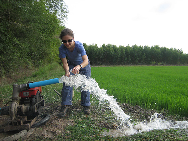
Laura Erban collects water samples to test for arsenic in wells in Vietnam. Courtesy of Laura Erban
For years, scientists and public health officials have known that arsenic threatens the water supplies of millions of people in the heavily populated floodplains of Southeast Asia. A recent study centers on Vietnam’s Mekong Delta, but has profound implications for the people of the entire region. In Vietnam, arsenic is naturally hosted in sediments drained off the Himalayas, which wash into the Mekong. Within the delta sediments, microbes dissolve the carcinogen, facilitating its movement. According to previous studies, arsenic can be avoided by “digging deeper” — by drilling farther into the aquifers, past the poisoned groundwater. But now, a team of researchers has found that digging deeper may actually accentuate arsenic poisoning rather than alleviate it.
Between 2002 and 2008, Vietnamese scientists discovered arsenic in about 4,000 of the nation’s wells. With a few colleagues, Laura Erban, a doctoral candidate at Stanford University, investigated why it was so prevalent despite the wells’ depths (some more than 150 meters). After examining the pre-existing records of 1,000 sites in the Mekong, they found that 60 percent were contaminated deep underground.
Once they had identified the breadth of the problem, Erban says, the researchers wanted to know why the contamination was occurring. In a recent study in Proceedings of the National Academy of Sciences, they suggested that arsenic spreads as the delta’s clays compact. At the microscopic level, clays form thin, platey disks in structures that resemble a house of cards. The delta’s clays are highly porous, cradling a large volume of groundwater. As aquifers are pumped for irrigation and drinking, the “houses” collapse: The land subsides, and arsenic-bearing fluid can leak into the wells, which draw the contaminant to the surface.
Once Erban and her colleagues had an idea of how this process worked, they turned to InSAR remote sensing to determine how widespread the subsidence might be. They found that at the surface the land sinks by up to three centimeters per year.
The team’s mapping may be as groundbreaking as their conclusions, says Charles Harvey, a hydrologist at MIT and a leading researcher on arsenic poisoning in Southeast Asia. Measuring the subsidence of roads with InSAR is nothing new, he says, but “in Vietnam, I think it’s a bit of an advance to use it on such an agricultural area.” Their research “pushes this technology a little further than I’ve seen before,” he adds.
The next question is how Erban’s team’s findings might influence prevention or treatment of contaminated water in Southeast Asian nations. First, however, both she and Harvey say that further research is needed to determine whether the connection between arsenic and clay compaction is widespread or confined to the Mekong. There is quite a bit of variation among the sites: Some have deeper wells; nearly all have disparate sedimentary histories, thinner or thicker rock layers, different surficial or subsurficial weathering conditions, and varying mineralogies, Erban says — any or all of which could influence well contamination. In addition, Harvey adds, a variety of mechanisms can help transport pollutants, so both clay cores and chemical analysis of the pore water would help illustrate the precise interactions between arsenic and water.
In the meantime, Erban says she hopes the study will raise awareness among researchers as well as government officials. “I would really love for the NGO community and the policymaking community in Vietnam to be able to absorb this paper as well.” She says she also hopes that InSAR could be used in other areas where pumping may be compacting clays, followed by some geochemical work to determine if arsenic is present.
© 2008-2021. All rights reserved. Any copying, redistribution or retransmission of any of the contents of this service without the expressed written permission of the American Geosciences Institute is expressly prohibited. Click here for all copyright requests.