
by Mary Caperton Morton Monday, July 17, 2017
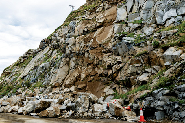
Rockfalls, like this one along Highway 198 in California, are a major hazard on many U.S. roadways. Credit: Tommy Lee Kreger, CC BY 2.0.
Rockfalls represent a significant hazard on many U.S. roadways that wind through steep terrain. But with money tight for roadside hazard mitigation, engineers are looking for more efficient ways to assess where and when unstable slopes could give way. In a new study, researchers suggest that lidar might be a cost-effective solution.
“Rockfall is becoming a bigger issue economically, legally and technologically,” says Keith Turner, a geologist at the Colorado School of Mines who was not involved in the new research. This is, in part, because many roads through mountainous areas were built in the 1960s and ‘70s, and decades of erosion of roadside cliffs, along with higher modern traffic loads, have increased risks from rockfalls.
Currently, most rockfall hazard assessments are based on visual inspections by a person on-scene — a costly, time-consuming and subjective process, says Joseph Wartman, a geotechnical engineer at the University of Washington and lead investigator of the new study, published in Engineering Geology. “With all the remote sensing technology we have available, it doesn’t make sense that we’re still relying on visual inspections and subjective assessments to monitor rockfall hazards. With the right tools, we can be much more efficient and cost-effective,” he says.
To develop a more objective, automated system for assessing roadside slopes, Wartman and his team turned to ground-based lidar, which uses a pulsed laser beam to measure precise distances and create three-dimensional maps of land surfaces. The ability of lidar to see through vegetation to rock underneath and to be used from a safe distance from slopes makes it an ideal tool for assessing rockfall, Wartman says, and ground-based lidar is preferable over airborne lidar in this case because it’s better at imaging vertical and near-vertical faces.
In 2016, Wartman’s team deployed its lidar equipment at two sites in Alaska, each featuring steep roadside slopes of varying types of rock. After scanning each of the slopes, the researchers used the data to develop a new metric, called the Rockfall Activity Index, to quantify how factors such as cliff slope angle and height, rock type, and erosion patterns contribute to the expected energy release during a rockfall. For example, as slides that originate higher on a cliff face are more damaging and dangerous than those originating lower down, slopes with loose rock higher up would have a higher Rockfall Activity Index score. “Our end goal is to create a system that allows you to pinpoint the most dangerous, most precarious zones, using a computer algorithm. So, you can collect data, run them through this program and get an automated map of the potential hazards at a given location,” Wartman says.
Using lidar to try to assess rock faces is not a new idea, but the approach Wartman and his team took — which economically and accurately determines rockfall hazards — is new, Turner says. The system needs to be tested at other sites — including in more seismically active areas where earthquakes can trigger rockfalls — to gauge its usefulness, he says, but the technique offers a much-needed alternative to current procedures.
Mitigating roadside hazards is expensive, and pinpointing where funding should be spent is crucial, Turner says. State transportation departments struggle “with how to manage and prioritize things like rockfall and slope instability. This study’s Rockfall Activity Index might be a useful tool in helping to solve that problem.”
The next step for Wartman’s team is to study other locations using their lidar setup, such as earthquake- and landslide-prone areas in the Pacific Northwest and in New Zealand, where imagery of steep roadside slopes taken before and after earthquakes may help shed light on how seismic activity affects rockfall hazards. They also plan to test whether using drone-mounted cameras, possibly an even more cost-effective method than ground-based lidar, could be used for similar mapping and hazard determination efforts, Wartman says. Drones and cameras are less expensive than lidar equipment, and they are able to image a given area in a fraction of the time it takes lidar, Wartman says, although the cameras wouldn’t be able to see through vegetation like lidar, so their usefulness would be limited in some places.
Mountainous states all over the country “are littered with rock slope hazards,” Wartman says. “This problem is not getting easier to manage, and we should definitely be using the best tools available to address it.”
© 2008-2021. All rights reserved. Any copying, redistribution or retransmission of any of the contents of this service without the expressed written permission of the American Geosciences Institute is expressly prohibited. Click here for all copyright requests.