
by Terri Cook Tuesday, February 27, 2018
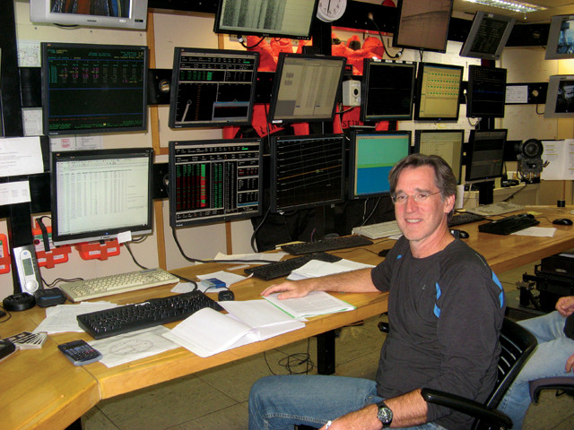
Harold Tobin, a marine geophysicist at the University of Wisconsin-Madison, aboard the research vessel Marcus G. Langseth, collecting a marine seismic reflection survey of the Cascadia Subduction Zone off the coast of Washington state. Credit: Jackie Caplan-Auerbach.
As a boy growing up on the East Coast, Harold Tobin loved being outdoors but was not all that excited by geology or the region’s ancient rocks. But the catastrophic eruption of Washington state’s Mount St. Helens in 1980, when Tobin was 15, and the notion that tectonic plates must be moving beneath the Pacific Northwest, captured his imagination. A few years later, while a student at Yale University, he volunteered as a summer intern at Mount St. Helens National Volcanic Monument. That experience, along with his undergraduate curriculum, convinced Tobin to become a geologist.
After two summers of fieldwork in Washington’s Olympic Mountains, he enrolled in graduate school at the University of California, Santa Cruz, where his advisor, J. Casey Moore, persuaded Tobin that the frontier of geophysical research lay offshore. So within a few months of arriving on campus, Tobin boarded the R.R.S. Charles Darwin to participate in a geophysical research cruise to the eastern equatorial Pacific — the first of five research cruises he participated in during his graduate research.
Tobin, now a professor in the Department of Geoscience at the University of Wisconsin-Madison, has spent more than 18 months aboard research vessels over the course of his career collecting data to better understand the mechanics of the major faults that delineate Earth’s plate boundaries. He combines information obtained from detailed seismic imaging, samples drilled directly from faults, and laboratory experiments to study the evolution and mechanics of strike-slip boundaries like California’s San Andreas and New Zealand’s Alpine Fault as well as subduction zone faults, including those off Cascadia, Costa Rica, Barbados and southern Japan. In 2004, Tobin was named co-chief project scientist of NanTroSEIZE, the largest scientific ocean drilling project ever undertaken, whose goal is to drill into and instrument the seismically active portion of the Nankai Trough, a subduction zone east of Japan’s Honshu Island with a history of unleashing magnitude-8 or larger earthquakes and devastating tsunamis.
Tobin recently spoke with EARTH contributor Terri Cook, with whom his path briefly overlapped in graduate school (including some memorable rock climbing trips), about what he enjoys about being at sea for weeks at a time, how huge subduction zone earthquakes differ from other seismic events, and how he knows that Bill Gates is familiar with his work.
TC: What is it like working on a large research vessel for weeks at a__ time?__
HT:__ The Chikyu, the Japanese research vessel built for the Integrated Ocean Drilling Program, houses about 100 crew members and 50 scientists, so it’s a big community on board. Because there aren’t many distractions, people tend to be very focused and collaborative, which creates an incredible synergy. It’s not like a meeting, where people leave after a few days and get absorbed by other things. There are also some downsides, such as strong personalities [clashing] and disagreements over data, which I have to help sort out, but these occur less frequently than I thought they would.
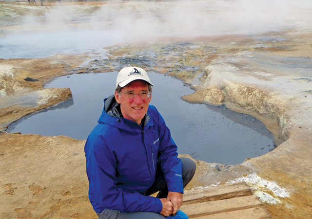
Tobin visits mud hot springs near Lake Myvatn in a rift zone in northern Iceland. Credit: Mary Dwyer.
TC: How does the Chikyu differ from other__ ships?__
HT:__ It’s the first research vessel capable of drilling 5 or more kilometers into the seafloor in water depths up to 2.5 kilometers. It has a large pipe, called a riser, which extends from the ship down to the seafloor and acts as an outer covering for the drill pipe. This is needed to circulate drilling mud so that we can control the downhole pressure, clean cuttings from the hole, and successfully core and log the hole.
TC: How has this technology been integral to the NanTroSEIZE__ project?__
HT:__ The goal of that project is to sample and instrument an active megathrust fault by drilling more than a dozen boreholes across the Nankai Trough. One of our targets is an ultra-deep site where we will drill through the entire thickness of the overriding plate and pierce the top of the subducting plate about 5,000 meters below the seafloor. This would have been impossible without the Chikyu’s riser system. If we successfully complete this hole in 2019, we’ll have sampled an active subduction plate boundary fault at the depth where earthquakes and slow-slip events occur. And we will then be able to directly monitor stress at multiple locations across the subduction zone, which is believed to be in the later stages of the earthquake cycle. On average, great earthquakes occur here about once per century, and the last one occurred in 1946.
TC: Are there any concerns that the drilling could trigger an__ earthquake?__
HT:__ We wouldn’t drill in this region if we thought there was any significant chance of causing a major earthquake. The borehole is less than 20 centimeters wide, and the operations don’t affect stresses except in a minor way right at the borehole, vastly smaller than the area over which earthquakes nucleate or begin. And we actually match the pressure conditions of the borehole to those in the surrounding rock pretty closely using the riser mud system. Additionally, subduction zone earthquakes begin much deeper and propagate upward along the fault toward the ocean floor, so the drilling, which targets the relatively shallow end, is very unlikely to affect the faults.
TC: Why did you decide to focus your current research on great__ earthquakes?__
HT:__ For my entire career, I’ve been fascinated by the scale and mystery of these largest of all faults hidden deep beneath the sea. In the 40 or so years following the Great Alaska Earthquake of 1964, there were no magnitude-9 earthquakes. The first one in my lifetime, which triggered the devastating Sumatra tsunami, occurred in 2004. By that time, we had actually already proposed the NanTroSEIZE project and were in the midst of planning it. After several more magnitude-8.5 or larger quakes followed, including the 2011 Tohoku earthquake and tsunami, I — along with a lot of other fault researchers — began to wonder why, after such a long gap, so many large earthquakes occurred during a single decade. It has certainly made it an exciting time, but I would have been pursuing this research anyway.
TC: Do we know why this__ has happened?__
HT:__ No, we don’t know. Some people think they’re linked in some way — a global aftershock sequence as it were, while other people think it’s just random clustering in time. Earthquakes of this size are so rare, and we have such a comparatively short record of them, that it is not really possible to tell.
The Patton Bay Fault, visible on Montague Island in Prince William Sound, Alaska, slipped up to 4 meters during the 1964 Great Alaskan earthquake. Credit: Peter Haeussler.
TC: How do great earthquakes differ from other seismic__ events?__
HT:__ Great, or megathrust earthquakes, which occur at subduction zones, seem to slip differently than other types of quakes. Once they start to release energy, they glide like they’re lubricated and can move several meters in a single second. The frictional resistance is actually the same as if it were slipping on banana peels. One hypothesis is that this is due to elevated fluid pressure in the subduction zone faults that may even develop during the earthquake itself, which helps weaken the plate boundary.
TC: Why did you record a lecture series on oceanography for the Great Courses, a series of pre-recorded, college-level audio and video__ courses?__
HT:__ I decided to do it because the potential audience is so large. More people have watched the 36 lectures of Oceanography: Exploring Earth’s Final Wilderness than I’ll reach in person during my entire teaching career.
TC: How was taping it different from teaching a__ class?__
HT:__ It was a really intense experience; I recorded three lectures a day for two weeks straight. Except for a cameraman, there was no audience and no visuals to point to, which was a little disconcerting. But more than 10,000 copies have sold, and I’ve received lots of positive feedback. Even Bill Gates mentioned that he was enjoying my course, along with Neil deGrasse Tyson’s lectures on astrophysics, in an article in Wired Magazine.
TC: Why did you work to establish the Halliburton Geoscience Visualization Center after you arrived in__ Madison?__
HT:__ Industry-academic partnerships aren’t very common, especially during lean budget times, but they fill an important niche. After I arrived on campus, I learned that David Lesar, who at the time was the CEO of Halliburton Energy Services, was an alumnus of the University of Wisconsin. He actually reached out to me and was instrumental in helping us establish a research laboratory where faculty and students can work together to interpret seismic images in the same way it happens in industry settings. Halliburton recognized the importance of training students in state-of-the-art software and didn’t ask for anything in return.
TC: One of my favorite stories demonstrating your commitment to public outreach is about the time you found yourself seated next to a conservative congressman on a cross-country flight. How did your conversation start, and what did you__ discuss?__
HT:__ I was on my way to the American Geophysical Union annual meeting and saw that the man next to me was reading a report about McMurdo Station, so I asked if he was heading to Antarctica. It turns out he was heading there as part of a congressional delegation to visit U.S. facilities there. After he learned that I’m a scientist, we talked about geologic topics ranging from finding natural resources to climate change, and how geoscientists know what we know. We discussed what a theory is, how data must back a theory up, and how all this relates to climate change. I’ve never worked so hard in my life! At the end, he told me that I was a good advocate for my profession — but I’m not sure I convinced him of any of it. The experience made me realize that scientists need to be very careful to separate research results from policy applications to be effective communicators and advocates for science. In this case, I don’t think we’d have had much of a dialog if I had just said “Sorry, climate change is real,” for example. Instead, I tried to key into the fact that he told me he was a trial lawyer by training, and so we talked about evidence.
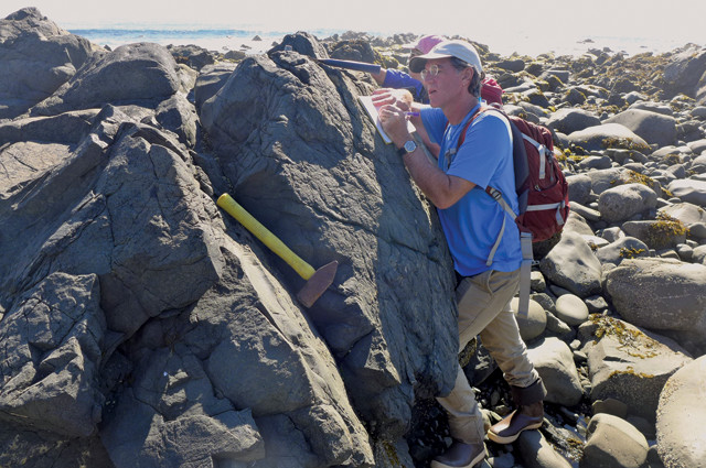
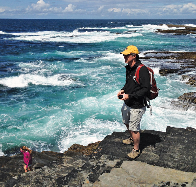
Tobin looks for outcrops of the Eagle River Fault on Turnagain Arm, above Hope, Alaska. Credit: Hannah Bartram.
Tobin near Kilkee, Ireland. Credit: Mary Dwyer.
TC: Your interest in geoscience began with the eruption of Mount St. Helens. From where do you draw your current__ inspiration?__
HT:__ It’s all about two things for me: first, the active earth processes — knowing that the planet is in motion in ways that are really challenging to detect, and that geology is not just about the remote past but is happening all around us today. It’s an incredibly fertile time in fault zone studies now. Our understanding of how faults work has been turned upside down by both the surprising earthquakes of the past decade or so, and by new observational tools like GPS and seafloor studies. Faults don’t behave quite the way we thought they did, and that’s an exciting target for research. Secondly, for me, marine research is still truly exploration — we know so little about what’s on or beneath the seafloor, so every project discovers new things about our planet. The best part about studying these active faults and tectonic plate boundaries is that it merges together fundamental research and real societal relevance, in terms of the hazards they pose.
HT:__ Pretty much anything that gets me outside and moving, such as hiking, rock climbing, mountain biking and Ultimate Frisbee, which is huge in Madison. I played on the club team at Yale and then took about 25 years off before joining a local recreational league here about five years ago. It’s a blast! Besides that, I love live music and good food. I also enjoy traveling and any chance to explore a new place. I have spent quite a bit of time in the Pacific Northwest, Japan, the Alps and Turkey, among many other places.
© 2008-2021. All rights reserved. Any copying, redistribution or retransmission of any of the contents of this service without the expressed written permission of the American Geosciences Institute is expressly prohibited. Click here for all copyright requests.